List of cultural monuments in Werbach
The list of cultural monuments in Werbach includes immovable architectural and art monuments from all parts of the municipality of Werbach . The basis for this list is the list of architectural and art monuments published by the Stuttgart Regional Council as of February 15, 2012. The article is part of the higher-level list of cultural monuments in the Main-Tauber district . This list is not legally binding. Legally binding information is only available on request from the Lower Monument Protection Authority of the municipality of Werbach.
Small monuments such as wayside shrines, statues and wayside crosses have been preserved in large numbers in the municipality. The reason lies in the agricultural structure that has existed since the Middle Ages. In modern times there was no densification of settlement and industry as in the metropolitan areas, so that these cultural monuments were largely preserved in the open air .
Architectural and cultural monuments of the Werbach community
Brunntal
Architectural, artistic and cultural monuments in Brunntal ( ⊙ ):
![]() Map with all coordinates of the cultural monuments in the Brunntal district: OSM
Map with all coordinates of the cultural monuments in the Brunntal district: OSM
| image | designation | location | Dating | description |
|---|---|---|---|---|
 |
St. Michael | Kreuzbergstrasse (map) |
1818-1821 | Catholic Church of St. Michael. Hall building with retracted choir and front tower by building officer Friedrich Streiter, Löwenstein. 1818/1821.
|
| Wayside shrine | Kreuzbergstraße 3 (in front of) (map) |
Wayside shrine
|
||
| Wayside shrine | Rotweg (map) |
Wayside shrine
|
||
 |
chapel | Waldstrasse (map) |
1797 | Fourteen Holy Chapel. Simple plastered chapel with arched entrance, inscribed in 1797 in the apex.
|
| Wayside shrine | Waldstrasse 10 (in front of) (map) |
Wayside shrine
|
||
| Wayside shrine | Wenkheimer Strasse 2 (in front) (map) |
Wayside shrine
|
Gamburg
Construction, artistic and cultural monuments in Gamburg with the village Gamburg ( ⊙ ), the farm and residential space Eul (Eil) schirben ( ⊙ ) and the living quarters Bimssteinfabrik ( ⊙ ), Dorfmuehle ( ⊙ ), station Gamburg ( ⊙ ), inn Tauber pearl ( ⊙ ), Lindhelle ( ⊙ ), Möbelfabrik ( ⊙ ) and Schlossberg ( ⊙ ):
![]() Map with all coordinates of the cultural monuments in the district of Gamburg: OSM
Map with all coordinates of the cultural monuments in the district of Gamburg: OSM
| image | designation | location | Dating | description |
|---|---|---|---|---|
 More pictures |
railway station | Bahnhofstrasse 13 (map) |
1867 | former railway station building. Taubertal Railway. Built in 1868. Now privately owned
|
 More pictures |
Historic Tauber Bridge | Brueckenstrasse (map) |
1720 | A ford was used as a crossing point until the 15th century. After that there was a wooden bridge and from around 1720 the bridge was built of stone.
|
 More pictures |
Gamburg Castle and Castle Park | Burgweg 29 (map) |
1157 | Castle and Castle Park. Medieval complex with fortified tower and residential buildings from the 12th to 16th centuries (§ 28) (Burgweg 29). Part of the totality: Defense tower with tombstone slab from 1422. Wooden floor with tented roof, put on by Prof. Clemens Buscher (1860–1916) at the beginning of the 20th century, served as a studio (Hohlweg, Flst.Nr. 103).
|
 More pictures |
Maria-Hilf chapel | Burgweg 34 (map) |
1833 | Maria Hilf chapel. Semicircular classical building with a round apse and open colonnade. 1833. Also forest chapel Maria Hilf or Ingelheim'sche Maria-Hilf chapel.
About the creation of the name: Maria Antonia Countess von Ingelheim called Echterin von und zu Mespelbrunn, born Countess von Westphalen zu Fürstenberg, made a vow in Rome to build a chapel, provided that her daughter Isabella Felicitas recovered from a life-threatening nervous fever. By the grace of Our Lady, your wish was granted.
|
 More pictures |
Eulschirbenmühle | Owls 2 (card) |
1245 | The Eulschirbenmühle is a former mill. A document from 1245 has been preserved in which the Eulschirbenmühle, located between Gamburg and Bronnbach an der Tauber, is mentioned for the first time. The name comes from the hamlet of Ulscirben, today Eulschirben, whose name in turn derives from althdt. ula = pot and scirbi = shards derived.
|
 More pictures |
Lower lock | Ravine (map) |
1522 | Below the castle is the "Lower Castle", built in 1522 by Johann Küchenmeister and renovated in 1751. Besides the main house there are u. a. the former tithe barn, a smaller barn building, an old prison tower, the so-called old house, a washing and baking house as well as a garden, which originally also comprised the area of today's village community center.
|
 |
Sunburnle | Ravine (map) |
1908 | Small monument No. 10 (Gamburg): Designed by Clemens Buscher in 1906 and completed in his workshop in 1908. It was built to ensure the water supply to the Burghalde.
|
 |
Turrets | Ravine | Towers on the ravine. A watch tower from the 15th century, which once belonged to the so-called Krappentor (= Rabentor). The gate established the brick connection to the fortifications of the castle. From 1890, the originally crenellated tower belonged to the sculptor Clemens Buscher (+1916), who provided it with a wooden structure. At the foot an epitaph of Anna ("Petronia") von Ehrenberg (+1422), wife of Peter the Elder, originally from the old village church. Ä. from Stettenberg (+1428).
|
|
 More pictures |
St. Martin | Kirchstrasse 11 (map) |
1895-1898 | Roman Catholic Martinskirche. Riemenschneider Madonna in an altar by Thomas Buscher and two other altars by the artist. Neo-Gothic hall building with a side tower, 1895 ins.
|
 More pictures |
Gamburg railway bridge | L 606 (over) | 1868 | Part of the entity "Badische Taubertalbahn"
|
 More pictures |
14 saints chapel | Steigweg 2 | 1923 | Chapel of the 14 saints, also called the Fourteen Holy Helpers Chapel, inscribed in 1923, entrance lintel and altarpiece from the previous chapel from 1823.
|
 |
House with Buscher Museum | Thomas-Buscher-Strasse 8 | 1785 | Residential house, eaves half-timbered building with profiled threshold, portal with skylight, 1785 ins. Courtyard wall with ogival double portal, late Gothic. The Buscher Museum, which opened in 2013, gives an overview of the work of the two artists Clemens Buscher (1855–1916) and Thomas Buscher (1860–1937). In addition to the sculptural works that were loaned to the museum, hall texts and video stations provide information about the artists and their historical background. The Buscher family of stonemasons and sculptors had lived in Gamburg since the time of Napoleon, around 1800.
|
 |
Vogtshaus | Thomas-Buscher-Strasse 12 | 16th century | Former Vogtshaus. Visible half-timbered building with half hip and round cellar arch, 16th century.
|
 More pictures |
Hokemo fountain | Uissigheimer Strasse 1 (map) |
1908 | The design of the triangular village fountain comes from Clemens Buscher (1908) from the Buscher family of sculptors. It was carried out by the stonemason Meckel. He represents the legendary hook man (Hokemo) who lures the children to the deaf and pulls them in with hooks because they did not follow the grandmother.
|
 More pictures |
Lang village mill | Uissigheimerstraße 40 | Former "village mill". or called "Obremühl", was mentioned for the first time in 1248 in the income register of the Archbishop of Mainz.
In 1546, the miller Endres Hertweck exchanged half of the village mill with the new owner of the Gamburger rulership, Eberhard Rüdt von Collenberg, for an annual amount of grain. The mill was later then completely jointly owned by the upper and lower rulers. In the middle of the 18th century the miller family Ruhland was finally given the mill as an inheritance. Afterwards it was married to the Eckert family and then to the Lang family. In 1954 an additional mill building with modern grinding machines was built. In 1970, with a heavy heart, the decision was made to shut down the mill and to stop grinding operations and to replace the existing turbine system from 1911 with a modern and powerful system and to feed the electricity generated into the existing power grid. Hartmut Lang has been the owner and operator of the hydropower plant ("Mühle" ) since 1988 .
|
|
 More pictures |
Pumice factory | Maisenbachstrasse 1 | Former "pumice factory". Privately inhabited today.
Originally an oil mill to which a sawmill was connected. In 1897 Hermann Volk built a kiln for the production of pumice stones in the oil mill and converted it into a sand mill. A large kiln with finally three ovens and large drying rooms as well as a residential building with the administration were newly built. The horse stable with barn and shed has been improved. A turbine replaced the old water wheel.
|
|
 |
Old forester's house | Burgweg 27 | Old "forester's house". In 1923 Count Rudolf von Ingelheim had the old barn in front of the castle converted into a chauffeur's house with stables, garages and stair turrets. In 1936 the Counts von Westerholt acquired it together with the castle and the associated part of the chamber forest and use it as a forester's house to this day. Above the door of the stairwell you can see the Ingelheim-Echter coat of arms of Count Rudolf together with that of his wife Leopoldine Schenk von Stauffenberg.
|
|
 |
Stettenberger Freihof | Thomas-Buscher-Str. | In Thomas-Buscher-Straße (formerly Judengasse), old Freihof of the Lords of Stettenberg with official cellars.
Acquired by Eberhard Rüdt von Collenberg as early as 1557. In 1669 this came into the possession of the upper lordship, i.e. the castle, as the last free aristocratic court in Gamburg. As early as 1557 .
|
|
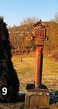 |
Wayside shrine | Uissigheimerstraße / cycle path junction | 1847 | Small monument no.09 (Gamburg): wayside shrine with the Walldürner blood miracle, created by the bricklayer Misselbeck in 1847, not far from the village mill.
|
 |
Wayside shrine | Bahnhofstrasse / Lindhelle footpath | 1493 | Small monument no. 27 (Gamburg): wayside shrine from 1493 (sometimes also incorrectly called "Ecce Homo") depicting the risen man, not far from the Martin guest house. Allegedly the oldest dated wayside shrine in the Taubertal. According to the inscription, it was hidden in the cellar garden for a long time until it was transported below its current location in 1742, which it only found in 1983. The cemetery was there from 1830 to 1852.
|
 |
Wayside shrine | Uissigheimerstrasse | 1735 | Small monument No. 08 (Gamburg): Trinity picture from 1735 with the representation of the Holy Trinity with Mary and Joseph as well as St. Sebastian and the breastfeeding Mother of God to the side. It is located a few meters from the location of the former mill gate.
|
| Wayside shrine | Peasant forest | 1619 | Wayside shrine depicting a crucifix. In the Bauernwald, from 1619 with the professional coats of arms of the four founders, Hanns Roth (crossed double hooks = glaziers), Clais Göller (double purpose = baker), Merten Müller (Müllershammer = Müller) and Baslen Alwert (ploughshare = farm farmer).
|
|
 |
Wayside shrine | Mühlbergwald hiking trail | 1767 | Small memorial No. 04 (Gamburg): wayside shrine depicting a crucifix. Mühlbergwald, on the road to Eiersheim-Uissigheim. Crucifix on an older wayside shrine, depicting a falling man, Wilhelm Rösner, who died in 1767. The original Uissigheim wayside shrine stood on the Eiersheim-Gamburg road until 1966.
|
 |
Wayside shrine | Muhlberg | 1607 | Small monument No. 32 (Gamburg): wayside shrine with crucifix from 1607, on the Mühlberg (= edge of the large chamber forest to the Maisenbachtal)
Incomplete inscription: LINHA ??? ??? SIGK DIE ??? ECHTRSCHER VOGDT TO GIESSEN AND HIGH HOUSES LAS AND EARN UP DIS PICTURE GOT TO PRAISE AND HONOR THE 3 MAY ANO 1607 HODIE MICHI CRAS TIBI inscription on the back: MK
|
 |
statue | Schulstrasse / Kirchstrasse | Small monument No. 19 (Gamburg): Depiction of the Madonna on a column with a base in Schulstrasse.
|
|
 |
statue | at the fire station | Small monument No. 20 (Gamburg): Depiction of the Madonna on a column with a base.
|
|
 |
statue | Thomas-Buscher-Strasse | Small monument No. 13 (Gamburg): Depiction of the Madonna on a column with a base, in Thomas-Buscher-Straße.
|
|
 |
statue | Uissigheimerstraße 3 | Small monument no. 14 (Gamburg): Depiction of the Madonna on the house wall, in Uissigheimer Straße 3. Birthplace of the artist Buscher
|
|
 |
statue | Kettenbronnen | Depiction of the Madonna at the Kettenbronnen courtyard house with the remains of the torn-off archway.
|
|
 |
relief | Uissigheimerstrasse, | Small monument No. 18 (Gamburg): Pieta, representation of St. Catherine, at the village mill.
|
|
 |
relief | Uissigheimerstrasse 23 A | 19th century | Small monument No. 16 (Gamburg): Relief shows Saint Wolfgang
On the house wall opposite the village mill, (area of the former post office building).
|
 |
Stone cross | Playground path, sports field | 1571 | Small monument no. 36 (Gamburg): Cross on Spielplatzweg (sports field), so-called cross meadows, right by the former moat.
|
|
|
||||
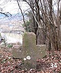 |
Stone cross | Old climbing path to the farmer's forest | 1598 | Small monument No. 34 (Gamburg): Cross from 1598, on the old climbing path to the Bauernwald. Allegedly in memory of a boy who is said to have died as a result of a major tussle over a girl on the way back from a church fair there. The famous stone cross nest near Reicholzheim , the largest of its kind in southern Germany, is intended to commemorate the other 14 dead .
|
 |
Stone cross | Schulstrasse 39 | unknown | Small monument no. 21 (Gamburg): An old cross is on the way to the cemetery, next to an old horse trough. Without inscription. According to legend, a shepherd was struck by lightning here.
|
 |
Stone cross | Bauernwald, Flst.Kreuz | unknown | Small monument no. 02 (Gamburg): stone cross, in the farmer's forest, on the so-called “panorama hiking trail” to Bronnbach. Half-destroyed atonement cross in the parcel named after him in the cross (peasant forest). The puzzling symbol on it was interpreted as a millstone, that is, as a professional symbol of the dead. But it is at least questionable whether this stone was even intended as an atonement or memorial cross .
|
 |
stele | Kammerforst | 1823 | Wayside shrine "Gaul" from 1823 created by the sculptor Matthias Buscher.
|
 |
Wayside shrine | 1592 | Small monument no.01 (Gamburg): wayside shrine. Inscription: "Anno dni 1592 is Got to praise and honor the image erected by the honorable Georg Kauffmann zu Hochhausen".
|
|
 |
Wayside shrine | K 2888 | 1842 | Small monument No. 03 (Gamburg): wayside shrine from 1842 erected by the brothers Andres and Johannes Freund.
Is next to the Josefskapelle (at the foot of the Apfelsberg). The Josefskapelle and the wayside shrine are now in the Tauberbischofsheim-Hochhausen district.
|
 |
Wayside shrine | K 2881 | 1736 | Small monument no.05 (Gamburg): wayside shrine. On the front are Mary with the body of Jesus, on the sides St. Laurentius and St. Anna are depicted. Inscription on the base 1736 -HHL -EHLN.
|
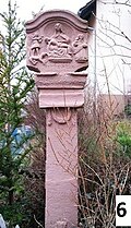 |
Small monument no.06 (Gamburg):
|
|||
 |
Wayside shrine | 1715 | Small memorial no. 07 (Gamburg): pilgrimage shrine "Zum heiligen Blut" from 1715, inscription: AO 1715, Got made HLF tis Pilt in honor.
including St. Blood of the Lord Jesus Christ to wd door in corpura.
|
|
 |
stone | Ravine | Small monument no. 11 (Gamburg): Remnants of the former gate fortifications, stands at the Sunrunnle
|
|
 |
Wayside shrine | Ravine | circa 1739 | Small monument No. 12 (Gamburg): wayside shrine with the Holy Family and the Trinity. Artist: Johannes Lutz, Gamburg. Stands in the top of the retaining wall at the ravine crossing Kirchweg
|
 |
statue | Uissigheimerstrasse | 1868 | Small monument No. 15 (Gamburg): Statue on an altar-like base created by Buscher in 1868.
Maria statue with representation of the Last Supper on an altar-like column. Location in the center of Uissigheimerstrasse / Abzw Ölbergweg.
|
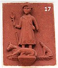 |
relief | Uissigheimerstrasse | 19./20. century | Small monument no. 17 (Gamburg): Relief with an illustration of a shepherd? (Saint Wolfgang?) Attached to the wall of the village mill
|
 |
Wayside shrine | Schulstrasse | 1598 | Small monument No. 22 (Gamburg): stone with a head. Disputed whether a horse's head or a lion's head. Artist?
|
 |
cross | graveyard | 1830 | Small monument no.23 (Gamburg): The cemetery cross on a base with an inscription:
O you all pass the way for mercket dog and see whether a Schmertz is like my Schmertz
|
 |
Tombstone | graveyard | 1844 | Small monument No. 24 (Gamburg): Gravestone of the Buscher family. Inscription: Mathias Buscher Maurermeister (1785 - 1844) and his grandchild Andres Buscher Maurarmeister, born June 26, 1856, rest in God
|
 |
Tombstones | graveyard | New installation | Small monument no.25 (Gamburg): Gravestones of the Gamburger pastor
(left-right) Georg Lorenz Henn (1882-1959) Clemens Irion (1890-1945) Kurt Barthelme (1875-1926) Kaspar Fischer (1794-1864)
|
 |
War memorial | Soldiers Grove Cemetery | Small memorial no.26 (Gamburg): War memorial for the First World War and Second World War .
|
|
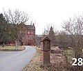 |
Wayside shrine | Bahnhofstrasse 13 | 1954 | Small memorial No. 28 (Gamburg): wayside shrine to commemorate an accident.
Inscription: In peace Friedrich Theodor Graf zu Stolberg-Stolberg Lord on Kyowitz, much merit for the country and people of the homeland, as a deportee from the Taubertal lovingly received, was snatched from his people here at Laetare and led by Christ to the eternal home. 14.Xii. 1877 to 28th III. 1954
|
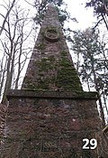 |
obelisk | in the castle forest of Gamburg | 1800 | Small monument no. 29 (Gamburg): Obelisk with the coat of arms of the Counts of Ingelheim and the inscription "20th April 1800"
This "Victory Column" was erected on April 20th, 1800 on the occasion of the wedding of Count Friedrich Karl Josef von Ingelheim with Countess Maria Antonia von Westphalen zu Fürstenberg.
|
 |
Burial ground | Gamburg cemetery | 1990 | Small monument No. 30 (Gamburg): cemetery, those of Mallinckrodt
(Baron Hans-Georg senior, and his wife and a daughter.) In the background, a cemetery cross and grave stones of the Buscher.
|
 |
Tombstone | Ravine | 1422 | Small monument no. 31 (Gamburg): The tombstone is now on the outer wall of the "Türmle", ie the gate tower of the former Krappentor.
The translated Latin inscription reads: 1422 Mistress Petronia von Ehrenberg died on January 27th. (She was probably the wife of the then gentleman (the Gamburg), Peter von Stettenberg.)
|
 |
Wayside shrine | Old climb | 1839 | Small memorial No. 33 (Gamburg): wayside shrine with Pieta from 1839.
Artist: Made by Franz-Anton (Anthony) Buscher at the age of 13. Emigrated to Chicago / USA in 1842. Location: Alte Steige / confluence with the Lindhelle access road
|
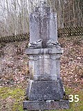 |
Tombstone | graveyard | 1888 | Small monument no.35 (Gamburg): gravestone from 1888
Location cemetery In memory of Doroth. Buscher née Häfner (1818 - 1888) Base inscription: Theresia Jesberger née Buscher (1948-1915)
|
 |
cross | Next to the church | 1906 | Small monument no.37 (Gamburg): Cross from 1906 created by sculptor Ch.Ziegler, Tauberbischofsheim. (Who also created the mission cross in the Tauberbischfsheim town hall).
Location next to the Gamburger Church of St Martin from 1895
|
 |
cross | Bike path | unknown | Small monument no. 38 (Gamburg): pilgrimage cross "to the Holy Blood"
Location: on the Gamburg cycle path towards Bronnbach, at the beginning of the steep path of the pilgrimage on foot to Walldürn.
|
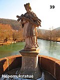 |
statue | bridge | 1720 | Small monument No. 39 (Gamburg): Nepomuk statue on a base. (Copy of the Nepomuk statue donated by Johannes Bernhard Kaltwasser in 1730. The original is in the Tauberbischofsheim Local History Museum in Tauberfränkisches Heimatmuseum. The inscription on the base reads:
AMORE ERGA PATRIAM ET IN HONOREM SAN CTI JOHANNIS NEPOMUCEMI HANC STATUAM ERIGE RE CURAVIT JOHANNES BERNARDUS COLD WATER ANNO DOMINI 1730)
|
 |
Wegstein | Burgweg | unknown | Small monument No. 40 (Gamburg): road stone from? . Is at the confluence of the Burgweg in the Uissigheimerstraße
|
 |
Wegstein | Brückenstrasse | unknown | Small monument No. 41 (Gamburg): Wegstein von?. Is at the Brückenstraße / end of the parking lot at the bridge.
|
 |
Wegstein | Burgweg | unknown | Small monument No. 42 (Gamburg): Wegstein von?. Stands on Burgweg, by the Forsthaus high water reservoir.
|
Niklashausen
Architectural, artistic and cultural monuments in Niklashausen with the village of Niklashausen ( ⊙ ) and the residential areas of the Altes Bahnwärterhaus ( ⊙ ) and the Niklashausen stop ( ⊙ ):
![]() Map with all coordinates of the cultural monuments in the district of Niklashausen: OSM
Map with all coordinates of the cultural monuments in the district of Niklashausen: OSM
| image | designation | location | Dating | description |
|---|---|---|---|---|
 More pictures |
Protestant church | Wertheimer Strasse 17 (map) |
1518 | Evangelical parish church. Gothic building with a polygonal choir and a side tower. Since 1518.
|
 |
Town hall with Pfeifermuseum | Wertheimer Strasse 28 | 19th century | Former town hall of Niklashausen, plastered building with half hipped and round cellar arch. 1st half of the 19th century. Pfeiferstube in the old town hall, which has existed since 1991, was expanded to a museum in 1999, exhibits a. a. from the stone carving trade, local history and the rural world. Memory of the so-called Pfeiferhannes, a shepherd and musician from Niklashausen, who is said to have burned his instruments after an apparition of the Virgin Mary in the spring of 1476 in order to preach equal property for everyone, refusal of compulsory labor, customs and tithes, free hunting and free fishing. After bans could not prevent the piper from his actions, Prince-Bishop Rudolf von Scherenberg from Würzburg had him arrested. After a brief detention, the piper was burned on July 19, 1476 as a heretic and popular agitator.
|
| War memorial | War Memorial First World War. The war memorial is in front of the Protestant church.
To the right of the entrance is a sandstone memorial plaque. In the middle, a downward pointing sword with laurel tendrils. Above the Niklashausen coat of arms.
|
|||
| War memorial | War Memorial Second World War. To the left of the church a sandstone-clad wall with a cross at the end, with the names of the victims of WWII.
|
Wenkheim
Architectural, artistic and cultural monuments in Wenkheim with the village of Wenkheim ( ⊙ ) and the residential areas Neumühle ( ⊙ ), Öl- und Sägmühle ( ⊙ ) and Seemühle ( ⊙ ) as well as the Mehlen settlement ( ⊙ ):
![]() Map with all coordinates of the cultural monuments in the district of Wenkheim: OSM
Map with all coordinates of the cultural monuments in the district of Wenkheim: OSM
| image | designation | location | Dating | description |
|---|---|---|---|---|
 More pictures |
synagogue | Breite Strasse 7 (map) |
1841 | Former synagogue. Solid construction with arched portal with vestibule and Hebrew inscription. Carved door leaf, 1841. Back then around 1840 typical round arch style. Facing the street is the rabbi's apartment, on the side remote from the street is the now carefully renovated prayer room with its magnificent stucco coffered ceiling and a women's gallery. Protected according to § 12 DSchG
|
 More pictures |
Jewish Cemetery | (Map) | The Jewish cemetery in Wenkheim
|
|
| Residential building | Herrenstrasse 4 | Plastered one and a half storey half-timbered building under a crooked hip roof with an eaves-side external staircase and a round cellar arch, 18th / 19th century. Century. Protected according to § 2 DSchG
|
||
| Formerly a Protestant rectory | Herrenstrasse 8 | 1790, eaves-standing, partly massive, partly half-timbered and plastered house with half-hipped roof and round cellar arch; older windows Protected according to § 2 DSchG
|
||
| Protestant church | Herrenstrasse 23 | 1792-1793 | Evangelical parish church. Baroque hall building from 1792/93 with entrance tower. Protected according to § 2 DSchG
|
|
| Residential building | Hindenburgstrasse 8 | Gabled, plastered half-timbered building from the 18th century. Under a gable roof, with stone sliding windows in the base and arched courtyard entrance, re. 1880 Protected according to § 2 DSchG
|
||
| Green Tree Inn | Hindenburgstrasse 11 | stately, plastered building standing on the eaves with double gate system, re. 1724; associated economic building Protected according to §§ 2 (totality) DSchG
|
||
| Residential building | Hindenburgstrasse 14 | two-storey, gable-independent half-timbered building with profiled thresholds, carved corner posts and a round cellar arch on the eaves; re. 1721 Protected according to § 2 DSchG
|
||
| Residential building | Lindenstrasse 13 | single-storey, gable-independent half-timbered building under a gable roof, profiled thresholds, eaves-side flight of stairs, round cellar arch; re. 1726; Modern extension on the back Protected according to § 2 DSchG
|
||
 More pictures |
St. Mary | Lochstrasse 1 (map) |
1823 | Catholic Parish Church of St. Mary. Neo-Gothic building with retracted polygonal choir, 1823 (§2). Next to it, a late Gothic tower from the former palace complex (§28). Protected according to § 2/28 DSchG
|
| Former cath. Rectory | Hole 2-4 | consisting of a single-storey rectory, a solid building under a crooked mansard roof with a strongly profiled eaves cornice, red sandstone window frames, at the entrance portal towards the courtyard, re. 1766, with z. T. original cassette and slat shutters. The parsonage wall and the stable barn, which was subsequently converted into a schoolhouse in the south-east, with a large, arched entrance to the courtyard side belong to it. On the slope side, the barn presents itself as a building made of quarry stone with a crooked hip and profiled eaves. Protected according to § 2 DSchG
|
||
| Council and school house | Lochstrasse 3 | 1887 | Former town hall and school building, "built in 1887" re. Eaves construction made of red sandstone blocks under a hipped roof. Central-axis entrance on the eaves side with double-leaf coffered door leaf from the same construction period. North-eastern narrow side with the original four-panel door leaf and largely original folding shutters (three-panel cassette shutters). Associated with it: side courtyard entrances leaving uncovered, each single-storey, gable-facing utility building also made of red sandstone blocks, the adjoining building to the church, formerly the abortion building of the school. Protected according to §§ 2 (aggregate) DSchG
|
|
| Water tank | Lochstrasse 17 (plot 8176/1) | re. 1921, flat-roofed building made of red sandstone blocks in the style of revolutionary classicism with corner blocks and an entrance crowned by a blinding pilaster and triangular gable, associated staircase with massive side walls and surrounding wall made of quarry stone facing the Lochgasse (door leaf of the container) modern and impairing appearance. Protected according to §§ test case DSchG
|
||
| Former village mill | Mühleck 3 | Consists of 3 buildings from the 19th century, of which the northwest is a two-storey plastered half-timbered building with an eaves-side entrance to the mezzanine floor with the original door leaf, according to the owner, the complete mill equipment (turbines), which was shut down in 1980, has been preserved in it. The three-storey building adjoining the eaves is solidly bricked in the two lower storeys and has a plastered upper storey that was probably added later. The associated Mühlkanal is preserved on the outlying or north side, protected according to §§ test case DSchG
|
||
| Welzbach Bridge | in the course of the Hindenburgstrasse standing, three-arched stone bridge, re. 1862 Protected according to § 2 DSchG
|
|||
| War memorial | War memorial
|
|||
| Deportation memorial | Memorial deportation 1940. The memorial for the deported Jewish fellow citizens is located in the center of Wenkheim, very close to the (former) synagogue that is still in existence.
The monument was designed in 2018 by a group of six young people from the Protestant parish of Wenkheim and inaugurated on October 13, 2018. The motto of the stone refers to the song “Your Guilt” by the pop group “Die Ärzte”. “It's not your fault that the world is what it is. It's only your fault if it stays that way. ”The wire mesh separates the two parts of the quote into past and future statements. This is intended to make clear to the viewer of this stone his responsibility for this society. The wire netting that separates the quote symbolizes the deportation and the terrible circumstances in the camps. Next to the memorial with the quote is a plaque with information about the deportation on October 22, 1942. Thirteen people are noted by their names.
|
|||
| Wayside shrine | Gauweg, K 2882 (an) (map) |
Wayside shrine
|
Werbach
Architectural, artistic and cultural monuments of the main town Werbach with the village Werbach ( ⊙ ) and the residential areas Blauer Rain ( ⊙ ), Fischzuchtanstalt ( ⊙ ), Schneidmühle ( ⊙ ), Steinig ( ⊙ ), Weidenmühle ( ⊙ ) and Welzmühle ( ⊙ ) :
![]() Map with all coordinates of the cultural monuments on the district of the main town Werbach: OSM
Map with all coordinates of the cultural monuments on the district of the main town Werbach: OSM
| image | designation | location | Dating | description |
|---|---|---|---|---|
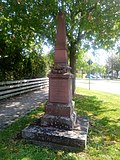 |
War memorial | Böttigheimer Straße 1 (K 2819) (near), Hauptstraße 58 (near) (map) |
1870/71 | War memorial 1870/71.
|
| crossroads | Böttigheimer Straße 1 (K 2819) (opposite), Grabenweg (map) |
crossroads |
|
|
| Wayside shrine | Böttigheimer Straße 1 (K 2819) (opposite), Grabenweg (map) |
Wayside shrine |
|
|
 |
War memorial | Denkmalweg 1, Hauptstrasse (map) |
1866 | War memorial in Werbach for the fallen soldiers of the Baden outpost battle near Walldürn (July 23, 1866) and the battle near Werbach (July 24, 1866).
|
| Wayside shrine | Friedhofstrasse 11 (near) (map) |
Wayside shrine
|
||
 More pictures |
Maria-Hilf chapel | Grabenweg 6 (map) |
1883 | Maria-Hilf-Chapel in Werbach. Chapel with a semicircular end. At the intersection of Kapellenweg and Grabenweg. 1883 re.
|
 More pictures |
St. Martin | Hauptstrasse 57 (map) |
1842 | Catholic parish church of St. Martin. Barrel-vaulted building with a gable tower in historicizing forms, 1842 re.
|
| Wayside shrine | K 2819 (at) (card) |
Wayside shrine, right at the K 2819 after leaving the village in the direction of Böttigheim.
|
||
 |
crossroads | L 2297 (an) (card) |
crossroads
|
|
| Wayside shrine | Liebfrauenbrunnstraße (K 2297) (an), Blauer Rain (an) (map) |
Wayside shrine
|
||
 More pictures |
Pilgrimage chapel Liebfrauenbrunn | Liebfrauenbrunnstrasse 34 (map) |
1902 | Pilgrimage chapel Liebfrauenbrunn between Werbach and Werbachhausen on the Welzbachtal cycle path. Neo-Gothic building with ridge turrets and polygonal termination, 1902 re.
|
 |
Wayside shrine | Liebfrauenbrunnstrasse 34 (map) |
1754 | Wayside shrine with cross group, 1754 ins.
|
 More pictures |
Way of the Cross at the pilgrimage chapel Liebfrauenbrunn | Liebfrauenbrunnstrasse 34 (map) |
1900 | Way of the cross to the pilgrimage chapel Liebfrauenbrunn on the Welzbachtalradweg, directly in front of the chapel. Cast iron Stations of the Cross, around 1900.
|
 More pictures |
1st station of the cross | Liebfrauenbrunnstrasse 34 (map) |
1900 | 1st station of the cross of the fourteen stations of the cross to the pilgrimage chapel Liebfrauenbrunn.
|
 More pictures |
2nd station of the cross | Liebfrauenbrunnstrasse 34 (map) |
1900 | 2nd station of the cross of the fourteen stations of the cross to the pilgrimage chapel Liebfrauenbrunn.
|
 More pictures |
3rd station of the cross | Liebfrauenbrunnstrasse 34 (map) |
1900 | 3rd station of the cross of the fourteen stations of the cross to the pilgrimage chapel Liebfrauenbrunn.
|
 More pictures |
4th station of the cross | Liebfrauenbrunnstrasse 34 (map) |
1900 | 4. Stations of the cross on the fourteen stations of the cross to the pilgrimage chapel Liebfrauenbrunn.
|
 More pictures |
5th station of the cross | Liebfrauenbrunnstrasse 34 (map) |
1900 | 5th station of the cross of the fourteen stations of the cross to the pilgrimage chapel Liebfrauenbrunn.
|
 More pictures |
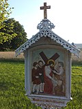
6. Stations of the Cross | Liebfrauenbrunnstrasse 34 (map) |
1900 | 6. Stations of the Cross of the fourteen stations of the Cross to the Liebfrauenbrunn pilgrimage chapel.
|
 More pictures |
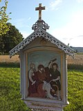
7th station of the cross | Liebfrauenbrunnstrasse 34 (map) |
1900 | 7th station of the cross of the fourteen stations of the cross to the pilgrimage chapel Liebfrauenbrunn.
|
 More pictures |
8. Station of the Cross | Liebfrauenbrunnstrasse 34 (map) |
1900 | 8. Station of the Cross of the fourteen stations of the Cross to the Liebfrauenbrunn pilgrimage chapel.
|
 More pictures |
9. Stations of the Cross | Liebfrauenbrunnstrasse 34 (map) |
1900 | 9. Stations of the cross on the fourteen stations of the cross to the pilgrimage chapel Liebfrauenbrunn.
|
 More pictures |
10th station of the cross | Liebfrauenbrunnstrasse 34 (map) |
1900 | 10. Stations of the cross on the fourteen stations of the cross to the pilgrimage chapel Liebfrauenbrunn.
|
 More pictures |
11. Stations of the Cross | Liebfrauenbrunnstrasse 34 (map) |
1900 | 11th station of the cross on the fourteen-station cross route to the pilgrimage chapel Liebfrauenbrunn.
|
 More pictures |
12. Stations of the Cross | Liebfrauenbrunnstrasse 34 (map) |
1900 | 12. Stations of the cross on the fourteen stations of the cross to the pilgrimage chapel Liebfrauenbrunn.
|
 More pictures |
13. Stations of the Cross | Liebfrauenbrunnstrasse 34 (map) |
1900 | 13. Stations of the cross on the fourteen stations of the cross to the pilgrimage chapel Liebfrauenbrunn.
|
 More pictures |
14. Station of the Cross | Liebfrauenbrunnstrasse 34 (map) |
1900 | 14. Stations of the cross on the fourteen stations of the cross to the pilgrimage chapel Liebfrauenbrunn.
|
 |
War memorial | Marketplace (map) |
1914-1919 | War Memorial First World War
|
| Atonement Cross | Taubertalstraße (L 506) (an) (map) |
Atonement Cross Werbach I
|
||
| Wayside shrine | Taubertalstraße (L 506) (an) (map) |
Wayside shrine
|
||
| Wayside shrine | Taubertalstraße (L 506) (an) (map) |
Wayside shrine
|
||
 More pictures |
Welzmühle | Welzbachtalradweg (map) |
Historic millstone
|
|
 |
Atonement Cross | Winterleitenweg (map) |
Atonement Cross Werbach III
|
|
| War memorial | 1939-1945 | War Memorial Second World War
|
Werbachhausen
Architectural, artistic and cultural monuments in Werbachhausen with the village of Werbachhausen ( ⊙ ) and the houses Emmentaler Mühle ( ⊙ ) and mill construction workshops:
![]() Map with all coordinates of the cultural monuments in the district of Werbachhausen: OSM
Map with all coordinates of the cultural monuments in the district of Werbachhausen: OSM
| image | designation | location | Dating | description |
|---|---|---|---|---|
| Atonement Cross | Altenberg, Welzbachstrasse (map) |
1634 | Atonement Cross Werbach VIII / District Werbachhausen. Inscription "1634". Two farmers, who came towards each other with their cart on the narrow path and did not want to evade each other, killed each other with a karst (vineyard hoe) (Losch 1981).
|
|
| Wayside shrine | Brunntaler Strasse (K 2817) (an) (map) |
Wayside shrine
|
||
| Wayside shrine | Brunntaler Strasse (K 2817) (an) (map) |
Wayside shrine
|
||
| Wayside shrine | Brunntaler Strasse, Klingenstrasse (map) |
Wayside shrine
|
||
 |
Wayside shrine | Brunntaler Straße, Welzbachtalradweg (map) |
Wayside shrine
|
|
 |
Wayside shrine | Klingenstrasse 10 (near) / Leidenweg (map) |
Wayside shrine
|
|
 More pictures |
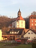
St. Laurence | Leidenweg 1 (map) |
1716/1731 | Catholic parish church of St. Laurentius. Baroque hall building with retracted polygonal choir and roof turret. High lining wall, 1716 and 1731 re. Behind the atonement cross, medieval.
|
 |
Atonement Cross | Leidenweg 1 (map) |
Atonement Cross Werbach VII / District Werbachhausen. "Schwedenkreuz" (Losch 1981).
|
|
 |
Atonement Cross | Leidenweg 1 (map) |
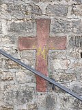
Atonement Cross Werbach IX. Walled-in stone cross at the entrance to the church. Not listed in Losch (1981).
|
|
 |
Wayside shrine | Leidenweg 1 (map) |
Wayside shrine
|
|
 More pictures |
Mary's Grotto | Leidenweg 1 (map) |
Mariengrotte (also called Lourdesgrotte) in Werbachhausen.
|
|
| school-building | Leidenweg 3 (map) |
19th century | School. Solid construction with half hip. Drilled portal with vestibule. Door frame with shoulder arch and skylight. 2nd half of the 19th century.
|
|
| Wayside shrine | Leidenweg (am) (map) |
Wayside shrine
|
||
| Wayside shrine | Leidenweg (am) (map) |
Wayside shrine
|
||
| Wayside shrine | Leidenweg (near) (map) |
Wayside shrine
|
||
| Wayside shrine | Unter dem Holz, Welzbach (am) (map) |
Wayside shrine
|
||
| Wayside shrine | Forest path (map) |
Wayside shrine
|
||
| Wayside shrine | Welzbachstrasse 8 (opposite) (map) |
Wayside shrine
|
||
 |
Wayside shrine | Welzbachstrasse 50 (near) (map) |
Wayside shrine
|
|
 More pictures |
Emmental mill | Welzbachstrasse 56 (map) |
Historic mill and several half-timbered houses.
|
See also
- List of cultural monuments in the Main-Tauber district
- List of war memorials in Werbach
- List of street names in Werbach where many of the cultural monuments are located
Web links
Remarks
- ↑ This list may not correspond to the current status of the official list of monuments. This can be viewed by the responsible authorities. Therefore, the presence or absence of a structure or ensemble on this list does not guarantee that it is or is not a registered monument at the present time. The State Office for Monument Preservation Baden-Württemberg provides binding information .
Individual evidence
- ↑ LEO-BW.de: St. Michael (Kreuzbergstraße, Werbach) . Online at www.leo-bw.de. Retrieved October 12, 2018.
- ↑ LEO-BW.de: Chapel (Waldstrasse, Werbach) . Online at www.leo-bw.de. Retrieved October 12, 2018.
- ↑ a b c d e f g h i j k l m n o p q r s t u v w x y z aa ab ac ad ae Gamburg.de: Sights . Online at www.gamburg.de. Retrieved October 12, 2018.
- ↑ LEO-BW.de: Gamburg Castle (Burgweg 29, Hohlweg, Werbach) . Online at www.leo-bw.de. Retrieved October 12, 2018.
- ↑ LEO-BW.de: Chapel (Burgweg 34, Werbach) . Online at www.leo-bw.de. Retrieved October 12, 2018.
- ↑ LEO-BW.de: St. Martin (Kirchstrasse 11, Werbach) . Online at www.leo-bw.de. Retrieved October 12, 2018.
- ↑ LEO-BW.de: Chapel (Steigweg 2, Werbach) . Online at www.leo-bw.de. Retrieved October 12, 2018.
- ↑ a b LEO-BW.de: Vogtei (Thomas-Buscher-Straße 8, 12, Werbach) . Online at www.leo-bw.de. Retrieved October 12, 2018.
- ↑ LEO-BW.de: Gamburger Buscher Museum . Online at www.leo-bw.de. Retrieved October 12, 2018.
- ↑ Reicholzheim. In: www.suehnekreuz.de. Retrieved September 11, 2019 .
- ↑ locations. In: suehnekreuz.de. Retrieved May 23, 2020 .
- ^ Gamburg, community of Werbach, Main-Tauber-Kreis, Baden-Würtemberg. In: denkmalprojekt.org. Retrieved May 19, 2020 .
- ↑ LEO-BW.de: Parish Church (Wertheimer Straße 17, Werbach) . Online at www.leo-bw.de. Retrieved October 12, 2018.
- ↑ LEO-BW.de: Town Hall (Wertheimer Straße 28, Werbach) . Online at www.leo-bw.de. Retrieved October 12, 2018.
- ↑ LEO-BW.de: Pfeifermuseum in the old town hall . Online at www.leo-bw.de. Retrieved October 12, 2018.
- ↑ a b Niklashausen, Werbach community, Main-Tauber district, Baden-Württemberg. In: denkmalprojekt.org. Retrieved May 19, 2020 .
- ^ Historical local analysis of Wenkheim
- ↑ LEO-BW.de: synagogue (Breitestraße 7, Werbach) . Online at www.leo-bw.de. Retrieved October 12, 2018.
- ↑ LEO-BW.de: school memorial synagogue Wenkheim . Online at www.leo-bw.de. Retrieved October 12, 2018.
- ↑ LEO-BW.de: Church (Mr 23, Werbach) . Online at www.leo-bw.de. Retrieved October 12, 2018.
- ↑ LEO-BW.de: St. Maria (Lochstrasse 1, Werbach) . Online at www.leo-bw.de. Retrieved October 12, 2018.
- ↑ LEO-BW.de: school and town hall (hole Straße 3, Werbach) . Online at www.leo-bw.de. Retrieved October 12, 2018.
- ^ Wenkheim, Werbach community, Main-Tauber district, Baden-Württemberg. In: denkmalprojekt.org. Retrieved May 19, 2020 .
- ↑ Memorial deportation 1940 Wenkheim, municipality Werbach, Main-Tauber-Kreis, Baden-Württemberg. In: denkmalprojekt.org. Retrieved May 19, 2020 .
- ↑ a b Werbach, Main-Tauber-District, Baden-Würtemberg. In: denkmalprojekt.org. Retrieved May 19, 2020 .
- ↑ LEO-BW.de: Chapel (Grabenweg 6, Werbach) . Online at www.leo-bw.de. Retrieved October 12, 2018.
- ↑ LEO-BW.de: St. Martin (Hauptstraße 57, Werbach) . Online at www.leo-bw.de. Retrieved October 12, 2018.
- ↑ a b c LEO-BW.de: Chapel (Liebfrauenbrunnstraße 34, Werbach) . Online at www.leo-bw.de. Retrieved October 12, 2018.
- ↑ a b Werbachhausen / OT from Werbach. In: suehnekreuz.de. Retrieved July 6, 2020 .
- ↑ LEO-BW.de: St. Laurentius (Leidenweg 1, Werbach) . Online at www.leo-bw.de. Retrieved October 12, 2018.
- ↑ LEO-BW.de: School (Leidenweg 3, Werbach) . Online at www.leo-bw.de. Retrieved October 12, 2018.

