List of cultural monuments in Lauda-Königshofen
|
List of cultural monuments in Lauda-Königshofen: Individual monuments of the districts: Beckstein • Deubach • Gerlachsheim • Heckfeld • Königshofen • Lauda ( A , B , G , K , L , M , O , P , R , T , W , Z ) • Marbach • Messelhausen • Oberbalbach • Oberlauda • Sachsenflur • Unterbalbach |
The list of cultural monuments in Lauda-Königshofen includes immovable architectural and art monuments from all districts of Lauda-Königshofen . The basis for this list is the list of architectural and art monuments published by the Stuttgart Regional Council as of February 15, 2012. The article is part of the higher-level list of cultural monuments in the Main-Tauber district . This list is not legally binding. Legally binding information is only available on request from the Lower Monument Protection Authority of the city of Lauda-Königshofen.
Small monuments such as wayside shrines, statues and wayside crosses have been preserved in large numbers in the city area. The reason lies in the agricultural structure that has existed since the Middle Ages. In modern times there was no densification of settlement and industry as in the metropolitan areas, so that these cultural monuments were largely preserved in the open air .
Architectural, art and cultural monuments in the Lauda-Königshofen district
Beckstein
Architectural, art and cultural monuments in Beckstein :
![]() Map with all coordinates of the cultural monuments in the Beckstein district: OSM
Map with all coordinates of the cultural monuments in the Beckstein district: OSM
| image | designation | location | Dating | description |
|---|---|---|---|---|
 More pictures |
St. Kilian | St.-Kilian-Strasse 1 (map) |
1914-1919 | Catholic parish church St. Kilian. Neo-Gothic hall building with entrance tower and polygonal choir, ins. 1914/1919. Inside epitaph from 1558 (1575?) For Martin Hundt.
|
 |
Half-timbered house | Laudaer Strasse 1 (map) |
|
|
 |
Old wine press | Weinstrasse 24 (map) |
|
|
 More pictures |
graveyard | Hofackerweg 6 (map) |
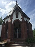
19th century | Walled cemetery with stations of the cross in sandstone reliefs. Neo-Gothic octagonal chapel with Pietà. Late 19th century. Several gravestones and small monuments worth seeing.
|
 More pictures |
Cemetery chapel | Hofackerweg 6 (map) |
19th century | Cemetery chapel. Neo-Gothic octagonal chapel with Pietà. Recorded as part of the total “cemetery” unit.
|
 |
Wayside shrine | Am Seeb-Weg, Gewann Nonnenweinberg (map) |
18./19. Century | Small monument no. 01 (Beckstein): Baroque wayside shrine with a Pieta; Inscription can no longer be deciphered. Renovated by the Alfons Braun family in 1976 and 1998.
|
 |
Wayside shrine | Am Seeb-Weg, Gewann Nonnenberg (map) |
1716 | Small monument no. 02 (Beckstein): Baroque wayside shrine with the Walldürner blood count on the board.
|
| Wayside shrine | At the junction between Laudaer Strasse and Weinstrasse (map) |
1616 | Small monument No. 03 (Beckstein): Late Gothic sandstone picture stick with crucifixion scene and final cross on a yellow sandstone base with (illegible) inscription. Inscription; VEITECK (reference to founder Veit Eck).
|
|
 |
Wayside shrine | Laudaer Strasse, Gewann Emmestal (map) |
1836 | Small monument no. 04 (Beckstein): wayside shrine in Empire style with the coronation of Mary and the Trinity; on the round column St. Nicholas relief as a reference to the founder Nikolaus Mohr. Also: wayside shrine "Emmelesbild".
|
 |
Wayside shrine | Königshöfer Weg, Gewann Kirbig (map) |
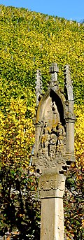
20th century | Small monument no. 05 (Beckstein): wayside shrine "Grotto". Early 20th century. Partly bricked and concreted protective grotto with an older pieta made of sandstone, which originally stood in front of a burned down house in the Ortsetter.
|
 |
Wayside shrine | Königshöfer Weg, Gewann Gemelein (map) |
1866 | Small monument no.06 (Beckstein). Wayside shrine in the Gemmelin. Neo-Gothic wayside shrine with the Coronation of Mary by the Trinity. Erected by Johann Hahn and his wife Margaretha, renovated by the A. Hahn family.
|
| Wayside shrine | Won Medium Blade (Map) |
1870 | Small monument no. 07 (Beckstein): neo-Gothic wayside shrine depicting the Holy Family; Inscription in the base with reference to the founder Karl Eck. Reminds of an accident.
|
|
 |
Wayside shrine | Königshöfer Weg 3 (map) |
18th century | Small memorial No. 08 (Beckstein): Baroque wayside shrine with the Coronation of Mary on the house wall.
|
 |
crossroads | Won Kleeb, at the entrance to the village (map) |
1860 | Small monument No. 09 (Beckstein): Old wayside cross, last renovated in 1984 with a new body donated by the Partin brothers. The inscription on the old base is only partially legible.
|
 |
Crucifixion sculpture | Won Kleeb, on the Weinstrasse, at the entrance to the village (map) |
20th century | Small monument no. 10 (Beckstein): Modern sculpture of the crucified on a supporting wall. Second half of the 20th century.
|
 |
Nepomuk figure | Confluence with Planken (map) |
1753 | Small memorial No. 11 (Beckstein): Nepomuk figure made of limestone on a gray-green base. Inscriptions on the base: 17 KE 53, refers to the founder Kilian Eck. Inscription on stele: Renovated by J. Gallus Strebel in 1859.
|
 |
statue | Planks, retaining wall of the Church of St. Kilian (map) |
1897 | Small monument No. 12 (Beckstein): Statue of guardian angel with child in a niche on the church retaining wall. Reminiscent of an accident.
|
 |
Virgin Mary statue | Geisbergstrasse 10 (map) |
1829 | Small monument no. 13 (Beckstein): Baroque statue of Our Lady with child, scepter and crown, at the feet the globe and snake; structured round column. Sandstone plinth with an inscription about the founder Josef Braun.
|
 |
Wayside shrine | Gewann Am Leschen, Gewann Geißberg (map) |
1819 | Small monument no. 14 (Beckstein): Richly decorated wayside shrine with a crucifixion motif; Relief of the local patron St. Kilian and inscription about the donor Georg Petter Schmitt on the column.
|
| Wooden cross | Cattle drive (map) |
circa 1875 | Small memorial No. 15 (Beckstein): Simple wooden cross without a body. Gained cattle drive, Zitterrain, approx. 500 m above the cemetery.
|
|
 More pictures |
Pieta | Hofackerweg 6, in the cemetery chapel (map) |
19th century | Small monument no. 16 (Beckstein): plaster pieta on a sandstone altar base in the neo-Gothic octagonal chapel (grave of the founder Prof. Karl Theodor Rückert). Recorded as part of the total “cemetery” unit. Late 19th century.
|
 More pictures |
Wooden figure | Hofackerweg 6, at the cemetery chapel (map) |
19th century | Small monument No. 17 (Beckstein): St. George's figure (dragon slayer) as a wooden figure above the entrance portal of the cemetery chapel. Late 19th century. Recorded as part of the total “cemetery” unit.
|
 More pictures |
War memorial | Hofackerweg 6, Beckstein Cemetery (map) |
1930s / 1950s | Small memorial No. 18 (Beckstein): War memorial. The central memorial dates from the mid-30s and commemorates the favor and
Missing people from WW1. In 1950 it was supplemented with two panels for the fallen and missing of the Second World War. A death scene is inserted into the memorial. A steel helmet, bayonet and laurel branches are carved out over it. A name board is also included, two more boards are attached next to it.
|
 More pictures |
Way of the Cross in the cemetery wall | Hofackerweg 6, cemetery wall (map) |
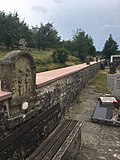
19th century | Small memorial No. 19 (01 to 14) (Beckstein): Wayside shrines with closing cross and sandstone reliefs of the 14 stations of the cross integrated into the cemetery wall.
|
 More pictures |
1st station of the cross | Hofackerweg 6, cemetery wall | 19th century | Small monument no. 19 (01/14) (Beckstein): 1st station of the cross of the fourteen stations of the cross in the cemetery wall. Material: sandstone.
|
 More pictures |
2nd station of the cross | Hofackerweg 6, cemetery wall | 19th century | Small memorial No. 19 (02/14) (Beckstein): 2nd station of the cross of the fourteen stations of the cross in the cemetery wall. Material: sandstone.
|
 More pictures |
3rd station of the cross | Hofackerweg 6, cemetery wall | 19th century | Small memorial No. 19 (03/14) (Beckstein): 3rd station of the cross of the fourteen stations of the cross in the cemetery wall. Material: sandstone.
|
 More pictures |
4th station of the cross | Hofackerweg 6, cemetery wall | 19th century | Small memorial No. 19 (04/14) (Beckstein): 4th station of the cross of the fourteen stations of the cross in the cemetery wall. Material: sandstone.
|
 More pictures |
5th station of the cross | Hofackerweg 6, cemetery wall | 19th century | Small memorial No. 19 (05/14) (Beckstein): 5th station of the cross of the fourteen stations of the cross in the cemetery wall. Material: sandstone.
|
 More pictures |
6. Stations of the Cross | Hofackerweg 6, cemetery wall | 19th century | Small monument no. 19 (06/14) (Beckstein): 6th station of the cross of the fourteen stations of the cross in the cemetery wall. Material: sandstone.
|
 More pictures |
7th station of the cross | Hofackerweg 6, cemetery wall | 19th century | Small memorial No. 19 (07/14) (Beckstein): 7th station of the cross of the fourteen stations of the cross in the cemetery wall. Material: sandstone.
|
 More pictures |
8. Station of the Cross | Hofackerweg 6, cemetery wall | 19th century | Small memorial No. 19 (08/14) (Beckstein): 8th station of the cross of the fourteen stations of the cross in the cemetery wall. Material: sandstone.
|
 More pictures |
9. Stations of the Cross | Hofackerweg 6, cemetery wall | 19th century | Small memorial No. 19 (09/14) (Beckstein): 9th station of the cross of the fourteen stations of the cross in the cemetery wall. Material: sandstone.
|
 More pictures |
10th station of the cross | Hofackerweg 6, cemetery wall | 19th century | Small memorial No. 19 (10/14) (Beckstein): 10th station of the cross of the fourteen stations of the cross in the cemetery wall. Material: sandstone.
|
 More pictures |
11. Stations of the Cross | Hofackerweg 6, cemetery wall | 19th century | Small memorial No. 19 (11/14) (Beckstein): 11th station of the cross of the fourteen stations of the cross in the cemetery wall. Material: sandstone.
|
 More pictures |
12. Stations of the Cross | Hofackerweg 6, cemetery wall | 19th century | Small memorial No. 19 (12/14) (Beckstein): 12th station of the cross of the fourteen stations of the cross in the cemetery wall. Material: sandstone.
|
 More pictures |
13. Stations of the Cross | Hofackerweg 6, cemetery wall | 19th century | Small memorial No. 19 (13/14) (Beckstein): 13th station of the cross of the fourteen stations of the cross in the cemetery wall. Material: sandstone.
|
 More pictures |
14. Station of the Cross | Hofackerweg 6, cemetery wall | 19th century | Small monument no. 19 (14/14) (Beckstein): 14th station of the cross of the fourteen stations of the cross in the cemetery wall. Material: sandstone.
|
| Stone cross | Cattle drive (map) |
1998 | Small monument no. 20 (Beckstein): Modern stone cross without corpus on a green area near the wood storage area.
|
Deubach
Architectural, artistic and cultural monuments in Deubach (with the village of Deubach and the Sailtheim farm):
![]() Map with all coordinates of the cultural monuments in the district of Deubach: OSM
Map with all coordinates of the cultural monuments in the district of Deubach: OSM
| image | designation | location | Dating | description |
|---|---|---|---|---|
 More pictures |
St. Anthony | Brechdarrenweg 2 (map) |
1877-1879 | Catholic Church of St. Antonius, hall building in neo-Gothic style with polygonal choir. 1877/79 re.
|
| Wayside shrine | Brechdarrenweg 2 (bei) (map) |
Wayside shrine
|
||
| crossroads | Deutschordensstrasse 22 (map) |
crossroads
|
||
| crossroads | Path of the Dead (map) |
crossroads
|
||
| Wayside shrine | (Map) | Wayside shrine
|
||
| War memorial | War Memorial First World War.
|
|||
| War memorial | War Memorial Second World War.
|
Gerlachsheim
Architectural, art and cultural monuments in Gerlachsheim :
![]() Map with all coordinates of the cultural monuments in the district of Gerlachsheim: OSM
Map with all coordinates of the cultural monuments in the district of Gerlachsheim: OSM
| image | designation | location | Dating | description |
|---|---|---|---|---|
 |
Baroque bridge | Brueckenstrasse (map) |
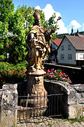
1730-1740 | Grünbach Bridge; a baroque bridge, which was built between 1730 and 1740. The bridge passes under the Grünbach
|
 |
St. Burkhard | Brueckenstrasse (map) |
1730-1740 | St. Burkhard on the bridge
|
 |
St. Kilian | Brueckenstrasse (map) |
1730-1740 | St. Kilian on the bridge
|
 |
St. Michael | Brueckenstrasse (map) |
1730-1740 | St. Michael on the bridge
|
 |
St. Nepomuk | Brueckenstrasse (map) |
1730-1740 | St. Nepomuk on the bridge
|
| graveyard | Friedhofstrasse | Gerlachsheim cemetery, surrounded by a cemetery wall in which there is also a fourteen-station way of the cross. Inside there are some interesting, historical tombstones and other small monuments.
|
||
| War memorial | War Memorial First World War. On the side of the funeral hall are three stone tablets with the names of those who fell in World War I.
|
|||
| Stone figure | War Memorial Second World War. Figure of a dying soldier from the old monument in the church.
|
|||
| Way of the Cross | Friedhofstrasse | The 14 stations of the Gerlachsheimer Kreuzweg are located in the cemetery wall.
|
||
 More pictures |
1st station of the cross | Friedhofstrasse | 1st station of the cross of the fourteen stations of the cross in the cemetery wall.
|
|
 More pictures |
2nd station of the cross | Friedhofstrasse | 2nd station of the cross of the fourteen stations of the cross in the cemetery wall.
|
|
 More pictures |
3rd station of the cross | Friedhofstrasse | 3rd station of the cross of the fourteen stations of the cross in the cemetery wall.
|
|
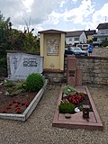 More pictures |
4th station of the cross | Friedhofstrasse | 4. Stations of the Cross of the fourteen stations of the Cross in the cemetery wall.
|
|
 More pictures |
5th station of the cross | Friedhofstrasse | 5th station of the cross of the fourteen stations of the cross in the cemetery wall.
|
|
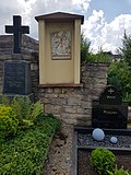 More pictures |
6. Stations of the Cross | Friedhofstrasse | 6. Stations of the Cross of the fourteen stations of the Cross in the cemetery wall.
|
|
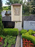 More pictures |
7th station of the cross | Friedhofstrasse | 7th station of the cross of the fourteen stations of the cross in the cemetery wall.
|
|
 More pictures |
8. Station of the Cross | Friedhofstrasse | 8. Stations of the Cross of the fourteen stations of the Cross in the cemetery wall.
|
|
 More pictures |
9. Stations of the Cross | Friedhofstrasse | 9. Stations of the Cross of the fourteen stations of the Cross in the cemetery wall.
|
|
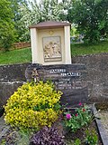 More pictures |
10th station of the cross | Friedhofstrasse | 10. Station of the Cross of the fourteen stations of the Cross in the cemetery wall.
|
|
 More pictures |
11. Stations of the Cross | Friedhofstrasse | 11. Station of the Cross of the fourteen stations of the Cross in the cemetery wall.
|
|
 More pictures |
12. Stations of the Cross | Friedhofstrasse | 12. Stations of the cross of the fourteen stations of the cross in the cemetery wall.
|
|
 More pictures |
13. Stations of the Cross | Friedhofstrasse | 13. Stations of the Cross of the fourteen stations of the Cross in the cemetery wall.
|
|
 More pictures |
14. Station of the Cross | Friedhofstrasse | 14. Station of the Cross of the fourteen stations of the Cross in the cemetery wall.
|
|
 |
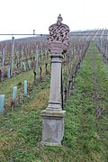
Wayside shrine | Herrenberg (map) |
Wayside shrine
|
|
 |
Wayside shrine | Herrenberg (map) |
Wayside shrine
|
|
 |
Wayside shrine | Herrenberg (map) |
Wayside shrine
|
|
 |
Wayside shrine | Herrenberg (map) |
"I am the vine"
|
|
 |
Old wine press | Herrenberg (map) |
Old wine press
|
|
 |
Wayside shrine | Herrenbergstrasse 3 (map) |
Wayside shrine
|
|
 |
tea house | Monastery garden (map) |
Tea house in the monastery garden
|
|
 |
Village mill | Mühlgasse 12 (map) |
1420 | Village mill, built in 1420, restored in 1821
|
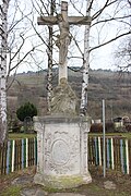 |
Baroque wayside shrine Mater Dolorosa | St.-Veit-Strasse (map) |
Baroque wayside shrine Mater Dolorosa, depicts Christ on the cross with Pieta and was donated by Johann Peter Buchler in 1741
|
|
 |
Imperial monument | Turmberg (map) |
Imperial monument
|
|
 |
Former home of the princely domain leader | Würzburger Strasse 24 (map) |
1806 | Former residence of the princely domain leader, built in 1806
|
| town hall | Würzburger Strasse 51 | 1850 | Former town hall. Solid construction with hipped mansard roof; simple structure. Jewelry portal with gable. Mid 19th century (around 1850).
|
|
 |
Wayside shrine | Würzburger Strasse 62 (map) |
Wayside shrine
|
|
 |
Buchler winery | Würzburger Strasse 67 (map) |
1706 | Winzerhaus Buchler, baroque building from 1706
|
 |
Gerlachsheim Monastery | Würzburger Strasse 79 (map) |
1228/18. Century | Former Gerlachsheim monastery, first mentioned in 1228, former women's and later men's monastery of the Premonstratensian order. Three-wing complex with rich ornamental portals, 18th century. The adjacent park was previously used as a monastery garden. Arched stone bridge and Chinese pavilion in the garden, around 1800 (factual entirety).
|
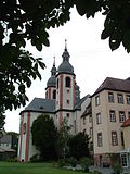 |
Holy Cross Church | Würzburger Strasse 81 (map) |
1723-1730 | Catholic Baroque Church of the Holy Cross, built 1723–1730. Baroque double tower complex. Arched facade with rich sculptural decoration. In simplified terms, it is modeled on St. Peter's Basilica. The church is one of the most important art monuments in the Baden Franconian region.
|
 |
Rococo free group of the Sorrowful Mother | Würzburger Strasse 81 (map) |
1751 | Rococo free group of Our Lady of Sorrows, built in 1751
|
 |
Gerlachsheim wayside shrine Coronation of Mary | Würzburger Strasse 83 (map) |
1812 | Gerlachsheim wayside shrine for the Coronation of Mary, from 1812
|
Heckfeld
Architectural, art and cultural monuments in Heckfeld :
![]() Map with all coordinates of the cultural monuments in the district of Heckfeld: OSM
Map with all coordinates of the cultural monuments in the district of Heckfeld: OSM
| image | designation | location | Dating | description |
|---|---|---|---|---|
 More pictures |
St. Vitus | Gissigheimer Strasse 33 (map) |
1604/1894 | Catholic parish church St. Vitus. Hall with transept and polygonal choir. 1604, with reconstruction in 1894. Older tower with Romanesque animal sculpture.
|
| War memorial | Gissigheimer Strasse 33 (map) |
War memorial 1870/71
|
||
| War memorial | Gissigheimer Strasse 33 | War memorial First and Second World War.
|
||
 More pictures |
National Socialist Victims Memorial | Gissigheimer Strasse 33 (map) |
National Socialist Victims Memorial. Inside the church of St. Vitus there is a memorial plaque for Anton Spies (born November 21, 1909 - April 19, 1945), parish vicar and martyr of the Heckfeld parish, who lived in the Dachau concentration camp three days before the longed-for liberation by the Americans died. Depiction: Wall plaque with the following inscription: MEMORY AND LEGACY OF OUR PRIEST (Anton Spies, dates) IF THE WHEAT GRAIN DOES NOT FALL INTO THE EARTH AND DIES, IT REMAINS ALONE; BUT WHEN IT DIES IT BRINGS RICH FRUIT. Joh. 12,24.
|
|
| Cemetery cross | Gissigheimer Strasse 33 (map) |
Cemetery cross
|
||
 |
Wayside shrine |
|
||
 |
Wayside shrine |
|
||
 |
Wayside shrine |
|
||
| Elevated water tank | Schüpfer Strasse | 1913 | Elevated tank, square construction with neoclassical structure, 1913 re.
|
Koenigshofen
Architectural, artistic and cultural monuments in Königshofen (with the town of Königshofen and the houses Elektrizitätswerk Neumühle and Roter Rain):
![]() Map with all coordinates of the cultural monuments in the district of Königshofen: OSM
Map with all coordinates of the cultural monuments in the district of Königshofen: OSM
| image | designation | location | Dating | description |
|---|---|---|---|---|
| Anthony's Chapel | Antoniusstrasse 11 | 1872 | Anthony's Chapel. Neo-Gothic building from 1872.
|
|
 |
War memorial | Eisenbahnstrasse | 1870-1871 | War memorial, erected 1870–1871
|
| Residential building | Eisenbahnstrasse 16 | 19th century | Residential building. Solid construction with a rich structure. Portal with vestibule. 2nd half of the 19th century.
|
|
 More pictures |
Käppele | Frauenberg (map) |
1898 | The so-called Käppele, at the foot of the Frauenberg, a little above the K 2832. Neo-Gothic chapel, 1898 re.
|
| Gasthof zur Gans | Hauptstrasse 61 | 18. – 19. Century | Gasthof zur Gans. Plastered building with a crooked hip roof that defines the townscape. Goose relief above the entrance. 18./19. Century.
|
|
| school | Kirchstrasse 13 | 1822 | Old school house. Plastered building with a crooked roof. Portal with vestibule and carved door leaf. 1822 re.
|
|
| Tenth house | Kirchstrasse 17 | 1615-1644 | Tithe Goths. Massive tower with half-timbered structure. Embedded coat of arms stones. Defense structure built in 1615 by the Mainz tithe master Simrock as part of the fortified church, archway on the ground floor re. 1644. (Developed as a clubhouse since 1973).
|
|
 |
St. Mauritius | Kirchstrasse 19 (map) |
1836 | Catholic parish church of St. Mauritius. Classicist hall building from 1836 with a Romanesque entrance tower in the basement.
|
| Plaster construction | Oberer Grabenweg 7 | 19th century | Kindergarten. Neo-baroque plastered building with hipped roof; Central projection with tail gable. Late 19th century.
|
|
| chapel | Sailtheimer Strasse | 1900 | Chapel around 1900.
|
|
 |
Stone arch | Tumbergstrasse | 1614 | Stone arch, erected in 1614
|
 |
Scherer house | Untere Mauerstrasse | 1709 | Scherer House, built in 1709, former pottery
|
 |
Stone cross | Stone cross
|
||
 |
Stone tablet with Latin inscription | 1596 | Stone tablet with Latin inscription, erected in 1596
|
|
| War memorial | War Memorial First World War. The grateful congregation of your sons who fell, died and missing in the World War 1914-1918.
|
|||
| Plaque | Commemorative plaque Second World War. 1939-1945. Our Fallen Heroes. They will see His face and have His name on their foreheads.
|
|||
| Memorial plaque to civilian victims | Memorial plaque to civilian victims. Plaque of civil victims: As a constant reminder of the day of horror on Easter April 1st, 1945, when two thirds of our hometown Königshofen was destroyed by the effects of the war, as was once the case on Whit Saturday, June 4th, 1525 in the peasant war. Twelve local residents were killed.
|
|||
| Memorial plaque fallen on site | Commemorative plaque Second World War. Fallen table on site: 1945 Fallen here in the Easter fights. 1945 await the resurrection. The bearers of the dog tags were buried unknown.
|
|||
| Memorial plaque in front of the church | Memorial plaque in front of the church
|
|||
| War cemetery | War cemetery
|
|||
| monument | Edge of the forest | Monument at the edge of the forest. War cemetery.
|
Lauda
Architectural, art and cultural monuments in Lauda :
![]() Map with all coordinates of the cultural monuments in the district of Lauda: OSM
Map with all coordinates of the cultural monuments in the district of Lauda: OSM
A.
| image | designation | location | Dating | description |
|---|---|---|---|---|
 |
Historic Tauber Bridge | Am Wörth (map) |
Historic Tauber Bridge with wayside shrines.
|
|
| Wayside shrine | Am Wörth (map) |
First of two wayside shrines on the Tauber Bridge
|
||
| Wayside shrine | Am Wörth (map) |
Second of two wayside shrines on the Tauber Bridge
|
B.
| image | designation | location | Dating | description |
|---|---|---|---|---|
 More pictures |
Half-timbered house | Bachgasse 8 | 1677 | Half-timbered house, from 1677
|
 More pictures |
Half-timbered house | Bachgasse 10 | Half-timbered house
|
|
 More pictures |
Marienkirche | Bahnhofstrasse 16 (map) |
1613/1617 | The Marienkirche, also Church of Our Lady or Church of Our Lady . Baroque-style late Gothic cemetery church with magnificent portal, 1613/17.
|
 |
graveyard | Bahnhofstrasse 16 | 1542/1613/1617 / around 1730 | Old city cemetery near the Marienkirche (older part), surrounded by a cemetery wall with a round arched double entrance, 1542, (§ 28), fourteen stations of the cross from the time around 1730. In the cemetery there are some historical gravestones and other small monuments worth seeing (§ 2 , A / 2004) (totality).
|
 |
War memorial | Bahnhofstrasse 16 (map) |
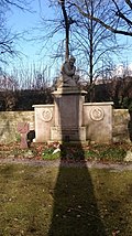
War memorial. The war memorial stands on one of the surrounding walls in the old cemetery by the Marienkirche. In the middle a square stone pillar with an inserted name plaque. Above is a praying soldier. Another name plate and an inscription plate are added to the right and left. Each with a carved laurel wreath.
|
|
| War graves | Bahnhofstrasse 16 | War graves from WWI and WWII in the old cemetery.
|
||
 More pictures |
Way of the Cross | Bahnhofstrasse 16 | around 1730 | Fourteen stations of the Cross in the cemetery wall of the old city cemetery around the Marienkirche.
|
 More pictures |
1st station of the cross | Bahnhofstrasse 12 | around 1730 | 1st station of the cross of the fourteen stations of the cross in the cemetery wall.
|
 More pictures |
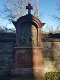
2nd station of the cross | Bahnhofstrasse 12 | around 1730 | 2nd station of the cross of the fourteen stations of the cross in the cemetery wall.
|
 More pictures |
3rd station of the cross | Bahnhofstrasse 12 | around 1730 | 3rd station of the cross of the fourteen stations of the cross in the cemetery wall.
|
 More pictures |
4th station of the cross | Bahnhofstrasse 12 | around 1730 | 4. Stations of the Cross of the fourteen stations of the Cross in the cemetery wall.
|
 More pictures |
5th station of the cross | Bahnhofstrasse 12 | around 1730 | 5th station of the cross of the fourteen stations of the cross in the cemetery wall.
|
 More pictures |
6. Stations of the Cross | Bahnhofstrasse 12 | around 1730 | 6. Stations of the Cross of the fourteen stations of the Cross in the cemetery wall.
|
 More pictures |
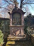
7th station of the cross | Bahnhofstrasse 12 | around 1730 | 7th station of the cross of the fourteen stations of the cross in the cemetery wall.
|
 More pictures |
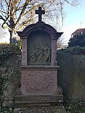
8. Station of the Cross | Bahnhofstrasse 12 | around 1730 | 8. Stations of the Cross of the fourteen stations of the Cross in the cemetery wall.
|
 More pictures |
9. Stations of the Cross | Bahnhofstrasse 12 | around 1730 | 9. Stations of the Cross of the fourteen stations of the Cross in the cemetery wall.
|
 More pictures |
10th station of the cross | Bahnhofstrasse 12 | around 1730 | 10. Station of the Cross of the fourteen stations of the Cross in the cemetery wall.
|
 More pictures |
11. Stations of the Cross | Bahnhofstrasse 12 | around 1730 | 11. Station of the Cross of the fourteen stations of the Cross in the cemetery wall.
|
 More pictures |
12. Stations of the Cross | Bahnhofstrasse 12 | around 1730 | 12. Stations of the cross of the fourteen stations of the cross in the cemetery wall.
|
 More pictures |
13. Stations of the Cross | Bahnhofstrasse 12 | around 1730 | 13. Stations of the Cross of the fourteen stations of the Cross in the cemetery wall.
|
 More pictures |
14. Station of the Cross | Bahnhofstrasse 12 | around 1730 | 14. Station of the Cross of the fourteen stations of the Cross in the cemetery wall.
|
 |
Wayside shrine | Bahnhofstrasse 16 | Wayside shrine
|
|
 |
Wayside shrine | Bahnhofstrasse 16 | Wayside shrine at the old city cemetery
|
|
| More pictures | Station (entity) | Bahnhofstrasse 17 | around 1910 | Bahnhofstrasse 17 (Flst. No. 388/1): Former Service residential building, 2 to 3 storey pavilion building with hipped roof and rich structure, Art Nouveau, around 1910 (§ 2).
|
| More pictures | Station (entity) | Bahnhofstrasse 21 | around 1900 | Bahnhofstraße 21: kiosk, single-storey classicist building under a hipped roof, around 1900.
|
| More pictures | Station (entity) | Bahnhofstrasse 23 | 1871 | Bahnhofstrasse 23 (Flst.No. 388/1): station reception building, 1 to 2 ½ storey classicist pavilion building with a central waiting hall, rich structure, re. 1871 (§ 2).
|
| More pictures | Station (entity) | Bahnhofstrasse 27 | after 1870 | Bahnhofstrasse 27: Former Car workshop with service building; 1 to 2 ½ storey classical pavilion building, after 1870 (§ 2).
|
| More pictures | Station (entity) | Bahnhofstrasse 29 | after 1870 / around 1900 | Bahnhofstrasse 29 (and 31): Former Car workshop with service house, 1 to 2 ½ storey classical pavilion building, after 1870 / around 1900 (§ 2).
|
| More pictures | Station (entity) | Bahnhofstrasse 31 | after 1870 / around 1900 | Bahnhofstrasse 31 (and 29): Former Car workshop with service house, 1 to 2 ½ storey classical pavilion building, after 1870 / around 1900 (§ 2).
|
 |
Truss | Becksteiner Strasse | Half-timbered, on Becksteiner Strasse, opposite the Upper Gate
|
|
 |
Stone portrait | Becksteiner Strasse | Stone portrait, on Becksteiner Strasse, opposite the Upper Gate
|
|
 |
Stone portrait | Becksteiner Strasse | Stone portrait, on Becksteiner Strasse, opposite the Upper Gate
|
|
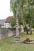 |
Stone pillar | Becksteiner Strasse | Stone pillar, on Becksteiner Strasse, opposite the Upper Gate
|
G
| image | designation | location | Dating | description |
|---|---|---|---|---|
| City fortifications (aggregate) | Gäßleinsweg | Gäßleinsweg: the remains of the city wall running parallel along the former moat (§ 28). Part of the totality of city fortifications, city walls / remains (partially running parallel) of medieval city fortifications with gates and towers.
|
K
| image | designation | location | Dating | description |
|---|---|---|---|---|
 |
Chapel to the Holy Sepulcher | Kapellenstrasse 3 | 1683 | Chapel of the Holy Sepulcher (also called Blood Chapel or Holy Blood Chapel ). Simple hall construction. Renewed in 1683.
|
 |
inscription | Kapellenstrasse | Stone inscription
|
|
| City fortifications (aggregate) | Kapellenstrasse 10 (near) | Kapellenstrasse 10: the remains of the city wall in the barn. Part of the totality of city fortifications, city walls / remains (partially running parallel) of medieval city fortifications with gates and towers.
|
L.
| image | designation | location | Dating | description |
|---|---|---|---|---|
| hospital | Luisenstrasse 2 | 1893 | Former Hospital. Solid construction with central projections and side dwelling houses, re. 1893.
|
M.
| image | designation | location | Dating | description |
|---|---|---|---|---|
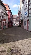 |
Half-timbered houses | Marienstrasse (map) |
Half-timbered houses on the edge of the smallest pedestrian zone in southern Germany
|
|
 |
Fountain | Marketplace 1 (map) |
Philipp Adam Ulrich Fountain
|
|
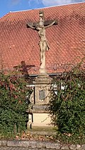 |
Stone cross | Marketplace 1 (map) |
So-called free strike cross
|
O
| image | designation | location | Dating | description |
|---|---|---|---|---|
| War Memorial | Upper corridor, mountain cemetery | Memorial to all war victims in the new cemetery (crosses over a naked figure).
|
||
| City fortifications (aggregate) | Obere Torgasse 3 | Obere Torgasse 3: The house sits on the city wall (which runs parallel to Oberlaudaer Straße). Part of the totality of city fortifications, city walls / remains (partially running parallel) of medieval city fortifications with gates and towers.
|
||
 |
Wall breakthrough | Upper Torgasse | Upper gate, wall breakthrough
|
|
 More pictures |
Half-timbered house | Obere Torgasse 7 | Half-timbered house
|
|
 |
City fortifications (aggregate) | Obere Torgasse 7 | Part of the totality of city fortifications, city walls / remains (partially running parallel) of medieval city fortifications with gates and towers.
|
|
 More pictures |
Half-timbered house | Obere Torgasse 8 | Half-timbered house
|
|
 More pictures |
Half-timbered house | Obere Torgasse 11 | Half-timbered house
|
|
| City fortifications (aggregate) | Oberlaudaer Strasse | Oberlaudaer Straße: remnants of the city wall running parallel along the former moat (§ 28). Part of the totality of city fortifications, city walls / remains (partially running parallel) of medieval city fortifications with gates and towers.
|
P
| image | designation | location | Dating | description |
|---|---|---|---|---|
 More pictures |
Half-timbered house | Pfarrstrasse 1 | Half-timbered house
|
|
 More pictures |
Half-timbered house | Pfarrstrasse 3 | Half-timbered house
|
|
 More pictures |
Half-timbered house | Pfarrstrasse 7 | Half-timbered house
|
|
 More pictures |
building | Pfarrstrasse 8 | building
|
|
| barn | Pfarrstrasse 8 (behind) | 17th century | Barn and parish cellar. Solid angle hook construction with corner grooves. Arched driveway with heraldic cartouche, 17th century.
|
|
 More pictures |
Stone gate | Pfarrstrasse 10 | Stone gate
|
|
 More pictures |
Half-timbered house | Pfarrstrasse 11 | Half-timbered house
|
|
 More pictures |
Half-timbered house | Pfarrstrasse 13 | Half-timbered house
|
|
 More pictures |
St. James | Pfarrstrasse 15 | 1322-1333 | Catholic parish church St. Jakob. Flat-roofed basilica, rebuilt in 1694 on late Gothic enclosing walls, with late Gothic retracted polygonal choir. Rococo furnishings. South portal 1610/20. Outside Mount of Olives. Erected for the first time in Gothic style from 1322 to 1333 under the Würzburg Prince-Bishop Wolfram von Grumbach.
|
| Lourdes grotto | Pfarrstrasse 15 (near) | 19th century | Lourdes grotto, 19th century.
|
|
 |
City fortifications (aggregate) | Pfarrstrasse 17 (map) |
Pfarrstrasse 17: Powder tower with remains of the city wall (§ 28). Part of the totality of city fortifications, city walls / remains (partially running parallel) of medieval city fortifications with gates and towers.
|
|
 |
statue | Pfarrstrasse 18 | Kilian statue
|
|
 |
Railway monument | Philipp-Adam-Ulrich-Strasse (map) |
Railway monument
|
|
 More pictures |
school | Philipp-Adam-Ulrich-Strasse 2 | 1912 | School. Former elementary school, today Lauda-Königshofen community school . Plastered building with hipped mansard roof in corner position, roof turrets, central dwarf house. Portal with canopy and relief decoration. 1912 re.
|
| Protestant church | Philipp-Adam-Ulrich-Strasse 17 | 1906-1907 | Ev. Parish church. Neo-Romanesque building from 1906/07.
|
|
| War memorial | Philipp-Adam-Ulrich-Strasse 17 | War Memorial Second World War. Memorial plaques for those killed in World War II in the Protestant church.
|
R.
| image | designation | location | Dating | description |
|---|---|---|---|---|
 |
Fountain | Rathausstrasse (map) |
Fool's well
|
|
 |
City fortifications (aggregate) | Rathausstrasse / Obere Torgasse | Rathausstrasse: Upper Gate (Section 28), late medieval city gate with a half-timbered tower. 1496 designated. Part of the totality of city fortifications, city walls / remains (partially running parallel) of medieval city fortifications with gates and towers.
|
|
| Residential building | Rathausstrasse 21 | 20th century | Residential building. Plastered building with hipped mansard roof. Door and window on the ground floor with decorative iron bars. Early 20th century.
|
|
 |
town hall | Rathausstrasse 21 (next to) (map) |
1728 | Old Town Hall. Solid construction with a hipped mansard roof, grooved corner pilaster strips and drilled door and window frames. Laterally arched entrance, 1728 inscribed.
|
 |
Stone pillar | Rathausstrasse 21 (map) |
Marian column with the mother of God
|
|
 |
Historic house | Rathausstrasse 23 (map) |
Historic house, housed the former savings bank
|
|
 |
Ulrich house with local museum | Rathausstrasse 25 (map) |
1551/1592 | Ulrich house with local museum. Ornamental half-timbered building with renaissance portal. 1551 and 1592. The local history museum was set up in 1965 in a wine-growing house built in 1551, the birthplace of the legal historian Philipp Adam Ulrich (1692-1748), who promoted the cultivation of potatoes and clover in the Principality of Würzburg and tried to raise silkworms. The museum owes its creation and its holdings to the initiative and collecting activities of the Lauda city archivist Karl Schreck. The exhibition has now been expanded to include several rooms. The ground floor houses a typical winemaker's apartment for the area with a farmer's kitchen, living room, bedroom and wine press room. On the two upper floors, guild and craftsmen's rooms as well as a bourgeois bedroom are reminiscent of Lauda's past as an upper official city in the Prince Diocese of Würzburg. There is also a fool's room, which is dedicated to the Franconian carnival tradition, and home rooms of the Sudeten and Carpathian Germans. Another room commemorates pastor Johann Martin Schleyer (1831-1912), who created the then successful planned language Volapük around 1880.
|
| pavilion | Rebgutstrasse 1 | 18. – 19. Century | Garden wall with half-timbered corner pavilion with tent roof. 18th / 19th century. Relief stones set into the wall: angel with monstrance, 18th / 19th century and carrying the cross, 18th century.
|
T
| image | designation | location | Dating | description |
|---|---|---|---|---|
| Lauda railway bridge | Tauber, Taubertal Cycle Path (map) |
1866 | Lauda railway bridge. The bridge was put into operation in 1866 with the opening of the Baden Odenwald Railway between Osterburken, Lauda and Würzburg.
|
|
| More pictures | Station (entity) | Tauberstrasse 16 | around 1870 | Tauberstrasse 16: Former Locomotive workshop I, later a magazine, shell limestone and sandstone block construction, around 1870.
|
 |
monument | Taubertal cycle path | Memorial for the air raid of 1944, on the Taubertal cycle path from Lauda to Distelhausen, shortly after the Lauda Dr. Wobbser on the right side of the road
|
W.
| image | designation | location | Dating | description |
|---|---|---|---|---|
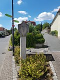 |
Wayside shrine | Weinbergsweg | Wayside shrine
|
Z
| image | designation | location | Dating | description |
|---|---|---|---|---|
| City fortifications (aggregate) | Zehntgasse | Zehntgasse, Lot No. 42: Remains of the city wall at the barn. Part of the totality of city fortifications, city walls / remains (partially running parallel) of medieval city fortifications with gates and towers.
|
||
| More pictures | Station (entity) | Access road 1 | after 1870 | Former Goods hall, 1 ½ storey red sandstone block construction with floating gables, after 1870.
|
| More pictures | Station (entity) | Access road 8 | after 1870 | Depot, single-storey red sandstone cuboid building with two-storey central projectile with floating gable, after 1870.
|
| More pictures | Station (entity) | Access road 9 | after 1879 | Former Bath house, single-storey shell limestone building with red sandstone structures with floating gables, after 1879.
|
| More pictures | Station (entity) | Access road 12 | after 1870 | Former Electricity works, 1-2 storey red sandstone block building, after 1870.
|
| More pictures | Station (entity) | Access road 13 | after 1870 | Access road 13: Former Locomotive workshop, single-storey red sandstone cuboid construction, after 1870.
|
Marbach
Architectural, art and cultural monuments in Marbach :
![]() Map with all coordinates of the cultural monuments in the Marbach district: OSM
Map with all coordinates of the cultural monuments in the Marbach district: OSM
| image | designation | location | Dating | description |
|---|---|---|---|---|
 More pictures |
St. Joseph | St.-Josef-Strasse 4 (map) |
1782 | Catholic Church of St. Joseph. Late baroque hall church with roof turret, 1782 ins.
|
 |
War memorial | St.-Josef-Strasse 4 | War memorial First and Second World War. On the outside of the church.
|
|
| graveyard |
|
|||
| Mary's Grotto |
|
Messelhausen
Architectural, artistic and cultural monuments in Messelhausen (with the village of Messelhausen and the hamlets of Hofstetten and Hof Marstadt):
![]() Map with all coordinates of the cultural monuments in the district of Messelhausen: OSM
Map with all coordinates of the cultural monuments in the district of Messelhausen: OSM
| image | designation | location | Dating | description |
|---|---|---|---|---|
| Tithe barn | Freiherr-von-Zobel-Strasse 9 | 17th century | Former Tithe barn. Solid construction with half-timbered attachment. Arched portals. Double coat of arms stone, probably 17th century.
|
|
 More pictures |
Messelhausen Castle | Freiherr-von-Zobel-Strasse 39 (map) |
16. – 19. Century | Former Castle complex in place of a moated castle, the so-called prison tower has been preserved from the previous complex, 16./17. Century; Castle (§ 28) with annex, three utility buildings, orangery, built in 1740/44; The mansard roof of the castle was converted into a gable roof in 1829/32; Gardens rebuilt in 1830/32; Enclosure wall and fountain in the castle courtyard, around 1850; Property since the 20th century. Pius-Keller-Haus of the Augustinian monastery in Würzburg (totality §2).
|
| Lady Chapel | Hofstetten 2 | 1857 | Marienkapelle with polygonal choir and roof turret. Neo-Gothic structure, made of red sandstone. 1857 re.
|
|
| Crucifixion group | St.-Burkhard-Strasse 7 | 1737 | Crucifixion Group, 1737.
|
|
 More pictures |
St. Burkard | St.-Burkhard-Strasse 8 (map) |
1595/1717 | Catholic Church of St. Burckhardt (§ 28), 1595, with changes from 1717, with churchyard wall and some gravestones (totality §2).
|
| War memorial | War memorial / cemetery of honor.
|
Oberbalbach
Architectural, art and cultural monuments in Oberbalbach :
![]() Map with all the coordinates of the cultural monuments in the district of Oberbalbach: OSM
Map with all the coordinates of the cultural monuments in the district of Oberbalbach: OSM
| image | designation | location | Dating | description |
|---|---|---|---|---|
 More pictures |
St. George | Balbachtalstrasse 30 (map) |
1738 | Catholic Church of St. George. Baroque hall from 1738 with older furnishings. Renovated in 1888.
|
 |
Wayside shrine | Local connection route (Oberbalbach - Messelhausen) (map) |
Small monument no.01 (Oberbalbach): wayside shrine on the local connection route from Oberbalbach to Messelhausen . Figure of Mary and Joseph at the manger. Inscription not completely recognizable.
|
|
 |
Wayside shrine | Local connection route (Oberbalbach - Messelhausen) (map) |
Small monument no.02 (Oberbalbach): wayside shrine on the local connection route from Oberbalbach to Messelhausen. Jesus praying. Inscription not recognizable.
|
|
 |
Wayside shrine | Local connection route (Oberbalbach - Messelhausen) (map) |
Small monument no.03 (Oberbalbach): wayside shrine on the local connection route from Oberbalbach to Messelhausen. Upper part broken off.
|
|
 |
Wayside shrine | K 2847 (Oberbalbach - Oesfeld) (map) |
Small memorial No. 04 (Oberbalbach): wayside shrine on the K 2847 to Oesfeld . Depiction of the 14 helpers and the baby Jesus. Inscription: You fourteen Holy Helpers pray for us, Great Helper in Need.
|
|
 |
Wayside shrine | K 2847 (Oberbalbach - Oesfeld) (map) |
Small monument no.05 (Oberbalbach): wayside shrine on the K 2847 to Oesfeld. Illustration of Mary, Joseph and Jesus (Holy Family). Inscription: Be an example, protection and ornament to us Holy Family here.
|
|
 |
Wooden cross | K 2847 (Oberbalbach - Oesfeld) (map) |
1925 | Small memorial no.06 (Oberbalbach): wooden cross on the K 2847 to Oesfeld. Mission cross, created in March 1925 (Ludwig Krückel family). Renewed in March 2005 (Georg Walch family). Atonement Cross. Simple wooden cross (mission cross). Inscription: Save your soul.
|
| Stone cross | Mühlberg (map) |
Small monument no.07 (Oberbalbach): stone cross. Presentation: Simple altar (formerly the altar of St. George's Church). Five crosses carved on top. At the boundary of Oberbalbach-Deubach.
|
||
 |
Wayside shrine | Rosenbergstrasse 8 (map) |
Small memorial No. 08 (Oberbalbach): wayside shrine. Representation: Figure of the crucified Jesus with a roof. Inscription: INRI.
|
|
| Wayside shrine | Kapellenäcker left (map) |
Small memorial No. 09 (Oberbalbach): wayside shrine. Simple small monument (without picture or cross). Inscription not recognizable.
|
||
 |
Wayside shrine | Cat fountain (card) |
Small memorial No. 10 (Oberbalbach): wayside shrine. Presentation: Coronation of Mary. Mary given a crown by Jesus and God; Dove of peace. Inscription: Most holy hear and redeem us.
|
|
| Wayside shrine | Huettenberg (map) |
Small memorial No. 11 (Oberbalbach): wayside shrine. Presentation: Jesus on the cross; Maria and other women. Inscription: Stand by us in every need, especially when we are dying.
|
||
| Wayside shrine | Mergentheimer Berg left (map) |
Small memorial No. 12 (Oberbalbach): wayside shrine. Depiction: Jesus crucified (with roof).
|
||
 |
chapel | Rainholzweg 6 (map) |
Small monument no. 13 a (Oberbalbach): Chapel on Rainholzweg with wayside shrine. Illustration of Maria, Josef, Jesus; above it Jesus with the cross; Dove of peace; God; Pillar: Expulsion of Adam and Eve from Paradise. Inscription: The uncreated and created [not recognizable] To the honor of God has this [not recognizable].
|
|
 |
Wayside shrine | Rainholzweg 6 (map) |
1769 | Small memorial No. 13 b (Oberbalbach): wayside shrine with the Holy Family in the chapel. 1769 re.
|
 More pictures |
Wayside shrine | K 2847 (Oberbalbach - Unterbalbach) (map) |
Small monument No. 14 (Oberbalbach): Marienbildstock on the K 2847 from Oberbalbach to Unterbalbach. Heart Mary statue. Inscription: O sweet heart Mary be our salvation.
|
|
 |
Wayside shrine | Georgsmühle (map) |
Small memorial no.15 (Oberbalbach): wayside shrine. Presentation: Jesus collapses under the cross. Inscription: Caspar Warmuth u Magaretha, had this wayside shrine made in honor of the bitter suffering of Christ.
|
|
 |
Stone cross | Vogelsang 11 (map) |
Small monument no.16 (Oberbalbach): stone cross. Depiction: stone cross in house wall. Legend: Two shepherds are said to have quarreled at this point. One killed the other.
|
|
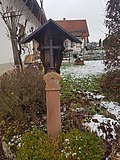 |
Wayside shrine | Eichholzweg 10 (map) |
Small memorial no.17 (Oberbalbach): wayside shrine. Depiction: metal cross on a sandstone stele. Without inscription.
|
|
| Wayside shrine | St.-Georg-Strasse (map) |
Small monument No. 18 (Oberbalbach): wayside shrine. Representation: man, Jesus and dead man (Gospel LK 7: 11-17); behind it a sign of the Augustine Way. Inscription: Young man, I tell you: stand up and live! (LK 7.14).
|
||
 |
Wayside shrine | Balbachstrasse 14 (map) |
Small memorial no.19 (Oberbalbach): wayside shrine. Mary with Jesus. Inscription: IHS.
|
|
 |
Wayside shrine | Balbachstrasse 9 (map) |
Small monument no.20 (Oberbalbach): wayside shrine. Representation of Mary with Jesus. Inscription: O Mother of Perpetual Help, pray for us.
|
|
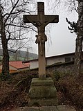 |
Stone cross | In the cemetery (map) |
Small monument no.21 (Oberbalbach): stone cross. Representation: Jesus crucified. Inscription: Oh, please also those who quarrel with Jesus and those who triumph for us poor suffering souls in purgatory.
|
|
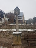 |
Wayside shrine | Sonnensteige / Messelhäuser Strasse | Small monument No. 22 (Oberbalbach): wayside shrine. Presentation: Mary with the body of Jesus. Inscription not recognizable. Intersection of Sonnensteige / Messelhäuser Strasse.
|
|
| Shrine of Mary | Messelhauser Strasse 12 | Small monument No. 23 (Oberbalbach): Shrine of Mary on the house facade. Representation: praying statue of Mary in a niche in the wall of the house.
|
||
 |
Wayside shrine | Balbachstraße 33a (Kindergarten) (map) |
Small monument No. 24 (Oberbalbach): wayside shrine. Presentation: Jesus praying on the Mount of Olives. Inscription: Not mine, but your will (Lk 22:42).
|
|
| Shrine of Mary | Balbachstrasse 41 (map) |
Small monument No. 25 (Oberbalbach): Shrine of Mary on the house facade. Presentation: Mary with baby Jesus.
|
||
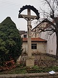 |
Stone cross | Balbachstrasse 43 (map) |
Small monument no.26 (Oberbalbach): stone cross. Depiction: crucified Jesus (with roof). Inscription: Our salvation is in the cross.
|
|
 |
War memorial | St. George's Church (map) |
Small monument no.27 (Oberbalbach): War memorial. Memorial to the dead. In front of St. George's Church. Presentation: In the foreground Jesus praying on the Mount of Olives, angel; In the background groups of soldiers. Inscription: The congregation their brave sons (names of those killed in the First and Second World Wars).
|
|
 |
Wayside shrine | St. George's Church (map) |
Small monument no.28 (Oberbalbach): wayside shrine. In St. George's Church. Presentation: Mary prays with her hands spread out.
|
|
 |
Fountain with statue | Balbachtalstrasse-Messelhäuser Strasse (map) |
Small monument no.29 (Oberbalbach): Fountain with a figure of St. George on a round base. Junction Balbachtalstraße-Messelhäuser Straße.
|
|
| Shrine of Mary | Messelhäuser Strasse 5 | Small monument No. 30 (Oberbalbach): Shrine of Mary on the house facade. Presentation: Mary with baby Jesus in her arms.
|
||
| Wayside shrine | Vogtstrasse 8 (map) |
Small memorial No. 31 (Oberbalbach): wayside shrine. Presentation: Relief of St. Anthony on a house wall. Inscription: Saint Anthony, pray for us.
|
||
| Marian shrine on house facade | St.-Georg-Strasse 14 (map) |
Small monument No. 32 (Oberbalbach): Madonna on the house facade. Mary with rosary chain in hand.
|
||
 |
Shrine of Mary | Balbachstrasse 55 (map) |
Small monument (Oberbalbach): Shrine of Mary on the house facade (Landgasthof Zum Hirschen). Presentation: Mary with baby Jesus.
|
Oberlauda
Architectural, art and cultural monuments in Oberlauda :
![]() Map with all coordinates of the cultural monuments in the district of Oberlauda: OSM
Map with all coordinates of the cultural monuments in the district of Oberlauda: OSM
| image | designation | location | Dating | description |
|---|---|---|---|---|
 |
Fountain | Brunnenstrasse | Fountain
|
|
| graveyard | Brunnenstrasse | Oberlauda cemetery, surrounded by a cemetery wall in which there is also a fourteen-station way of the cross. Inside there are some interesting, historical tombstones and other small monuments.
|
||
| chapel | Brunnenstrasse | 20th century | Chapel with openwork carved door. Early 20th century.
|
|
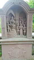
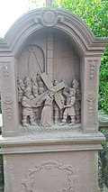
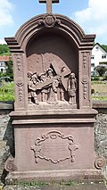
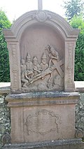
| More pictures | Way of the Cross | Brunnenstrasse | The 14 stations of the cross are located in the cemetery wall of the Oberlauda cemetery. It is one of two different open-air crossroads in Oberlauda.
|
|
 More pictures |
1st station of the cross | Brunnenstrasse | 1st station of the cross of the fourteen stations of the cross in the cemetery wall.
|
|
 More pictures |
2nd station of the cross | Brunnenstrasse | 2nd station of the cross of the fourteen stations of the cross in the cemetery wall.
|
|
 More pictures |
3rd station of the cross | Brunnenstrasse | 3rd station of the cross of the fourteen stations of the cross in the cemetery wall.
|
|
 More pictures |
4th station of the cross | Brunnenstrasse | 4. Stations of the Cross of the fourteen stations of the Cross in the cemetery wall.
|
|
 More pictures |
5th station of the cross | Brunnenstrasse | 5th station of the cross of the fourteen stations of the cross in the cemetery wall.
|
|
 More pictures |
6. Stations of the Cross | Brunnenstrasse | 6. Stations of the Cross of the fourteen stations of the Cross in the cemetery wall.
|
|
 More pictures |
7th station of the cross | Brunnenstrasse | 7th station of the cross of the fourteen stations of the cross in the cemetery wall.
|
|
 More pictures |
8. Station of the Cross | Brunnenstrasse | 8. Stations of the Cross of the fourteen stations of the Cross in the cemetery wall.
|
|
 More pictures |
9. Stations of the Cross | Brunnenstrasse | 9. Stations of the Cross of the fourteen stations of the Cross in the cemetery wall.
|
|
 More pictures |
10th station of the cross | Brunnenstrasse | 10. Station of the Cross of the fourteen stations of the Cross in the cemetery wall.
|
|
 More pictures |
11. Stations of the Cross | Brunnenstrasse | 11. Station of the Cross of the fourteen stations of the Cross in the cemetery wall.
|
|
 More pictures |
12. Stations of the Cross | Brunnenstrasse | 12. Stations of the cross of the fourteen stations of the cross in the cemetery wall.
|
|
 More pictures |
13. Stations of the Cross | Brunnenstrasse | 13. Stations of the Cross of the fourteen stations of the Cross in the cemetery wall.
|
|
 More pictures |
14. Station of the Cross | Brunnenstrasse | 14. Station of the Cross of the fourteen stations of the Cross in the cemetery wall.
|
|
 More pictures |
St. Martin | Brunnenstrasse 43 (map) |
1790 | Catholic parish church of St. Martin. Late baroque - early classicist building with entrance tower. 1790.
|
 |
Weather cross | District boundary (Lauda-Königshofen - Tauberbischofsheim) |
1714 | Weather Cross, from 1714; Erected as an "eternal memory" of a major storm damage; Its pedestal formed the boundary stone to the districts of five old communities (Oberlauda, Lauda, Distelhausen, Dittigheim and Dittwar), whose coats of arms are shown on it. After the regional reform in Baden-Württemberg, some of the neighboring old communities are only districts and Dittigheim is no longer a direct neighbor.
|
 |
Wayside shrine | Local connection route (Oberlauda – Dittwar) |
Wayside shrine
|
|
 |
School building in Oberlauda | Schulstrasse 37 | School building in Oberlauda
|
|
 |
Mill wheel | Schulstrasse 3 (behind) (map) |
Mill wheel; Largest overshot mill wheel in southern Germany with a diameter of 8.5 meters
|
|
 More pictures |
Way of the Cross | Valley road | The 14 stations of the cross to the Mariengrotte begin at the end of Talstrasse. It is one of two different open-air crossroads in Oberlauda.
|
|
 More pictures |
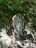
1st station of the cross | Valley road | 1st station of the cross of the fourteen stations of the cross to the Mariengrotte in Oberlauda.
|
|
 More pictures |
2nd station of the cross | Valley road | 2nd station of the cross of the fourteen stations of the cross to the Mariengrotte in Oberlauda.
|
|
 More pictures |
3rd station of the cross | Valley road | 3rd station of the cross of the fourteen stations of the cross to the Mariengrotte in Oberlauda.
|
|
 More pictures |
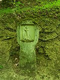
4th station of the cross | Valley road | 4. Stations of the Cross of the fourteen stations of the Cross to the Mariengrotte in Oberlauda.
|
|
 More pictures |
5th station of the cross | Valley road | 5th station of the cross of the fourteen stations of the cross to the Mariengrotte in Oberlauda.
|
|
 More pictures |
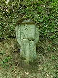
6. Stations of the Cross | Valley road | 6. Stations of the Cross of the fourteen stations of the Cross to the Mariengrotte in Oberlauda.
|
|
 More pictures |
7th station of the cross | Valley road | 7th station of the cross of the fourteen stations of the cross to the Mariengrotte in Oberlauda.
|
|
 More pictures |
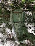
8. Station of the Cross | Valley road | 8. Station of the Cross of the fourteen stations of the Cross to the Mariengrotte in Oberlauda.
|
|
 More pictures |
9. Stations of the Cross | Valley road | 9. Stations of the Cross of the fourteen stations of the Cross to the Mariengrotte in Oberlauda.
|
|
 More pictures |
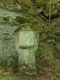
10th station of the cross | Valley road | 10. Stations of the cross of the fourteen stations of the cross to the Mariengrotte in Oberlauda.
|
|
 More pictures |
11. Stations of the Cross | Valley road | 11. Station of the Cross of the fourteen stations of the Cross to the Mariengrotte in Oberlauda.
|
|
 More pictures |
12. Stations of the Cross | Valley road | 12th station of the cross of the fourteen stations of the cross to the Mariengrotte in Oberlauda.
|
|
 More pictures |
13. Stations of the Cross | Valley road | 13. Stations of the Cross of the fourteen stations of the Cross to the Mariengrotte in Oberlauda.
|
|
 More pictures |
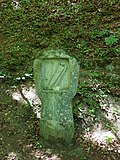
14. Station of the Cross | Valley road | 14. Stations of the Cross of the fourteen stations of the Cross to the Mariengrotte in Oberlauda.
|
|
 More pictures |
Mary's Grotto | Valley road | 1905 | Mary's Grotto from 1905 at the end of a fourteen-station Way of the Cross that begins at the end of Talstrasse.
|
| War memorial | War memorial 1870/71. The memorial for those who participated in the war in 1870/71 stands above the village: a stepped red sandstone obelisk.
|
|||
| War memorial | War Memorial First World War. The sons of the Oberlauda parish who died for the fatherland in the World War 1914-18.
|
|||
| War memorial | War Memorial Second World War. Stone. The victims of violence and war 1933-1945.
|
|||
| Plaque | in the former parish hall | Memorial plaque First World War. Memorial plaque for the members of the Oberlauda community who died in the World War. 1914-1918.
|
||
| Plaque | in the former parish hall | Commemorative plaque Second World War. 1939-1945.
Memorial plaque for the fallen and missing. Oberlauda municipality.
|
Sachsenflur
Architectural, artistic and cultural monuments in Sachsenflur (with the village Sachsenflur and the house Breite Mühle):
![]() Map with all the coordinates of the cultural monuments in the Sachsenflur district: OSM
Map with all the coordinates of the cultural monuments in the Sachsenflur district: OSM
| image | designation | location | Dating | description |
|---|---|---|---|---|
 More pictures |
Sachsenflur Castle | Sachsenstrasse 10-12 (map) |
Sachsenflur Castle
|
|
| Protestant church | Sachsenstrasse 14 (map) |
Ev. Church. Hall building from 1785 with an older entrance tower.
|
||
| town hall | Sachsenstrasse 16 (map) |
19th century | Town hall. Solid construction with window frames and rich portal zone with 3 segment-arched openings and carved door leaves. 2nd half of the 19th century.
|
|
| War memorial | War memorial 1870/71.
|
|||
| War memorial | War memorial First and Second World War.
|
Unterbalbach
Architectural, artistic and cultural monuments in Unterbalbach (with the village of Unterbalbach and the houses Mühle and Unterbalbach train station):
![]() Map with all coordinates of the cultural monuments in the suburb of Unterbalbach: OSM
Map with all coordinates of the cultural monuments in the suburb of Unterbalbach: OSM
| image | designation | location | Dating | description |
|---|---|---|---|---|
 More pictures |
Mountain chapel | Buchrainstrasse 18 (map) |
1900 | Mountain chapel, also a former cemetery chapel. Rectangular construction with corner bossing and roof turrets. Around 1900.
|
 More pictures |
Cemetery chapel | Buchrainstrasse 18 (map) |
|
|
 More pictures |
St. Mark | St.-Markus-Strasse 7 (map) |
1824/1825 | St. Mark. Hall church from 1824/25 with an older entrance tower.
|
 |
Wayside shrine | Taubertal Cycle Path (map) |
Wayside shrine
|
|
| War memorial | War memorial
|
|||
| Soldier grave | Soldier grave. Next to the war memorial there is a single grave for 7 soldiers (including 6 unknown).
|
See also
- List of cultural monuments in the Main-Tauber district
- List of war memorials in Lauda-Königshofen
- List of street names in Lauda-Königshofen , where many of the cultural monuments are located
Web links
- Topics> Monuments in the Main-Tauber district> Small monuments> Lauda-Königshofen on the website of the geographic information system of the Main-Tauber district at gistbb.de
Remarks
- ↑ This list may not correspond to the current status of the official list of monuments. This can be viewed by the responsible authorities. Therefore, the presence or absence of a structure or ensemble on this list does not guarantee that it is or is not a registered monument at the present time. The State Office for Monument Preservation Baden-Württemberg provides binding information .
Individual evidence
- ↑ LEO-BW.de: St. Kilian (St.-Kilian-Straße 1, Lauda-Königshofen) . Online at www.leo-bw.de. Retrieved October 17, 2018.
- ↑ a b c d e f LEO-BW.de: Friedhof (Hofackerweg 6, Lauda-Königshofen) . Online at www.leo-bw.de. Retrieved October 17, 2018.
- ^ Beckstein, City of Lauda-Königshofen, Main-Tauber-District, Baden-Württemberg. In: denkmalprojekt.org. Retrieved May 18, 2020 .
- ↑ LEO-BW.de: St. Antonius (Brechdarrenweg 2, Lauda-Königshofen) . Online at www.leo-bw.de. Retrieved October 17, 2018.
- ^ A b Deubach, City of Lauda-Königshofen, Main-Tauber District, Baden-Württemberg. In: denkmalprojekt.org. Retrieved May 18, 2020 .
- ^ A b Gerlachsheim, City of Lauda-Königshofen, Main-Tauber District, Baden-Württemberg. In: denkmalprojekt.org. Retrieved May 18, 2020 .
- ↑ LEO-BW.de: Town Hall (Würzburger Straße 51, Lauda-Königshofen) . Online at www.leo-bw.de. Retrieved October 17, 2018.
- ↑ LEO-BW.de: Kloster (Wurzburg 79, Lauda-Königshofen) . Online at www.leo-bw.de. Retrieved October 17, 2018.
- ↑ LEO-BW.de: Heiligkreuzkirche (Würzburger Straße 81, Lauda-Königshofen) . Online at www.leo-bw.de. Retrieved October 17, 2018.
- ↑ LEO-BW.de: St. Vitus (Gissigheimer 33, Lauda-Königshofen) . Online at www.leo-bw.de. Retrieved October 17, 2018.
- ↑ a b Heckfeld, City of Lauda-Königshofen, Main-Tauber District, Baden-Württemberg. In: denkmalprojekt.org. Retrieved May 18, 2020 .
- ↑ Financial T ('a) ime - school newspaper of the commercial school TBB: Commercial school TBB: Excursion with contemporary witnesses to the Dachau concentration camp - students walk in the footsteps of Anton Spies . November 9, 2012. Online at www.schuelerzeitung-tbb.de. Retrieved January 10, 2015.
- ↑ WKSt.V. Unitas Ruhrania: Martyrs in the Third Reich: Federal Brother Parish Vicar Anton Spies . September 29, 2004. Online at www.unitas-ruhrania.org. Retrieved January 10, 2015.
- ↑ WKSt.V. Unitas Ruhrania: Defamation brought him to the concentration camp: Bbr died 54 years ago. Anton Spies in Dachau . November 24, 2009. Online at www.unitas-ruhrania.org. Retrieved January 10, 2015.
- ^ Heckfeld, City of Lauda-Königshofen, Main-Tauber District, Baden-Württemberg. In: denkmalprojekt.org. Retrieved May 20, 2020 .
- ↑ LEO-BW.de: elevated water tank (Lauda-Königshofen) . Online at www.leo-bw.de. Retrieved October 17, 2018.
- ↑ LEO-BW.de: Chapel (Antonius 11, Lauda-Königshofen) . Online at www.leo-bw.de. Retrieved October 17, 2018.
- ↑ LEO-BW.de: House (Eisenbahnstraße 16, Lauda-Königshofen) . Online at www.leo-bw.de. Retrieved October 17, 2018.
- ↑ LEO-BW.de: Chapel (Lauda-Königshofen) . Online at www.leo-bw.de. Retrieved October 17, 2018.
- ↑ LEO-BW.de: Zur Gans (Hauptstrasse 61, Lauda-Königshofen) . Online at www.leo-bw.de. Retrieved October 17, 2018.
- ↑ LEO-BW.de: Schoolhouse (Kirchstrasse 13, Lauda-Königshofen) . Online at www.leo-bw.de. Retrieved October 17, 2018.
- ↑ LEO-BW.de: Zehnthaus (Kirchstrasse 17, Lauda-Königshofen) . Online at www.leo-bw.de. Retrieved October 17, 2018.
- ↑ LEO-BW.de: St. Mauritius (Kirchstrasse 19, Lauda-Königshofen) . Online at www.leo-bw.de. Retrieved October 17, 2018.
- ↑ LEO-BW.de: Putzbau (Oberer Grabenweg 7, Lauda-Königshofen) . Online at www.leo-bw.de. Retrieved October 17, 2018.
- ↑ LEO-BW.de: Chapel (Sailtheimer Straße, Lauda-Königshofen) . Online at www.leo-bw.de. Retrieved October 17, 2018.
- ^ A b c d e Königshofen, City of Lauda-Königshofen, Main-Tauber District, Baden-Württemberg. In: denkmalprojekt.org. Retrieved May 18, 2020 .
- ↑ a b Königshofen (war cemetery), town of Lauda-Königshofen, Main-Tauber district, Baden-Württemberg. In: denkmalprojekt.org. Retrieved May 18, 2020 .
- ↑ a b c LEO-BW.de: Church (Bahnhofstrasse 16, Lauda-Königshofen) . Online at www.leo-bw.de. Retrieved October 17, 2018.
- ^ A b c d Lauda, City of Lauda-Königshofen, Main-Tauber District, Baden-Württemberg. In: denkmalprojekt.org. Retrieved May 20, 2020 .
- ↑ a b c d e f g h i j k l LEO-BW.de: Bahnhof (Bahnhofstrasse 17, 21, 23, 27, 29, 31, Tauberstrasse 16, Zufahrtsstrasse 1, 8, 9, 12, 13, Lauda- Koenigshofen) . Online at www.leo-bw.de. Retrieved October 17, 2018.
- ↑ a b c d e f g h LEO-BW.de: City fortifications (Gäßleinsweg, Kapellenstraße 10 (near), Obere Torgasse 3, 7, Oberlaudaer Straße, Pfarrstraße 17, Rathausstraße, Zehntgasse, Lauda-Königshofen) . Online at www.leo-bw.de. Retrieved October 17, 2018.
- ↑ LEO-BW.de: Heiligblutkapelle (Kapellenstrasse 3, Lauda-Königshofen) . Online at www.leo-bw.de. Retrieved October 17, 2018.
- ↑ LEO-BW.de: Hospital (Luisenstraße 2, Lauda-Königshofen) . Online at www.leo-bw.de. Retrieved October 17, 2018.
- ↑ LEO-BW.de: Scheune (Pfarrstrasse 8 (behind), Lauda-Königshofen) . Online at www.leo-bw.de. Retrieved October 17, 2018.
- ↑ LEO-BW.de: St. Jakob (Pfarrstraße 15, Lauda-Königshofen) . Online at www.leo-bw.de. Retrieved October 17, 2018.
- ↑ LEO-BW.de: Lourdesgrotte (Pfarrstrasse 15 (near), Lauda-Königshofen) . Online at www.leo-bw.de. Retrieved October 17, 2018.
- ↑ LEO-BW.de: School (Philipp-Adam-Ulrich-Straße 2, Lauda-Königshofen) . Online at www.leo-bw.de. Retrieved October 17, 2018.
- ↑ LEO-BW.de: https://www.leo-bw.de/web/guest/detail-gis/-/Detail/details/DOKUMENT/lad_denkmale/102434566/Kirche+Philipp-Adam-Ulrich-Stra%C3 % 9Fe + 17 + Lauda-K% C3% B6nigshofen . Online at www.leo-bw.de. Retrieved October 17, 2018.
- ↑ LEO-BW.de: House (city hall 21, Lauda-Königshofen) . Online at www.leo-bw.de. Retrieved October 17, 2018.
- ↑ LEO-BW.de: Rathaus (Town Hall Street 21 (next), Lauda-Königshofen) . Online at www.leo-bw.de. Retrieved October 17, 2018.
- ↑ LEO-BW.de: Ulrich-Haus (Rathausstrasse 25, Lauda-Königshofen) . Online at www.leo-bw.de. Retrieved October 17, 2018.
- ↑ LEO-BW.de: Heimatmuseum Lauda . Online at www.leo-bw.de. Retrieved October 17, 2018.
- ↑ LEO-BW.de: pavilion (Rebgutstraße 1, Lauda-Königshofen) . Online at www.leo-bw.de. Retrieved October 17, 2018.
- ↑ LEO-BW.de: (St.-Joseph-Strasse 1, Lauda-Königshofen) . Online at www.leo-bw.de. Retrieved October 17, 2018.
- ^ Marbach, City of Lauda-Königshofen, Main-Tauber-District, Baden-Württemberg. In: denkmalprojekt.org. Retrieved May 18, 2020 .
- ↑ LEO-BW.de: Tithe Barn (Freiherr von Zobel-Straße 9, Lauda-Königshofen) . Online at www.leo-bw.de. Retrieved October 17, 2018.
- ↑ LEO-BW.de: castle (Freiherr von Zobel-Straße 39, Lauda-Königshofen) . Online at www.leo-bw.de. Retrieved October 17, 2018.
- ↑ LEO-BW.de: Chapel (Hofstetten 2, Lauda-Königshofen) . Online at www.leo-bw.de. Retrieved October 17, 2018.
- ↑ LEO-BW.de: Crucifixion (St. Burkhard-Straße 7, Lauda-Königshofen) . Online at www.leo-bw.de. Retrieved October 17, 2018.
- ↑ LEO-BW.de: St. Burckhardt (St.-Burkhard-Straße 8, Lauda-Königshofen) . Online at www.leo-bw.de. Retrieved October 17, 2018.
- ↑ Messelhausen, City of Lauda-Königshofen, Main-Tauber District, Baden-Württemberg. In: denkmalprojekt.org. Retrieved May 18, 2020 .
- ↑ LEO-BW.de: St. Georg (Balbachtalstraße 30, Lauda-Königshofen) . Online at www.leo-bw.de. Retrieved October 17, 2018.
- ↑ LEO-BW.de: wayside shrine (Rainholzweg 6, Lauda-Königshofen) . Online at www.leo-bw.de. Retrieved October 17, 2018.
- ^ Oberbalbach, City of Lauda-Königshofen, Main-Tauber-District, Baden-Württemberg. In: denkmalprojekt.org. Retrieved May 18, 2020 .
- ↑ LEO-BW.de: Chapel (Brunnenstrasse, Schloßweg, Lauda-Königshofen) . Online at www.leo-bw.de. Retrieved October 17, 2018.
- ↑ LEO-BW.de: St. Martin (Brunnenstraße 43, Lauda-Königshofen) . Online at www.leo-bw.de. Retrieved October 17, 2018.
- ↑ Fränkische Nachrichten: 300 years of the Wetterkreuz: Star march from the neighboring communities of Oberlauda, Lauda, Distelhausen, Dittigheim and Dittwar as well as Heckfeld: The response exceeded all expectations . September 16, 2014. online at www.fnweb.de. Retrieved December 29, 2014.
- ↑ Heimat- und Kulturverein Dittwar e. V .: The weather cross . Online at www.hkvdittwar.de. Retrieved May 16, 2015.
- ^ A b c d e Oberlauda, City of Lauda-Königshofen, Main-Tauber District, Baden-Württemberg. In: denkmalprojekt.org. Retrieved May 18, 2020 .
- ↑ LEO-BW.de: Church (Sachsenstraße 14, Lauda-Königshofen) . Online at www.leo-bw.de. Retrieved October 17, 2018.
- ↑ LEO-BW.de: Town Hall (Sachsenstrasse 16, Lauda-Königshofen) . Online at www.leo-bw.de. Retrieved October 17, 2018.
- ^ A b Sachsenflur, town of Lauda-Königshofen, Main-Tauber-Kreis, Baden-Württemberg. In: denkmalprojekt.org. Retrieved May 18, 2020 .
- ↑ LEO-BW.de: Chapel (Buchrainstraße 18, Lauda-Königshofen) . Online at www.leo-bw.de. Retrieved October 17, 2018.
- ↑ LEO-BW.de: St. Markus (St.-Markus-Straße 7, Lauda-Königshofen) . Online at www.leo-bw.de. Retrieved October 17, 2018.
- ^ A b Unterbalbach, City of Lauda-Königshofen, Main-Tauber District, Baden-Württemberg. In: denkmalprojekt.org. Retrieved May 18, 2020 .
