List of cultural monuments in Ahorn (Baden)
The list of cultural monuments in Ahorn includes immovable architectural and art monuments from all districts of Ahorn . The basis for this list is the list of architectural and art monuments published by the Stuttgart Regional Council as of February 15, 2012. The article is part of the higher-level list of cultural monuments in the Main-Tauber district . This list is not legally binding. Legally binding information is only available on request from the Lower Monument Protection Authority of the municipality of Ahorn.
Small monuments such as wayside shrines, statues and wayside crosses have been preserved in large numbers in the municipality. The reason lies in the agricultural structure that has existed since the Middle Ages. In modern times there was no densification of settlement and industry as in the metropolitan areas, so that these cultural monuments were largely preserved in the open air .
Architectural, artistic and cultural monuments of the municipality of Ahorn
Berolzheim
Architectural, art and cultural monuments in Berolzheim :
![]() Map with all the coordinates of the cultural monuments in the district of Berolzheim: OSM
Map with all the coordinates of the cultural monuments in the district of Berolzheim: OSM
| image | designation | location | Dating | description |
|---|---|---|---|---|
 More pictures |
War memorial | Hauptstrasse 3 (near) (map) |
War memorial First and Second World War.
|
|
| chapel | Kapellenstrasse 35 | 1878 | Chapel, neo-Gothic solid construction with roof turrets and polygonal closure. 1878 designated.
|
|
| St. Kilian | Kirchbrunnenstrasse 5 (map) |
1844 | Catholic parish church St. Kilian, hall building in round arch style with entrance tower, built in 1844 by master builder Brenner, as well as baroque Ölberggruppe, sandstone. The parish church has a four-part bell from the Grüninger foundry from 1925 and 1949. The four bells hang in a steel bell cage in two compartments on two floors. Bells 2, 3 and 4 are integrated into the clock.
|
|
 More pictures |
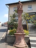
Wayside shrine | Hauptstrasse 54 (map) |
1915 | Christ the King wayside shrine with inscription, sculpture made of red sandstone, shows Jesus with a crown of thorns
|
Book on the maple
Architectural, artistic and cultural monuments in Buch am Ahorn (with the village of Buch am Ahorn and the hamlet of Schwarzenbrunn ):
![]() Map with all the coordinates of the cultural monuments in the Buch am Ahorn district: OSM
Map with all the coordinates of the cultural monuments in the Buch am Ahorn district: OSM
| image | designation | location | Dating | description |
|---|---|---|---|---|
 More pictures |
Protestant church | Lindenstrasse 31 (map) |
1752 | Evangelical Church in Buch am Ahorn, labeled Baroque Hall, 1752, built on the site of an older church. Only the tower of the old church was retained, which again had to be replaced by a new one in 1892. Organ from 1771.
|
| Tombstone | Lindenstrasse 31 | 1730 | Baroque epitaph on the south front of the church, from 1730, Johann Philipp Roth
|
|
| Tombstone | Lindenstrasse 31 | 1628 | Grave slab, at the bottom of the terrace wall of the church, from 1628, Erasmus Treutlinger
|
|
 More pictures |
War memorial | Lindenstrasse 31 (near) (map) |
War memorial for those who fell in the village in the First and Second World Wars in Buch am Ahorn. The war memorial is located at the church. In the middle a sandstone column with a carved cross. In addition, a total of six name memorial stones.
|
|
 More pictures |
Fallen memorial | Buch am Ahorn cemetery (map) |
Monument to the fallen World War II. In the cemetery there is a small facility for those who died on March 31, 1945 near Buch am Ahorn. Two stone slabs are in a green area.
|
|
| Atonement Cross | (Map) | approx. 16./17. Century | Atonement Cross Ahorn I / Buch am Ahorn district. A plowing farmer died here when the oxen ran away. See also: List of Murder and Atonement Crosses in Maple .
|
|
| Atonement Cross | (Map) | approx. 16./17. Century | Atonement Cross Ahorn II / Buch am Ahorn district. "Kreuzstein" / Is associated with the Thirty Years' War. See also: List of Murder and Atonement Crosses in Maple .
|
Eubigheim
Architectural, artistic and cultural monuments in Eubigheim (with the village of (Unter-) Eubigheim and the hamlet of Obereubigheim ):
![]() Map with all coordinates of the cultural monuments in the district of Eubigheim: OSM
Map with all coordinates of the cultural monuments in the district of Eubigheim: OSM
| image | designation | location | Dating | description |
|---|---|---|---|---|
| Eubigheim station | Bahnhofstrasse 14 (map) |
1866 | Eubigheim station. On November 1, 1866, a section of the "Odenwaldbahn" from Osterburken via Eubigheim to Lauda was put into operation. At this point the station building was also completed. Opposite the station building is a Raiffeisen building with a grain silo. To the left of the station building there is a toilet facility followed by an open loading siding and a free-standing goods shed. In the building there is an interlocking room with a track plan push button interlocking.
|
|
 More pictures |
Bettendorf's Castle (Town Hall) |
Schlossstrasse 24 (map) |
1566 | Town hall. Former moated castle. Solid construction with half hip and corner towers. Arched central passage 1566 re. with baroque coat of arms stone, hall wing from the period between 1750 and 1780.
Former Bettendorf castle; an old moated castle with a buried moat; consisting of two components. Larger component provided with two oriel turrets at the corners. Later set up as a council house and school house. Bettendorf's alliance coat of arms above the outer gateway; while the inner one shows the year 1566. Ornate baroque pillars at the entrance to the garden from the street.
|
 More pictures |
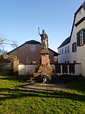
War memorial | Schloßstraße 24 (near) (map) |
War memorial 1870/71, First and Second World War. The war memorial is located at the municipal administration. A column on a multi-level pedestal on which the goddess of victory stands. In front of it a name plaque made of marble. There are three sandstone nameplates on the wall behind.
|
|
 More pictures |
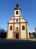
St. Mary | Schlossstrasse 28 (map) |
1781/1958 | Catholic parish church St. Maria in Eubigheim. New building from 1958 with a baroque facade from 1781 with a Pietà niche. Light building in classical forms, from 1781 with an inscription above the entrance door.
|
 More pictures |
Protestant church | Schlossstrasse 29 (map) |
1780 | Evangelical parish church in Eubigheim. Baroque hall building with roof turret. Rich portal frame, rococo door leaf, 1780 inscribed. In similar dimensions and shapes as the Catholic Church. Both churches seem to have been built by the same architect.
|
| synagogue | Meisenstrasse 3 (map) |
1850 | Former synagogue in Untereubigheim
|
|
| Jewish Cemetery | Fourteen mornings (card) |
1850 | Former Jewish cemetery in Untereubigheim. Around 1850, a Jewish cemetery was laid out in Gewann Vierzehnmorgen. The cemetery was used until after 1933 and 39 tombstones still exist today. The oldest surviving tombstone dates from 1880, the last burial probably took place in 1938.
|
|
| plate | 1623 | Plate on a house near the castle with a relief of the Rüdt coat of arms in the middle; Year 1623 below; Shell semicircle as the upper end; Initials available.
|
||
| Historic house | 1780 | Historic house, from 1780
|
||
| Historic house | 1801 | Historic house, from 1801
|
||
| sign | 1790 | Forged host shield; at the inn zum Ochsen, from 1790
|
||
 More pictures |
chapel | Obereubigheim 17 (map) |
1888 | Neo-Gothic chapel with turret, 1888 ins.
|
| Eubigheim tunnel | Eubigheim tunnel. Part of the entity "Badische Odenwaldbahn".
|
Hohenstadt
Architectural, art and cultural monuments in Hohenstadt :
![]() Map with all coordinates of the cultural monuments in the district of Hohenstadt: OSM
Map with all coordinates of the cultural monuments in the district of Hohenstadt: OSM
| image | designation | location | Dating | description |
|---|---|---|---|---|
| Protestant church | Eubigheimer Strasse 5 (map) |
1778 | Evangelical parish church in Hohenstadt. Hall construction with roof turrets and polygonal closure. Edification stone, 1778 re.
|
|
| War memorial | War memorial. At the Protestant church there is a sandstone stele composed of three parts with a sword that is entwined with laurel. Next to it are two name plates made of sandstone.
|
|||
| chapel | Eubigheimer Strasse 23 (map) |
18th century | Chapel. Simple plastered construction with roof turrets and drilled portal and windows. 18th century.
|
Schilling city
Architectural, art and cultural monuments in Schillingstadt :
![]() Map with all coordinates of the cultural monuments in the district of Schillingstadt: OSM
Map with all coordinates of the cultural monuments in the district of Schillingstadt: OSM
| image | designation | location | Dating | description |
|---|---|---|---|---|
| Protestant church | Kirchplatz 8 (map) |
1735 | Ev. Church. Hall building with half hip and choir tower. 1735 with an older choir tower. Lower parts of the tower have been preserved from an older Gothic church; Shapes point to the 15th century.
|
|
| pulpit | Kirchplatz 8 (map) |
1771 | Pulpit of the Protestant church; According to the inscription on the cover, it was “overgold” in 1771.
|
|
| St. Joseph | Lange Strasse 59 (map) |
1776/1777 | Catholic branch church St. Josef. Baroque hall building with roof turrets and polygonal closure. Drilled portal with niche, therein Joseph's statue, 1776 inscribed. A branch church of St. Kilian in Berolzheim. Erected by Elector Karl Theodor in 1777.
|
|
| town hall | Lange Strasse 61 (map) |
1936 | Town hall. Rich ornamental half-timbered building with a round archway, 1936 re.
|
|
| Village fortification | There are no more traces of the former village fortifications that once surrounded the place. The last of three gates, the "thick" gate, towards Eubigheim, was broken off in 1833.
|
|||
 |
War memorial | (Map) | War memorial First and Second World War. Sandstone monument with the figure of a reclining, resting and exhausted soldier. On it the name board of the fallen and deceased of the 1st World War. Left and right two sandstone pillars; on it affixed the name boards of the fallen, missing and deceased of the 2nd World War.
|
See also
- List of cultural monuments in the Main-Tauber district
- List of war memorials in Ahorn (Baden)
- List of street names in Ahorn (Baden) , where many of the cultural monuments are located
Web links
Remarks
- ↑ This list may not correspond to the current status of the official list of monuments. This can be viewed by the responsible authorities. Therefore, the presence or absence of a structure or ensemble on this list does not guarantee that it is or is not a registered monument at the present time. The State Office for Monument Preservation Baden-Württemberg provides binding information .
Individual evidence
- ↑ a b c d e The state of Baden-Württemberg. Official description by district and municipality. Volume IV: Stuttgart district, Franconian and East Württemberg regional associations. Kohlhammer Stuttgart 1980, ISBN 3-17-005708-1 . Pp. 302-305
- ^ Berolzheim, Ahorn community, Main-Tauber district, Baden-Württemberg. In: denkmalprojekt.org. Retrieved May 18, 2020 .
- ↑ LEO-BW.de: Chapel (Kapellenstrasse 35, Ahorn) . Online at www.leo-bw.de. Retrieved April 3, 2019.
- ↑ LEO-BW.de: St. Kilian (Kirchbrunnenstraße 5, Ahorn) . Online at www.leo-bw.de. Retrieved April 3, 2019.
- ^ Archdiocese of Freiburg: Catholic parish church St. Kilian in Ahorn-Berolzheim . Online at www.ebfr-glocken.de. Retrieved June 18, 2018.
- ^ Church district Adelsheim-Boxberg: Evangelical church community book . Online at www.adelsheim-boxberg.de. Retrieved June 18, 2018.
- ↑ LEO-BW.de: Church (Lindenstrasse 31, Ahorn) . Online at www.leo-bw.de. Retrieved April 3, 2019.
- ↑ a b c Adolf von Oechelhäuser : The art monuments of the Grand Duchy of Baden. Volume 4: District of Mosbach. Second division: Tauberbischofsheim district. Freiburg im Breisgau 1898, pp. 14–15 (Buch am Ahorn).
- ↑ a b Buch am Ahorn, municipality of Ahorn, Main-Tauber-Kreis, Baden-Württemberg. In: denkmalprojekt.org. Retrieved May 18, 2020 .
- ↑ station Eubigheim - zielbahnhof.de. In: bf-a.zielbahnhof.de. Retrieved May 8, 2020 .
- ↑ LEO-BW.de: Schloßstraße 24 . Online at www.leo-bw.de. Retrieved April 3, 2019.
- ↑ a b c d e f g Adolf von Oechelhäuser: The art monuments of the Grand Duchy of Baden. Volume 4: District of Mosbach. Second division: Tauberbischofsheim district. Freiburg im Breisgau 1898, pp. 22-23 (Eubigheim).
- ^ Eubigheim, municipality of Ahorn, Main-Tauber district, Baden-Württemberg. In: denkmalprojekt.org. Retrieved May 18, 2020 .
- ↑ LEO-BW.de: Parish (lock 28, maple) . Online at www.leo-bw.de. Retrieved April 3, 2019.
- ^ Church district Adelsheim-Boxberg: Evangelical church community Eubigheim . Online at www.adelsheim-boxberg.de. Retrieved June 18, 2018.
- ↑ LEO-BW.de: Parish Church (Schloßstraße 29, Ahorn) . Online at www.leo-bw.de. Retrieved April 3, 2019.
- ^ A b Alemannia Judaica: Eubigheim (district Untereubigheim, municipality Ahorn, Main-Tauber district) Jewish history / prayer hall / synagogue . Online at www.alemannia-judaica.de. Retrieved June 18, 2018.
- ↑ LEO-BW.de: Chapel (Obereubigheim 17, Ahorn) . Online at www.leo-bw.de. Retrieved April 3, 2019.
- ↑ LEO-BW.de: Parish Church (Maple) . Online at www.leo-bw.de. Retrieved April 3, 2019.
- ^ Church district Adelsheim-Boxberg: Evangelical church community Hohenstadt . Online at www.adelsheim-boxberg.de. Retrieved June 18, 2018.
- ^ Hohenstadt, municipality of Ahorn, Main-Tauber district, Baden-Württemberg. In: denkmalprojekt.org. Retrieved May 18, 2020 .
- ↑ LEO-BW.de: Chapel (Eubigheimer Straße 23, Ahorn) . Online at www.leo-bw.de. Retrieved April 3, 2019.
- ↑ LEO-BW.de: Church (Kirchplatz 8, Ahorn) . Online at www.leo-bw.de. Retrieved April 3, 2019.
- ↑ a b Ahorn-Schillingstadt.de: Church . Online at www.ahorn-schillingstadt.de. Retrieved June 18, 2018.
- ^ Church district Adelsheim-Boxberg: Evangelical church community Schillingstadt . Online at www.adelsheim-boxberg.de. Retrieved June 18, 2018.
- ↑ a b c Adolf von Oechelhäuser : The art monuments of the Grand Duchy of Baden. Volume 4: District of Mosbach. Second division: Tauberbischofsheim district. Freiburg im Breisgau 1898, pp. 148-149 (Schillingstadt).
- ↑ LEO-BW.de: St. Josef (Lange Straße 59, Ahorn) . Online at www.leo-bw.de. Retrieved April 3, 2019.
- ^ Archdiocese of Freiburg: Catholic branch church St. Josef in Ahorn-Schillingstadt . Online at www.ebfr-glocken.de. Retrieved June 18, 2018.
- ↑ LEO-BW.de: Town Hall (Lange Straße 61, Ahorn) . Online at www.leo-bw.de. Retrieved April 3, 2019.
- ↑ Schillingstadt - Altgemeinde ~ Teilort - detail page - LEO-BW. In: leo-bw.de. Retrieved August 25, 2020 .
- ↑ Ahorn-Schillingstadt, Main-Tauber-Kreis, Baden-Württemberg - online project fallen memorials. In: denkmalprojekt.org. Retrieved May 18, 2020 .

