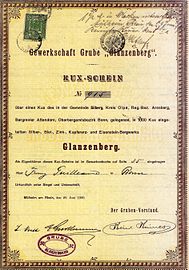
Glanzenberg mine
| Glanzenberg | |||
|---|---|---|---|
| General information about the mine | |||
| Funding / total | 3.5 million t (2 million t lead ore; 1.5 million t zinc ore) |
||
| Rare minerals | Barite , boulangerite , cerussite , pale ore | ||
| Information about the mining company | |||
| Employees | 300 | ||
| Start of operation | before 1876 | ||
| End of operation | 1935 | ||
| Funded raw materials | |||
| Degradation of | Brown iron stone , Spate iron stone , copper gravel | ||
| Greatest depth | 500 m | ||
| Geographical location | |||
| Coordinates | 51 ° 2 '5.3 " N , 8 ° 2' 0.4" E | ||
|
|||
| Location | Silberg | ||
| local community | Kirchhundem | ||
| District ( NUTS3 ) | Olpe | ||
| country | State of North Rhine-Westphalia | ||
| Country | Germany | ||
| District | Attendorn mountain area | ||
The Glanzenberg mine was an important lead and zinc ore mine in Kirchhundem - Silberg in the Olpe district (southern Sauerland ). Despite its location in the southern Sauerland, the pit was one of the northernmost pits on winner country dykes built .
history
The pit was first mentioned in 1876. In 1888 the mining rights to silver , lead, zinc, copper and iron stone were newly granted . Consolidation pits were Goldberg I & Goldberg II . These consolidated on March 2, 1898 with Glanzenberg and passed into the possession of businessman Heinrich Haines from Cologne.
Civil engineering began in 1895 . The main shafts were operated on the site of the Goldberg I & II pits . The shaft Goldberg II had a depth m of 500th 2 million t of lead ore and 1.5 million t of zinc ore were promoted. In 1930 the change from wet mechanical processing to flotation took place . This processing plant was in operation until the 1940s. Up to 300 staff members worked in the mine, up from 275 before it was closed in 1935.
In August 2004 day breaks occurred on the site of the mine .
See also
Web links
- Gerd Bäumer: Ore mining in the Siegerland area ( Memento from November 7, 2001 in the Internet Archive )
Individual evidence
- ↑ Horst G. Koch: Before the lights went out , Verlag Gudrun Koch, Siegen, 1982.

