Guadalaviar
| Guadalaviar River | ||
|
Río Guadalaviar near Albarracín |
||
| Data | ||
| location | Teruel Province , Spain | |
| River system | Río Turia | |
| source |
Montes Universales in the Sierra de Albarracín 40 ° 24 ′ 17 ″ N , 1 ° 43 ′ 50 ″ W |
|
| Source height | approx. 1700 msnm | |
| muzzle | Confluence with Río Alfambra near Teruel ; from da Río Turia Coordinates: 40 ° 20 '43 " N , 1 ° 7' 23" W 40 ° 20 '43 " N , 1 ° 7' 23" W |
|
| Mouth height | approx. 870 msnm | |
| Height difference | approx. 830 m | |
| Bottom slope | approx. 9.8 ‰ | |
| length | approx. 85 km | |
| Catchment area | approx. 1200 km² | |
| Small towns | Albarracín | |
The Río Guadalaviar ( Valencian Riu Túria ) is an approximately 85 km long river in the province of Teruel in the south of the autonomous community of Aragon in Spain .
course
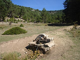
The Río Guadalaviar rises about 5 km northwest of the town of Guadalaviar in the Montes Universales of the Sierra de Albarracín ; it flows almost constantly eastwards and finally forms the Río Turia about 2 km west of Teruel together with the Río Alfambra , which flows into the Mediterranean after another 280 km in the port city of Valencia .
Places on the river
Reservoir
- Embalse de San Blas El Arquillo
Attractions
The largely natural and therefore very clean Río Guadalaviar is lined with rocks, forests and hiking trails. Albarracín, which is almost medieval in many respects, is one of the most beautiful villages in Spain.

