
Gualeguay (Entre Ríos)
| Basic data | |||
|---|---|---|---|
| location | 33 ° 9 ′ S , 59 ° 19 ′ W | ||
| Height above d. M .: | 12 m | ||
| Population (2010): | 40.507 | ||
|
|||
| administration | |||
| Province : |
|
||
| Department : | Gualeguay | ||
| Mayor: | Luis Erro (FpV) | ||
| Others | |||
| Postal code : | E2840 | ||
| Telephone code: | 03444 | ||
| map | |||

|
|||

Gualeguay is a city in northeast Argentina , located in the province of Entre Ríos (German: between the rivers , namely the Rio Paraná and the Rio Uruguay) on the Gualeguay River.
Gualeguay with 36,000 inhabitants is located 226 km from the provincial capital Paraná and 234 km northwest of the Argentine capital Buenos Aires . The city was founded on March 20, 1783 by the explorer and surveyor Tomás de Rocamora; At this time, the cities of Nogoyá , Victoria , Gualeguaychú , Concepción del Uruguay and Concordia emerged .
The city is located on Provincial Route Nº 136 and has a small airfield (Aeroclub Gualeguay grass runway).
Personalities
- Juan Bautista Ambrosetti (1865-1917), anthropologist
- Cesáreo Bernaldo de Quirós (1879–1968), painter
- Juan Laurentino Ortiz (1896–1978), poet
- Carlos Mastronardi (1901–1976), poet
- Fernando Ayala (1920–1997), film producer and director
- Jorge Burruchaga (born 1962), football player
- Cristian Sebastián Cejas (* 1975), football player
- Lisandro Martínez (* 1998), football player
gallery

City coat of arms of Gualeguay
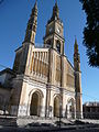
San Antonio Church in Gualeguay

Street scene in Gualeguay


Web links
Commons : Gualeguay - Collection of images, videos and audio files
- Official website of Gualeguay (Spanish)
- Secretaría de Turismo de la Municipalidad de Gualeguay (Spanish)
- Series of images