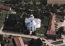
Győrtelek
| Győrtelek | ||||
|
||||
| Basic data | ||||
|---|---|---|---|---|
| State : | Hungary | |||
| Region : | Northern Great Plain | |||
| County : | Szabolcs-Szatmár-Bereg | |||
| Small area until December 31, 2012 : | Mátészalka | |||
| District since 1.1.2013 : | Mátészalka | |||
| Coordinates : | 47 ° 55 ' N , 22 ° 26' E | |||
| Area : | 14.78 km² | |||
| Residents : | 1,591 (Jan. 1, 2011) | |||
| Population density : | 108 inhabitants per km² | |||
| Telephone code : | (+36) 44 | |||
| Postal code : | 4752 | |||
| KSH kódja: | 10126 | |||
| Structure and administration (as of 2012) | ||||
| Community type : | local community | |||
| Mayor : | József Halmi ( MSZP ) | |||
| Postal address : | Árpád út 32 4752 Györtelek |
|||
| Website : | ||||
| (Source: A Magyar Köztársaság helységnévkönyve 2011. január 1st at Központi statisztikai hivatal ) | ||||
Győrtelek is a rural municipality in Szabolcs-Szatmár-Bereg County in Hungary . The community consists of two parts, the main part (approx. 15 km²) and an exclave (approx. 45 ha) to the northeast, which is enclosed by the rural community of Géberjén .
Population development
| 02/01/2001 1 | 01.10.2011 1 | 01/01/2012 | 01/01/2013 | 01/01/2014 | 01/01/2015 | 01/01/2016 |
| 1,732 | 1,641 | 1,631 | 1,615 | 1,608 | 1,599 | 1,556 |
1 census data ( Census )
Web links
Commons : Győrtelek - collection of images, videos and audio files
Individual evidence
- ↑ Detailled Gazetteer of Hungary. KSH, accessed March 2, 2017 .


