Strandabyggð

|
|
| Basic data | |
|---|---|
| State : |
|
| Region: | Vestfirdir |
| Constituency : | Norðvesturkjördæmi |
| Sýsla : | Strandasýsla |
| Population: | 449 (January 1, 2019) |
| Surface: | 1906 km² |
| Population density: | 0.24 inhabitants / km² |
| Post Code: | 510, 512 (Hólmavík) 500 (Staður) |
| politics | |
| Community number | 4911 |
| Mayor: | Ásdís Leifsdóttir |
| Contact | |
| Address of the municipal administration: | Hafnarbraut 19 510 Hólmavík |
| Website: | www.strandabyggd.is |
| map | |

Coordinates: 65 ° 42 ′ N , 21 ° 40 ′ W |
|
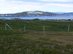
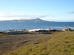
Strandabyggð is a municipality in the Vestfirðir region in northwest Iceland .
On January 1, 2019, the municipality had 449 inhabitants, 322 of whom lived in the main town of Hólmavík.
Emergence
Strandabyggð was formed in June 2006 through the merger of the previous rural communities Hólmavík ( Isl . Hólmavíkurhreppur ) and Broddanes (Isl. Broddaneshreppur ). The alternative name suggestions Strandahreppur and Sveitarfélagið Strandir could not prevail among the electorate.
Hólmavík
The rural community Hólmavík (Isl. Hólmavíkurhreppur ) was formed on June 9, 2002 through the merger of the former rural community Hólmavíkurhreppur with the rural community Kirkjubólshreppur.
meaning
The main town Hólmavík (Eng. "Island Bay") is located on the west bank of the Steingrímsfjörður fjord on the east side of the Vestfirðir region. The place has been the district's trading center for about 100 years. The main source of income - as can be seen at times from the colorful boats - is fishing. This has given the place relative wealth. The importance of Hólmavík as an administrative center for the area is also proven by a small hospital and a secondary school on site.
Transport links
Hólmavík is located on Djúpvegur ![]() , which continues over the mountains to Ísafjörður . The distance to Reykjavík is 273 kilometers by road.
, which continues over the mountains to Ísafjörður . The distance to Reykjavík is 273 kilometers by road.
Attractions
The small, light, wood-clad church Hólmavíkurkirkja , which stands on a hill above the town, and the port of the former shark fishing center are particularly worth seeing .
The Museum of Magic ( Galdrasafn ) in the village, which relates to the history of the alleged witches and wizards in Iceland and especially in the Strandir region , as well as the Museum of Sheep Breeding ( Sauðfjársafn ) located a little outside the village towards Reykjavík, illuminate the past and present the area.
Broddanes
The rural community Broddanes (Isl. Broddaneshreppur ) was formed on January 1, 1992 by the merger of the two rural communities Fell ( Fellshreppur ) and Óspakseyri ( Óspakseyrarhreppur ).
Former parishes
| Hólmavík | Broddanes | |
|---|---|---|
| Municipality number: | 4,910 | 4,909 |
| Area in km²: | 1,610 | 296 |
| Population on Dec. 1, 1997: | 548 (area status 2002) | 94 |
| Population on Dec. 1, 2003: | 494 | 54 |
| Population on December 1st, 2004: | 462 | 53 |
| Population on Dec. 1, 2005: | 447 | 53 |
| Population change 1997-2005: | -18% | -44% |
In 2006, after a long period of time, the population grew again and continued in 2007.
Town twinning
-
 Årslev , Denmark
 -
 Tanum , Sweden
 -
 Hole , Norway
 -
 Kustavi / Merimasku , Finland
Within Iceland there is a city partnership with Raufarhöfn .
See also
Web links
- Local government website (Icelandic)
- Homepage of Galdrasafn (English / Icelandic)
- Sheep Breeding Museum website (English / Icelandic)
Individual evidence
- ^ Website of the museum on the wizards of the Westfjords (English / Icelandic); Accessed August 12, 2011
- ↑ cf. http://www.strandir.is/saudfjarsetur/enska-index.htm website of the museum (English / Icelandic); Accessed August 12, 2011


