Reykhólahreppur

|
|
| Basic data | |
|---|---|
| State : |
|
| Region: | Vestfirdir |
| Constituency : | Norðvesturkjördæmi |
| Sýsla : | Austur-Barðastrandarsýsla |
| Population: | 258 (January 1, 2019) |
| Surface: | 1090 km² |
| Population density: | 0.24 inhabitants / km² |
| Post Code: | 380 (Króksfjarðarnes) 345 (Flatey) |
| politics | |
| Community number | 4502 |
| Mayor: | Einar Örn Thorlacius |
| Contact | |
| Address of the municipal administration: | Álfheimum 380 Reykhólum |
| Website: | www.reykholar.is |
| map | |

Coordinates: 65 ° 27 ′ N , 22 ° 12 ′ W |
|
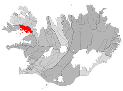
The rural municipality of Reykhólar ( Isl. Reykhólahreppur , Isl. Reykhólar "smoking hills") is located in the south of the Vestfirðir region in northwest Iceland .
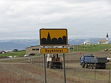
On January 1, 2019, the community had 258 inhabitants, 120 of whom lived in the main town of Reykhólar .
geography
The municipality is located on Breiðafjörður and from west to east of the foothills, the fjords Kjálkafjörður , Kerlingarfjörður , Skálmarfjörður , Kvígindisfjörður , Kollafjörður , Djúpifjörður , Þorskafjörður , Berufjörður , fjords, Króksfjörður and Gilsfjörður cut.
The main town Reykhólar is located on the Reykjanes peninsula . To the northeast of the village lies the idiosyncratic mountain range of Vaðalfjöll .
history
Settlements on the site of today's Reykhólar can be proven since the time of the conquest . In July 1987 the four rural communities Geiradalur (Isl. Geiradalshreppur ), Gufudalur (Isl. Gufudalshreppur ), Múli (Isl. Múlahreppur ) and Flatey (Isl. Flateyjarhreppur ) were incorporated.
Population development
The population decline from 1997 to 2006 was 25%.
| date | Residents |
|---|---|
| Dec 1, 1997 | 335 |
| Dec. 1, 2003 | 283 |
| Dec. 1, 2004 | 260 |
| Dec 1, 2005 | 255 |
| Dec. 1, 2006: | 251 |
| Dec. 1, 2007: | 266 |
Daughters and sons
- Gestur Pálsson (1852–1891), Icelandic writer and journalist
Web links
- Local government website (Icelandic)
- http://www.pbase.com/flydra/image/65887989 Photo: Vaðalfjöll

