Hackenberg (Vienna)
| Hackenberg | ||
|---|---|---|
|
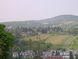
The Hackenberg with its allotment and vineyards seen from the Dr. Meißner Park |
||
| height | 306 m above sea level A. | |
| location | Vienna , Austria | |
| Mountains | Vienna Woods | |
| Coordinates | 48 ° 15 '8 " N , 16 ° 18' 56" E | |
|
|
||
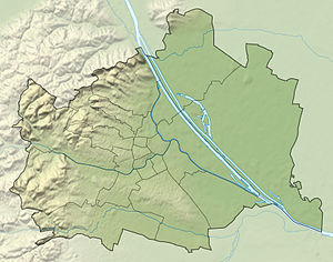
The Hackenberg is a 306 meter high mountain in the Sievering part of the 19th district of Vienna Döbling .
The Hackenberg is covered by marine sands and gravel . The Arbesbach flows around the mountain in the northeast and the Krottenbach in the southwest . Today, however, both rivers are routed as stream canals in this area . The foothills of the mountain to the east run to the Crimea ( Unterdöbling ). The Hackenberg was first mentioned in 1305 in a deed of purchase for Duke Rudolf as "hakkenperge". The name comes from the old meadow measure hook . The original derivation of the name from the personal name Hacko has since been discarded. In the Middle Ages, on the southwest slope of the Hackenberg, the village of Chlaintzing was located in the midst of vineyards , but today it is only known as a desert . Today the Hackenberg is covered in particular by allotment garden settlements, but some vineyards have also been preserved. Below the summit, towards Krottenbachstrasse, is the Hackenberg water reservoir of the Vienna water supply . The Sieveringer Friedhof has been located on the south-western slope since 1883 .
literature
- Karl Kothbauer: Döbling - and its reed and field names . Dissertation, Vienna 2001.

