Haflong
| Haflong | ||
|---|---|---|
|
|
||
| State : |
|
|
| State : | Assam | |
| District : | Dima Hasao | |
| Sub-district : | Haflong | |
| Location : | 25 ° 10 ′ N , 93 ° 1 ′ E | |
| Height : | 695 m | |
| Residents : | 43,756 (2011) | |
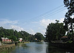
| Lake in Haflong | ||
Haflong ( Assamese : হাফলং Hāphlaṃ [ ˈhaflɔŋ ], also Haflang ) is a city in the Indian state of Assam . It is the administrative center and largest city of the Dima Hasao district (formerly North Cachar Hills ). The population was just under 44,000 in the 2011 census.
Haflong lies at an altitude of almost 700 meters above sea level in the middle of the Barail Mountains . The next largest cities are Silchar 110 kilometers south and Shillong 240 kilometers west. After Guwahati , the largest city of Assam, there are 368 km. Haflong lies on a ridge above the valley of the Diyung River. This is a tributary of the Kopili , which in turn flows into the Brahmaputra . The National Highway 54, the only road connection through the Barail Mountains, passes Haflong. Haflong is connected to the rail network via a meter-gauge line from Silchar to Lumding .

