Hahnentiefschaar
| Hahnentiefschaar | ||
|---|---|---|
| View across the two headlands of the Bessin to the south to the Hahnentiefschaar (center) | ||
| Waters | Vitter Bodden ( Baltic Sea ) | |
| Geographical location | 54 ° 34 '10 " N , 13 ° 8' 50" E | |
|
|
||
| length | 2.3 km | |
| width | 1 km | |
| surface | 2 km² | |
| Map of the area from 1893 with the Bessin group | ||
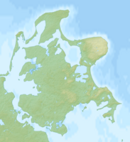
The Hahnentiefschaar (also Bessinsche Schaar ) is a sandbank between the Baltic Sea islands of Hiddensee and Rügen off the coast of Mecklenburg-Western Pomerania . It is located in the Vitter Bodden south of the Bessin double peninsula and west of the Bug peninsula in the core zone of the Vorpommersche Boddenlandschaft National Park . The sandbar has an area of around 2 km². In several places in the northern and central part of the sandbank it is so far above the mean water that small islands form on which pioneer plants settle. The Bessinsche Schaar is also described as a windwatt with numerous small islands. It serves as a feeding area for breeding and migrating waders .
Islands
Northern part
Several small islands have formed on the Hahnentiefschaar between the southern peaks of Alt- and Neubessin, up to 200 and 110 meters respectively from them. One of these islands belongs to the municipality of Insel Hiddensee . The island measures about 71 meters in an east-west orientation and around 68 meters in a north-south direction. The highest points are only a little over a meter above sea level. It is mostly overgrown. The island is not yet on the map of the Reichsamt für Landesaufnahme from 1893. The entire coastline had a different course. On some contemporary maps this island is mistakenly called Plathe , which, according to the Standing Committee on Geographical Names, is probably due to a transcription error. The name Plat (h) e refers to the east following the cock deep Schaar sea part . It is derived from the Low German name for an island or a sandbank that occasionally falls dry.
Middle part
In the middle part of the Hahnentiefschaar, where it reaches its greatest width of around 1 km, current aerial photos show at least five small silting zones, three of them with clearly recognizable vegetation. Official topographic maps from 1981 to 1987 show an island there with a diameter of around 300 meters.
Individual evidence
- ^ Map portal Environment Mecklenburg-Vorpommern , accessed on July 1, 2019
- ↑ State Office for Geoinformation and Land Surveying Lower Saxony: Geographical Names in German Coastal Waters, Supplement to Sheet 4 , East Mecklenburg and Western Pomerania Coast, Mecklenburg Bay to Pomeranian Bay, Rügen, 2nd edition 2017, page 10. Editor: Standing Committee for Geographical Names, State Surveying Office Mecklenburg-Western Pomerania 2005 (PDF, 1.39 MB). Retrieved August 18, 2019.
- ↑ Tour's Magazin WasserWelten 1/2018, 23rd year: National Park Vorpommersche Boddenlandschaft: Autumn bird migration (PDF)
- ↑ a b Geodata Viewer of the Office for Geoinformation, Surveying and Cadastral Affairs Mecklenburg-Western Pomerania ( notes )
- ↑ Map of the area around the island in the MV geoportal , accessed on June 30, 2019
- ↑ Nautical Chart No. 1621 Northern Rügen Bodden , scale 1: 30,000, year 2016, Federal Maritime and Hydrographic Agency .
- ↑ chart 2:32 Vitter Bodden , scale 1: 20,000 maps Werft GmbH, Flensburg, ISBN 978-3-944082-94-3 .


