Hakari
|
Hakari Həkəri, Հակարի, Акера, Акари, Хакари |
||
|
Hakari near Laçın |
||
| Data | ||
| location | Syunik Province ( Armenia ), Nagorno-Karabakh Republic / Azerbaijan |
|
| River system | Kura | |
| Drain over | Macaws → Kura → Caspian Sea | |
| Confluence of |
Schalua and Hoçaz in the Lesser Caucasus 39 ° 41 ′ 25 ″ N , 46 ° 29 ′ 50 ″ E |
|
| muzzle | in the Aras dammed up to the Khudaferin Reservoir Coordinates: 39 ° 8 ′ 23 " N , 46 ° 50 ′ 9" E 39 ° 8 ′ 23 " N , 46 ° 50 ′ 9" E
|
|
| length | 113 km | |
| Catchment area | 5650 km² | |
| Outflow at the Laçın gauge |
MQ |
22.7 m³ / s |
| Right tributaries | Vorotan | |
| Small towns | Laçın | |
|
Course of the Hakari |
||
The Hakari ( aserbaidschanisch Həkəri ; Armenian Հակարի ; Russian Акера, Акари, Хакари ) is a 113 km long left tributary of the macaws , by the Republic Karabakh in the art ( Azerbaijan and) a short distance along the Armenian extends limit.
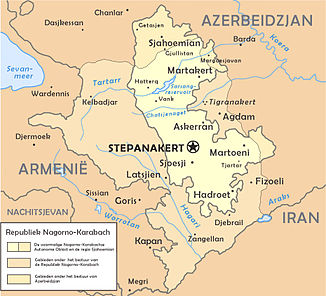
The Hakari arises at the confluence of the Schalua (left) and Hoçaz (right), about 10 km north of the city of Laçın . From there it flows south through the so-called Lachin Corridor in the Nagorno-Karabakh province of Kaschatach . The river valley separates the Karabakh Mountains belonging to the Lesser Caucasus in the east from the Karabakh highlands (part of the Armenian highlands ) in the west. The Hakari passes Laçın. Shortly afterwards it forms the border with Armenia for about 6 km. In the lower reaches the Hakari unites with the Vorotan streaming in from the right . Another 10 km downstream, the Hakari finally flows into the macaws that are dammed up to form the Khudaferin reservoir . The catchment area of the Hakari covers 5650 km². The discharge near Laçın is 22.7 m³ / s.
Individual evidence
- ↑ Article Vorotan in the Great Soviet Encyclopedia (BSE) , 3rd edition 1969–1978 (Russian)

