Laçın (city)
| Laçın Բերձոր Laçın |
||
| Country |
|
|
| Province in Artsakh | Kashatach | |
| Rayon in Azerbaijan | Laçın | |
| Coordinates | 39 ° 38 ′ N , 46 ° 33 ′ E | |
| Residents | 2,247 (2005) | |
| Time zone | UTC + 4 | |
|
|
||
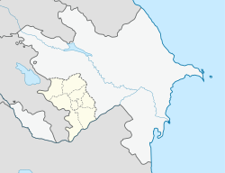
Laçın ( Azerbaijani ) or Berdsor ( Armenian Բերձոր ; Kurdish Laçîn, Russian Лачин ; also Latschin and Lachin ) is a city in Azerbaijan . It is the capital of the Azerbaijani Rayon Laçın , but has been occupied since 1992 and administered by the internationally unrecognized Republic of Nagorno-Karabakh , where it is the capital of the Kashatach Province . According to the Nagorno-Karabakh census, the city had 2,247 inhabitants in 2005. Before 1923 the city was called Abdalyar . The name Laçın means "falcon".
The city is located on the hillside on the left bank of the Hakari River .
history
From 1923 to 1929 Laçın was the administrative center of the autonomous province of Red Kurdistan in the Azerbaijani Soviet Republic . After the dissolution of red Kurdistan, many Kurds were deported to Central Asia from 1937 onwards.
According to the 1989 census, Laçın had 7902 Azeris (61.5%), 2613 Kurds (20.1%), 2210 Armenians (18%) and 52 others (0.4%).
In the course of the Nagorno-Karabakh conflict , the city was occupied by Armenia on May 18, 1992 , as it lies between Armenia and the disputed Nagorno-Karabakh region . The city was badly destroyed in the fighting. Many of the Muslim residents have been displaced to other parts of Azerbaijan. In the period after that, the Armenian government resettled Armenian refugees from Azerbaijan in the city.
traffic
The road from Goris in Armenia to Stepanakert in Nagorno-Karabakh runs through the city, also known as the Lachin Corridor , as it represents the most important connection between Armenia and Nagorno-Karabakh.
Web links
Individual evidence
- ↑ census.stat-nkr.am/nkr (PDF; 227 kB) Census in the BKR of 2005, p. 15
- ↑ Samvel Karapetian: Armenian Cultural Monuments in the Region of Karabagh . Yerevan: Gitutiun Publishing House, 2001, p. 169.
- ↑ HFB Lynch, F. Oswald: Map of Armenia and Adjacent Countries . London, 1901.
- ↑ Azerbaijan Developement Gateway ( Memento of November 14, 2008 in the Internet Archive ) about the rayon and the city
- ↑ a b azerb.com about city and rayon

