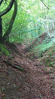
Harbecke (Lenne)
|
Harbecke Harbecker Siepen |
||
| Data | ||
| Water code | DE : 27661932 | |
| location | Schmallenberg ; Hochsauerlandkreis , North Rhine-Westphalia ( Germany ) | |
| River system | Rhine | |
| Drain over | Lenne → Ruhr → Rhine → North Sea | |
| source | in Beerenberg , northeast of Harbecke 51 ° 8 ′ 47 ″ N , 8 ° 14 ′ 40 ″ E |
|
| Source height | 515 m | |
| muzzle | south of Harbecke and south of the B 236 into the Lenne (Ruhr) coordinates: 51 ° 8 ′ 11 ″ N , 8 ° 13 ′ 45 ″ E 51 ° 8 ′ 11 ″ N , 8 ° 13 ′ 45 ″ E |
|
| Mouth height | 338 m | |
| Height difference | 177 m | |
| Bottom slope | 77 ‰ | |
| length | 2.3 km | |
| Catchment area | 3.7 km² | |
| Medium-sized cities | Schmallenberg | |
The Harbecke , also called Harbecker Siepen , is an approx. 2.3 km long brook in the area of the town Schmallenberg in the Hochsauerlandkreis in North Rhine-Westphalia . It flows into the Lenne near the Harbecker Weg .
geography
The Harbecke rises in Beerenberg , about 700 meters northeast of the village of Harbecke , a district of the town of Schmallenberg. From its source it flows about 300 meters to the west or district road 25. When you arrive at the road, it bends 90 ° to the south towards Harbecke. From there it always goes to the left of Kreisstraße 25, through Harbecke to the B 236 on Harbecker Weg. Once there, it flows through an underpass under the main road to the Lenne.
Due to development, the Harbecke flows part of its way through underground pipes in the ground. Smaller rivulets feed the stream below Harbecke. In summer, during warmer periods, the Harbecke is usually as good as dry.
At the end of winter, as well as in spring, the stream is well filled because the melt water from the Beerenberg flows into the Lenne.
history
The residents of Harbeck knew how to use the power of water from an early age. Old records show that the water of the stream was used on a farm as early as 1909 to generate electricity for a threshing shop, a saw and for electric light with the help of a turbine. That was unique in this area at the time.
See also
Web links
Individual evidence
- ↑ a b c Topographical Information Management, Cologne District Government, Department GEObasis NRW ( information )
- ↑ Self- measurement on the specialist information system ELWAS, Ministry for Climate Protection, Environment, Agriculture, Nature and Consumer Protection NRW ( information )
- ↑ Franz Dempewolff: Private family chronicle . Ed .: Franz Dempewolff. Harbecke 1947.

