Herekino
| Herekino | ||
| Geographical location | ||
|
|
||
| Coordinates | 35 ° 16 ′ S , 173 ° 13 ′ E | |
| Region ISO | NZ-NTL | |
| Country |
|
|
| region | Northland | |
| District | Far North District | |
| Ward | Te Hiku Ward | |
| Residents | few | |
| height | 23 m | |
| Post Code | 0481 | |
| Telephone code | +64 (0) 9 | |
| Photography of the place | ||
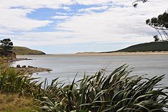
 Herekino Harbor |
||
Herekino is a small settlement in the Far North District of Northland on the North Island of New Zealand .
Origin of name
Herekino was named by the Māori chief Tohe , who passed the place on the way to visit Chief Taunaha , who lived in Owhata . He found an improperly tied bird's noose that would have caused unnecessary suffering to a potential victim. He named the area Herekino-a-Taunaha (the wrong knot of Taunaha ).
geography
Herekino is located around 18 km southwest of Kaitaia at the northeast end of Herekino Harbor , a small natural harbor that extends around 7 km inland. The port is a submerged river valley into which various streams flow today. The Herekino Forest , which has a larger population of Kauri trees , is located in the north of the settlement. The Tauroa Peninsula is around 15 km northwest of the settlement.
history
The Iwi Ngāti Ruānui (now Te Aupōuri ) ruled the ports of Herekino and Whangape . Several battles were fought against other tribes before the area was colonized by the Europeans.
In 1846, the confused Brigg H.MS Osprey in fog the Herekino Heads with the similar entrance to the Hokianga Harbor , the 30 km further south. Both have a northern limit of the entrance formed by sand dunes. The Osprey ran aground on the flat sandbar north of the headland and sank. There were no victims. Herekino was on some charts given the similarities in the approach as " False Hokianga " ( "false Hokianga entered").
Dalmatian immigrants grew wine in the late 1890s, and by 1906 there were 14 wineries.
In the mid-1960s, Herekino was a small town with shops, a butcher, a gas station, and more. However, after the road to Kaitaia was paved, they soon had to close.
population
The New Zealand Office Statistics New Zealand shows a population for 2013 of 2016 under the local term Herekino . However, the area under which the statistical data were summarized extends over 30 km in a north-south direction and around 25 km in an east-west direction and has nothing in common with the settlement described here except its name. According to the Mashbock evaluation, the settlement has far fewer than 100 inhabitants.
Natural harbor
With the exception of a narrow channel, the natural harbor mostly falls dry at low tide. In the upper part of the canal there is a mangrove forest . The small settlement of Owhata is located on the rocky south coast of the harbor entrance. Owhata is a flat, grassy area with a fairly flat coastline of mud and sand. There is little protection from the weather and there is a shortage of water in summer.
Education
The Herekino school is a co-educational primary school with around 60 students.
literature
- William Frederick Parkes : The Visitors' Guide to the Far North . Mangonui County . 3. Edition. Self-published , Kaitaía 1968 (English).
Individual evidence
- ↑ a b c Parkes : The Visitors' Guide to the Far North . 1968, p. 14 .
- ↑ Topo250 maps . Land Information New Zealand , accessed June 10, 2017 .
- ^ Claudia Orange : Northland places - Kaitāia and district . In: Te Ara - the Encyclopedia of New Zealand . Ministry for Culture & Heritage , May 4, 2015, accessed April 17, 2019 .
- ↑ Rawiri Taonui : Muriwhenua tribes - te aupōuri and Te Rarawa . In: Te Ara - the Encyclopedia of New Zealand . Ministry for Culture & Heritage , March 22, 2017, accessed April 17, 2019 .
- ^ Carl Walrond : Dalmatians - Farming, fishing, winemaking . In: Te Ara - the Encyclopedia of New Zealand . Ministry for Culture & Heritage , March 1, 2015, accessed April 17, 2019 .
- ↑ 2013 Census QuickStats about a place: Herekino . Statistics New Zealand , accessed June 10, 2017 .
- ↑ Description of Area: Hokianga, Whangape and Herekino Harbors . Northland Marine Library , archived from the original on October 21, 2008 ; accessed on September 10, 2019 (English, original website no longer available).
