Herndon, Virginia
| Herndon | ||
|---|---|---|
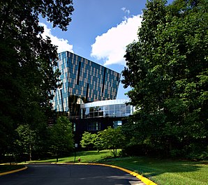
 Center for Innovative Technology |
||
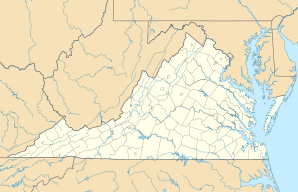
| Location in Virginia | ||
|
|
||
| Basic data | ||
| Foundation : | 1858 | |
| State : | United States | |
| State : | Virginia | |
| County : | Fairfax County | |
| Coordinates : | 38 ° 58 ′ N , 77 ° 23 ′ W | |
| Time zone : | Eastern ( UTC − 5 / −4 ) | |
| Residents : | 24,545 (as of 2018) | |
| Population density : | 2,251.8 inhabitants per km 2 | |
| Area : | 10.9 km 2 (approx. 4 mi 2 ) of which 10.9 km 2 (approx. 4 mi 2 ) is land |
|
| Height : | 112 m | |
| Postcodes : | 20170–20172, 20190–20196, 22095–22096 | |
| Area code : | +1 571, 703 | |
| FIPS : | 51-36648 | |
| GNIS ID : | 1495675 | |
| Website : | www.herndon-va.gov | |
| Mayor : | Lisa Merkel | |
Herndon is a city in Fairfax County in the US state of Virginia and is located about 35 km west of Washington, DC With a population of 24545 (2018), the city is the 44th largest municipality in Virginia. Due to special administrative structures, however, it is the largest so-called incorporated town in the county.
history
The city was founded in 1858 and named in honor of Commander William Lewis Herndon.
geography
Herndon is just east of Washington Dulles International Airport .
economy
Due to the proximity to the airport, some technology companies such as Network Solutions or XO Communications have settled here.
various
The headquarters of the International Institute of Islamic Thought (IIIT) is located in Herndon .
Sister city of Herndon is the town of Runnymede in Surrey , England .
Web links
- Official website of the city of Herndon ( English )
