
Herrenseegraben (Jerichower Land)
| Herrenseegraben | ||
 |
||
| Data | ||
| location | District of Jerichower Land Saxony-Anhalt Middle Elbe Biosphere Reserve | |
| River system | Elbe | |
| Drain over | Kühns Loch → Pareyer connecting canal → Elbe → North Sea | |
| confluence |
Mohr Lake trench + Noosdorfer trench 52 ° 18 '49 " N , 11 ° 50' 32" O |
|
| Source height | 38 m | |
| muzzle |
Kühns Loch coordinates: 52 ° 23 ′ 13 ″ N , 11 ° 58 ′ 44 ″ E 52 ° 23 ′ 13 ″ N , 11 ° 58 ′ 44 ″ E
|
|
| length | 14 km | |
| Left tributaries | Blumenthaler Graben east, Küsterbuschgraben, Graben Werdersche Mark, Heringsgraben, Wolterseegraben | |
| Right tributaries | Shattered Trench | |
| Flowing lakes | Parchauer See → Güldensee → Gehrendscher See → Herrensee Zerben → Lakes Parey → Mühlenlanke Parey | |
| Communities | Parchau , Parey (Elbe) | |
| Navigable | No | |
|
22 bridges and crossings - some only for pedestrians |
||
The Herrenseegraben river landscape is located in the Jerichower Land district and is part of the Middle Elbe Biosphere Reserve . It follows the course of the Old Elbe and is not navigable. Its total length is 14 km.
description
The Herrenseegraben begins on the west bank of the Parchauer See with the tributaries Mohrslakegraben and Noosdorfer Graben . He also runs through the Güldensee at Ihleburg and Gehrendscher lake past Zerben . At Parey it widens to form several small lakes before flowing into Kühns Loch . Nutria have settled
in the Pareyer waters . These lakes do not dry out in summer either, while the shallow ditch often no longer has any water in the spring.
dig

The slope of the dry trench is undercut (May 2020)

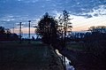
Belt of reeds near Zorben
In March 2017 the shallow ditch still had water


Flowing lakes
| number | view | Surname | place | surface | location |
| 01 west |  |
Parchauer See | Parchau | 17.5 ha | cards |
| 01 middle |  |
Parchauer See | Parchau | 7.5 ha | cards |
| 01 east |  |
Parchauer See | Parchau | 7.0 ha | cards |
| 02 south |  |
Güldensee | Ihleburg | 0.5 ha | cards |
| 02 north |  |
Güldensee | Ihleburg | 2.8 ha | cards |
| 03 |  |
Gehrendscher See | Ihleburg | 2.5 ha | cards |
| 04 |  |
Herrensee | Break | 2.0 ha | cards |
| 05 |  |
'At the old dike' | Parey | 0.3 ha | cards |
| 06 south |  |
'At the MTS' | Parey | 0.3 ha | cards |
| 06 north |  |
'At the MTS' | Parey | 0.5 ha | cards |
| 07 |  |
Mühlenlanke | Parey | 1.0 ha | cards |
Bridges and footbridges
| number | view | detail | place | Remarks | location |
|---|---|---|---|---|---|
| 01 |

|

|
Parchau / Parchauer See | Sea dam with forest path | cards |
| 02 |

|

|
Parchau / Parchauer See | Sea embankment with road | cards |
| 03 |

|

|
Parchau / east of the lake |
|
cards |
| 04 |

|

|
Parchau / east of the lake | Weir with bridge | cards |
| 05 |

|

|
Parchau / east of the place | Dirt road (paved) | cards |
| 06 |

|

|
Ihleburg / west |
|
cards |
| 07 |

|

|
Ihleburg / northwest | footbridge | cards |
| 08 |

|

|
Ihleburg / north | Weir with bridge | cards |
| 09 |

|

|
Ihleburg / east of Gehrendscher See | Weir with bridge | cards |
| 10 |

|

|
Broken / western | Dirt road | cards |
| 11 |

|

|
Broken / western |
|
cards |
| 12 |

|

|
Broken / western |
|
cards |
| 13 |

|

|
Broken / northwest | Haberlandweg (dirt road, paved) | cards |
| 14th |

|

|
Zerbe / north | Dirt road (paved) | cards |
| 15th |

|

|
Zerbe / north |
|
cards |
| 16 |

|

|
Zerbe / north |
|
cards |
| 17th |

|

|
Zerbe / north |
|
cards |
| 18th |

|

|
Parey / southwest | footbridge | cards |
| 19th |

|

|
Parey / west |
|
cards |
| 20th |

|

|
Parey / west | Weir with pedestrian bridge | cards |
| 21st |

|

|
Parey / west | footbridge | cards |
| 22nd |

|

|
Parey / west |
|
cards |
| 23 |

|

|
Parey / west | Dirt road (paved) | cards |
| 24 |

|

|
Parey / west | Old arch bridge without connection |
cards |
| 25 New |

|

|
Parey / northwest | Weir with pedestrian bridge | cards |
| 25 alt |

|

|
Parey / northwest |
Weir with pedestrian bridge Replaced by a new building after 2017 |
cards |
| 26th |

|

|
Parey / Bittkauer Weg (street) | Bridge with Corrugated steel pipe passage |
cards |