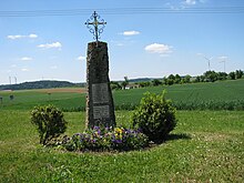
Hilzhofen
|
Hilzhofen
Municipality of Pilsach
Coordinates: 49 ° 18 ′ 8 " N , 11 ° 35 ′ 36" E
|
|
|---|---|
| Height : | 525 m |
| Residents : | 83 (1987) |
| Incorporation : | May 1, 1978 |
| Postal code : | 92367 |
| Area code : | 09186 |
Hilzhofen is an officially named part of the municipality of Pilsach in the Neumarkt district in Upper Palatinate in Bavaria .
geography
The village is located in the Upper Palatinate Jura about 2 km north of the valley of the Schwarzen Laber at about 525 m above sea level .
traffic
Hilzhofen is located on local roads that lead from Eschertshofen , Dietkirchen and Unterwiesenacker to the village.
history
Hilzhofen was probably created in Carolingian times by Frankish colonizers. In 1325 the place is listed in a first description of the property of the Kastl monastery - probably a former Habsberg property ; In 1410 there were two farms and a Söldenlehen . Around 1500 the place appears in a Salbuch as "Hylltzhoffen". In 1622 Hilzhofen consisted of seven estates, two of which were Castilian. At the end of the Old Kingdom , around 1800, the village consisted of eight properties and the community shepherd's house; they were subject to the Palatinate-Neuburg Office of Helfenberg .
In the Kingdom of Bavaria (1806) the tax district Unterwiesenacker was formed around 1810 , which was assigned to the Parsberg district court , it included Unterwiesenacker, Oberwiesenacker with the Gehermühle , Oberweickenhof , Unterweickenhof , Hilzhofen and Habertshofen . With the community edict of May 15, 1818, it became the rural community of Oberwiesenacker under the Parsberg district court .
Lived in the Hilzhofen community
- 1836 79 inhabitants (12 houses),
- 1867 93 inhabitants (24 buildings),
- 1875 88 inhabitants (42 buildings; 9 horses and 81 head of cattle among large livestock),
- 1900 98 inhabitants (15 residential buildings),
- 1925 85 inhabitants (14 residential buildings),
- 1937 101 inhabitants (only Catholics),
- 1950 88 inhabitants (13 residential buildings).
- 1987 83 inhabitants (18 buildings with living space, 21 apartments).
Today 37 house numbers are assigned. As part of the Bavarian regional reform , the municipality of Oberwiesenacker was incorporated into the city of Velburg on May 1, 1978; the village of Hilzhofen came to the municipality of Pilsach.
Water supply
A mechanical ram from the former water supply system, which was in use from 1927 to around 1980, has been preserved in the village . It was a currentless water lifting device to transport the water from contained springs on the valley flank of the Schwarzen Laber west of Hilzhofen to an elevated tank north of Hilzhofen. The water initially flowing downwards from the spring was forced into the thinner riser to the elevated tank in the Aries “air chamber” by natural pressure, and from there it flowed into the village via a main line. Around 1980 the ram was replaced by motors to cope with the increased water consumption. Finally, in 1989 Hilzhofen was connected to the central water supply of the "Prönsdorfer Group".
Landscape cinema
A “Juradistl landscape cinema” created by the Neumarkt Landscape Management Association and the municipality of Pilsach has been located on the Kuppenalb hiking trail east of Hilzhofen since 2016. These are weatherproof folding chairs that are firmly arranged in a semicircle and terrace and from which the Jura landscape can be viewed.
Church conditions
Hilzhofen has belonged to the Dietkirchen parish of the Kastl monastery in the Eichstätt diocese since ancient times . From 1540 to 1626 the parish Palatinate-Neuburg and thus Hilzhofen was Protestant.
Others
There are several golf courses nearby .
literature
- Franz Xaver Buchner : The diocese of Eichstätt. Volume I, Eichstätt: Brönner & Däntler, 1937
- Bernhard Heinloth: Historical Atlas of Bavaria. Part Altbayern, Issue 16: Neumarkt , Munich: Commission for Bavarian State History, 1967
- Manfred Jehle: Historical Atlas of Bavaria, part of Old Bavaria, volume 51: Parsberg , Munich 1981
Individual evidence
- ↑ Jehle, p. 5
- ↑ Jehle, pp. 4, 319, 325
- ↑ Jehle, p. 336; Heinloth, p. 434
- ↑ Jehle, pp. 336, 494
- ↑ Jehle, pp. 536, 543
- ↑ Th. D. Popp (ed.): Matriculation des Bissthumes Eichstätt , Eichstätt: Ph. Brönner, 1836, p. 50
- ↑ Joseph Heyberger: Topographical-statistical manual of the Kingdom of Bavaria together with an alphabetical local dictionary , Munich 1867, Col. 797
- ↑ Complete list of localities of the Kingdom of Bavaria ... based on the results of the census of Dec. 1, 1875 , Munich 1877, column 980
- ↑ Kgl. Statistical Bureau in Munich (edit.): List of localities of the Kingdom of Bavaria ... [based on the results of the census of December 1, 1900] , Munich 1904, column 903
- ^ Localities directory for the Free State of Bavaria according to the census of June 16, 1925 and the territorial status of January 1, 1928 , Munich 1928, Col. 911
- ↑ Buchner I, p. 171
- ^ Official register of places for Bavaria edited on the basis of the census of September 13, 1950 , Munich 1952, Col. 787
- ↑ Official directory for Bavaria, territorial status: May 25, 1987 , Munich 1991, p. 260
- ^ Federal Statistical Office (ed.): Historical municipality directory for the Federal Republic of Germany. Name, border and key number changes in municipalities, counties and administrative districts from May 27, 1970 to December 31, 1982 . W. Kohlhammer GmbH, Stuttgart / Mainz 1983, ISBN 3-17-003263-1 , p. 650 .
- ↑ Information board on the ram
- ↑ Juradistl experiences
- ↑ Buchner I, p. 169


