Hirtenbach (Elsava)
| Hirtenbach | ||
|
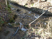
The Wasenbrunnen |
||
| Data | ||
| location |
Spessart
|
|
| River system | Rhine | |
| Drain over | Elsava → Main → Rhine → North Sea | |
| source | in the Wasenbrunnen in Heimbuchenthal 49 ° 53 ′ 41 ″ N , 9 ° 18 ′ 34 ″ E |
|
| Source height | 245 m above sea level NN | |
| muzzle | at the church in Heimbuchenthal in Elsava Coordinates: 49 ° 53 '48 " N , 9 ° 18' 11" E 49 ° 53 '48 " N , 9 ° 18' 11" E |
|
| Mouth height | 230 m above sea level NN | |
| Height difference | 15 m | |
| Bottom slope | 21 ‰ | |
| length | 700 m | |
| Catchment area | approx. 3.8 km² | |
The Hirtenbach is a left tributary of the Elsava in the district of Aschaffenburg in the Bavarian Spessart .
geography
course
The Hirtenbach rises from the Wasenbrunnen in the local area of Heimbuchenthal and runs to the west. It is completely piped from its source to the mouth. Near the St. Martinus Church it flows into the left arm of the Elsava .
The source of the stream is located in a valley system that continues uphill by significantly more than the length of the stream. The catchment area covers about 3.8 km², at 478 m above sea level. NN highest point on the Zeugplatte is at its northeastern tip above the end of the longest upper valley .
Elsava river system
See also
Web links
Commons : Hirtenbach (Elsava) - Collection of images, videos and audio files
Individual evidence

The Hirtenbach (front) flows into the left arm of the Elsava (from right to left)
