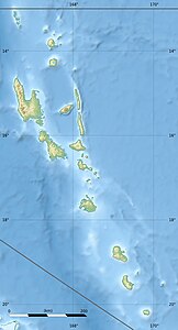
Hiw (island)
| Hiu (Hiw) | ||
|---|---|---|
| Hiu island map | ||
| Waters | Coral sea | |
| Archipelago | Torres Islands | |
| Geographical location | 13 ° 9 ′ S , 166 ° 34 ′ E | |
|
|
||
| length | 13.5 km | |
| width | 4.5 km | |
| surface | 50.6 km² | |
| Highest elevation | Mount Wonvara 366 m |
|
| Residents | 84 (1979) 1.7 inhabitants / km² |
|
| main place | Gavigamana (Yögevigemëne) | |
| Hiu in the north of the Torres Islands | ||
Hiw ([ hiw ]), German also Hiu , is the northernmost island of the Pacific island state of Vanuatu . With about 60 km² it is also one of the largest of the Torres Islands , which politically belong to the Vanuatu province of Torba .
geography
The island extends from north to south for about 13.5 kilometers and is a maximum of 4.5 kilometers wide. The highest point is Mount Wonvara at 366 m .
Just under two kilometers from the southern tip ( Pointe Gagévétawa ) is the island of Metoma , separated by the Mawatan Passage ( Passe Cosmao ). Vewoag Point , the northern tip of Hiu, is the northernmost landmass of Vanuatu. 1.6 km north of Hiu is the submarine reef Ngwei Gakw (formerly Recif Giraudeau ), over which the waves break.
Hiu is densely forested inland. There are three villages on the east coast: Yogwye [ ˈjɔɰwjə ], Yaqane [ jaˈkʷanə ], and the main town Yögevigemëne [ ˌjɵɣəˌβiɣəˈmenə ]. In the east of the main town, the 50 hectare peninsula Nēnye (Nenia) joins over the narrow isthmus Tinemë Vönyö . The peninsula is erroneously listed as Île Lonagavanoua in some sources .
population
The current population (as of the 2009 census) is 269, after 200 in 1999. For the 1979 census, a population of 84 was determined. In 1971 only 48 were counted.
The residents speak Hiw , an endangered Oceanic language.
Individual evidence
- ↑ a b List of islands and languages spoken in the Torres and Banks Islands of Vanuatu (CNRS, Paris)
- ↑ cf. Geonames Database . This satellite image clearly shows that Nēnye is not an island, but a peninsula.
- ↑ Vanuatu Census 2009 and 1999
- ↑ PDF at hbs.bishopmuseum.org
- ↑ World Atlas of Threatened Languages (Hiw Language) .


