Hochzeiger
| Hochzeiger | ||
|---|---|---|
|
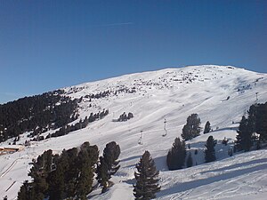
Ski area on the Hochzeiger with the Sechszeiger |
||
| height | 2560 m above sea level A. | |
| location | Tyrol , Austria | |
| Mountains | Ötztal Alps | |
| Coordinates | 47 ° 8 '43 " N , 10 ° 47' 44" E | |
|
|
||
The Hochzeiger is a summit of the Geigenkamm , a mountain range in the Ötztal Alps in Tyrol . The mountain has a height of 2560 m above sea level. A. and is located east of Jerzens in the Pitztal . The Hochzeiger offers a view of the district capital Imst , the Gurgl and the Inn valleys .
ways
An important starting point for climbing the mountain is the Hochzeigerhaus , which used to be accessible from Jerzens by chairlift, today you can get there by car. It is located at an altitude of 1829 m , northwest of the Hochzeiger. The Hochzeiger can be reached in around 1½ hours from the Hochzeigerhaus. Marked trails lead over the north ridge, the west ridge and from the southeast from the Riegetalpe to the frequently visited summit. The north-facing path has some insurance and easy climbing sections of difficulty level I (UIAA) . On the summit of the Hochzeiger there is a summit cross with a summit book .
Ski Area
One of the ski areas in Austria is located on the Hochzeiger . It includes an 8-seater gondola, two 6-seater chairlifts, 1 four-seater chairlift and 5 other lifts that can transport up to 15,200 people per hour. With these, a total of 40 kilometers of slopes can be reached, which consist of pull paths with little incline to black slopes with 80% incline. In addition to the ski slopes, there is a toboggan run and a freestyle park. In 2010 the ski area was named “Newcomer of the Year” by the ADAC . From the 115,000 m³ reservoir located at the Sechszeiger summit, the 66 snow machines can be supplied, which enable complete snow-making on all slopes within 10 days.
The area is the home ski Benjamin Raich , the from Arzl derived ski racer , the Olympic champion , world champion and World Cup winner has. One of the black runs is named after him.
literature
- Walter Klier : Alpine Club Guide Ötztal Alps . Bergverlag Rother, Munich 2006, ISBN 3-7633-1123-8
Web links
Individual evidence
- ^ Austrian map 1: 50,000, AMAP Online. Federal Office for Metrology and Surveying ; Retrieved March 11, 2011
- ^ Walter Klier : Alpine Club Guide Ötztal Alps . 14th edition. Bergverlag Rother, Munich 2006, ISBN 978-3-7633-1123-1 , p. 138-139 ( Google Books ).
- ↑ a b ski lifts & snow machines. ( Memento of the original from January 12, 2011 in the Internet Archive ) Info: The archive link was inserted automatically and has not yet been checked. Please check the original and archive link according to the instructions and then remove this notice. hochzeiger.com
- ↑ Ski slopes ( Memento of the original from December 28, 2010 in the Internet Archive ) Info: The archive link has been inserted automatically and has not yet been checked. Please check the original and archive link according to the instructions and then remove this notice. , hochzeiger.com
- ↑ The slopes on the Hochzeiger. ( Memento of the original from December 25, 2012 in the Internet Archive ) Info: The archive link was inserted automatically and has not yet been checked. Please check the original and archive link according to the instructions and then remove this notice. hochzeiger.com
- ^ ADAC top ski area 2010. On: adac-skiguide.de, December 1, 2009. Accessed on August 31, 2011

