
Jerzens
|
Jerzens
|
||
|---|---|---|
| coat of arms | Austria map | |
 |
|
|
| Basic data | ||
| Country: | Austria | |
| State : | Tyrol | |
| Political District : | Imst | |
| License plate : | IN THE | |
| Surface: | 30.39 km² | |
| Coordinates : | 47 ° 9 ' N , 10 ° 45' E | |
| Height : | 1107 m above sea level A. | |
| Residents : | 947 (January 1, 2020) | |
| Postal code : | 6474 | |
| Area code : | 05414 | |
| Community code : | 7 02 05 | |
| NUTS region | AT334 | |
| Address of the municipal administration: |
Jerzens 220 6474 Jerzens |
|
| Website: | ||
| politics | ||
| Mayor : | Karl Raich ( together for Jerzens ) | |
|
Municipal Council : (2016) (11 members) |
||
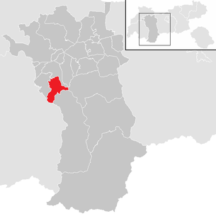
| Location of Jerzens in the Imst district | ||
  |
||
 Jerzens, seen from Wenns |
||
| Source: Municipal data from Statistics Austria | ||

Jerzens is a municipality with 947 inhabitants (as of January 1, 2020) in the Imst district ( Imst judicial district ), Tyrol ( Austria ).
Geographical location
Jerzens is located in the front Pitztal on the east side on a south-west slope. Below the clustered village of Jerzens, the highest corn-growing area in North Tyrol extends in a sunny and sheltered location.
structure
Jerzens consists of a single village or cadastral municipality. Hamlets on both sides of the Pitze in the valley, such as Ritzenried and Wiesle, also belong to the community .
Neighboring communities
from Jerzens are:
history
The favorable conditions for agriculture and animal husbandry probably led to early settlement. To the pre-Roman Rhaetian population from about 600 came from the north advancing Bavarian immigrants. The then influential lords of Starkenberg and Stams Abbey founded several scattered Schwaighöfe , from which today's hamlets developed through division over the centuries.
The Walsers who immigrated from the Swiss Valais and who advanced over the Piller to Jerzens in the 13th and 14th centuries are also accepted as settlers .
The Jerzner cutlery were very famous.
In a register from 1313, Irtzens and Ritzenried are named as local tax groups of the court (= administrative area) Imst . Around 1650 Jerzens was an independent tax municipality, from which the political municipality emerged in 1811 during the Bavarian rule.
In 1923 a municipal power station was built above the mill. Jerzens has been getting electricity from TIWAG since 1955. In 1954 the aqueduct was built. In 1951 an avalanche of dust on the alpine pastures and meadows carried away 30 pills. 1966 devastated a Mure the districts Mühlloch and Niederhofstraße.
Since 1986 the classrooms have been housed in the parish hall. In 1995 the old schoolhouse was demolished and the second part of the parish hall was built in its place.
Population development

Culture and sights
economy
Until the middle of the 20th century, agriculture and handicrafts were the main source of income for the residents, with many residents being forced to emigrate or to hire out seasonal workers abroad. This changed with the onset of tourism, when a ski lift went into operation at the Hochzeigerhaus in 1964 .
Today the Hochzeiger ski area has an 8-seater gondola lift, two 6-seater chairlifts, a quadruple chairlift and five other lifts with a total of 52 kilometers of slopes. Jerzens has about 2000 guest beds, sometimes in holiday apartments, guest houses and inns and also some top wellness hotels. The hamlet of Liß / Kaitanger is particularly dominated by tourism.
Personalities
Sons and daughters of the church
- Hermann Raich SVD (1934–2009), bishop emeritus of the Wabag diocese in the highlands of Papua New Guinea
- Gernot Reinstadler (1970–1991), ski racer
- Helmut Wechselberger (* 1953), racing cyclist
- Lambert Grutsch (1914–1995), Righteous Among the Nations
Personalities associated with the community
- Traudl Eder (* 1941), ski racer
Web links
- 70205 - Jerzens. Community data, Statistics Austria .
- Site of the Jerzens community
- Jerzens , in the history database ofthe association "fontes historiae - sources of history"
Individual evidence
Arzl im Pitztal | Haiming | Imst | Imsterberg | Jerzens | Karres | Karrösten | Längenfeld | Mieming | Mils at Imst | Mötz | Nassereith | Obsteig | Oetz | Rietz | Roppen | St. Leonhard im Pitztal | Sautens | Silz | Sölden | Stams | Tarrenz | Umhausen | If it