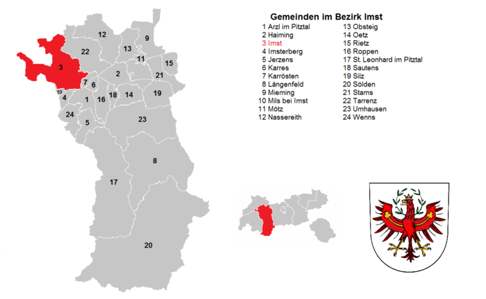
Imst district
| location | |
|---|---|
| Basic data | |
| state | Tyrol |
| NUTS III region | AT-334 |
| Administrative headquarters | Imst |
| surface | 1724 km² |
| Residents | 60,474 (January 1, 2020) |
| Population density | 35 inhabitants / km² |
| License Plate | IN THE |
| District Commission | |
| District Captain | Raimund Waldner |
| website | www.tirol.gv.at/imst |
| map | |
The Imst district is a political district in the Austrian state of Tyrol . It is named after Imst , the administrative seat and the only town in the district.
The district borders in the west on the district Landeck , in the east on the Innsbruck-Land district , in the north on the Reutte district and to a small extent on Bavaria ( Garmisch-Partenkirchen district ) and in the south on South Tyrol .
geography
The district covers 1,723.82 km² part of the Upper Inn Valley with side valleys ( Ötztal , Pitztal and Gurgltal ) and the Mieminger Plateau . In addition to the valleys, the area is mainly formed by high mountains (part of the Stubai and Ötztal Alps , Mieminger Mountains ).
Economy and Infrastructure
The economy is heavily influenced by the service sector, with two-season tourism dominating here. The most important industrial location is Imst.
The largest companies are: Hofer (grocery trade), Holzindustrie Pfeifer, MS-Design (auto tuning parts), Sparkasse Imst and Riml Hotels in Sölden.
The district has a high number of out-commuters, especially in the greater Innsbruck area.
Administrative division
The Imst district is divided into 24 municipalities , including one town and no market town.
- Regions in the table are Tyrolean planning associations (as of March 2017)
| local community | location | Ew | km² | Ew / km² | Judicial district | region | Type
|
photo | Metadata |
|---|---|---|---|---|---|---|---|---|---|
Arzl in the Pitztal
|

|
3.164 | 29.36 | 108 | Imst | 12 - Pitztal | local community
|

|
According to code: 70201 |
Haiming
|

|
4,757 | 40.18 | 118 | Silz | 13 - Ötztal | local community
|

|
According to code: 70202 |
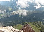
Imst
|

|
10,765 | 113.34 | 95 | Imst | 10 - Imst and surroundings | urban community
|
|
According to code: 70203 |
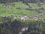
Imsterberg
|

|
801 | 10.81 | 74 | Imst | 10 - Imst and surroundings | local community
|
|
According to code: 70204 |
Jerzens
|

|
947 | 30.39 | 31 | Imst | 12 - Pitztal | local community
|

|
According to code: 70205 |
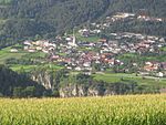
Carts
|

|
620 | 7.5 | 83 | Imst | 10 - Imst and surroundings | local community
|
|
According to code: 70206 |
Roasting
|
|
676 | 7.9 | 86 | Imst | 10 - Imst and surroundings | local community
|

|
Acc. To code: 70207 |
Längenfeld
|

|
4,742 | 195.61 | 24 | Silz | 13 - Ötztal | local community
|

|
Acc. To code: 70208 |
Mieming
|

|
3,790 | 50.34 | 75 | Silz | 11 - Inntal – Mieminger Plateau | local community
|

|
Acc. To code: 70209 |
Mils at Imst
|

|
608 | 3.48 | 175 | Imst | 10 - Imst and surroundings | local community
|

|
Acc. To code: 70210 |
Mötz
|
|
1,250 | 5.84 | 214 | Silz | 11 - Inntal – Mieminger Plateau | local community
|
|
Acc. To code: 70211 |
Nassereith
|

|
2.149 | 72.39 | 30th | Imst | 10 - Imst and surroundings | local community
|
|
According to code: 70212 |
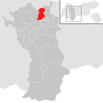
Obsteig
|
|
1,381 | 34.62 | 40 | Silz | 11 - Inntal – Mieminger Plateau | local community
|

|
Acc. To code: 70213 |
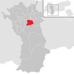
Oetz
|
|
2,392 | 29.17 | 82 | Silz | 13 - Ötztal | local community
|

|
According to code: 70214 |
Rietz
|

|
2,367 | 19.55 | 121 | Silz | 15 - Telfs and the surrounding area – Salzstrasse | local community
|

|
Acc. To code: 70215 |
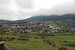
Ropes
|

|
1,818 | 30.83 | 59 | Silz | 13 - Ötztal | local community
|
|
Acc. To code: 70216 |
St. Leonhard in the Pitztal
|

|
1,384 | 223.44 | 6.2 | Imst | 12 - Pitztal | local community
|

|
Acc. To code: 70217 |
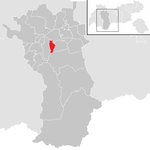
Sautens
|
|
1,623 | 11.6 | 140 | Silz | 13 - Ötztal | local community
|

|
Acc. To code: 70218 |
Silz
|

|
2,563 | 65.62 | 39 | Silz | 11 - Inntal – Mieminger Plateau | local community
|
|
Acc. To code: 70219 |
Soelden
|

|
3,041 | 466.78 | 6.5 | Silz | 13 - Ötztal | local community
|
|
According to code: 70220 |
Stams
|

|
1,547 | 33.55 | 46 | Silz | 11 - Inntal – Mieminger Plateau | local community
|

|
According to code: 70221 |
Tarrenz
|

|
2,736 | 74.59 | 37 | Imst | 10 - Imst and surroundings | local community
|

|
Acc. To code: 70222 |
Umhausen
|

|
3,314 | 137.31 | 24 | Silz | 13 - Ötztal | local community
|

|
Acc. To code: 70223 |
If it
|

|
2,039 | 29.63 | 69 | Imst | 12 - Pitztal | local community
|

|
According to code: 70224 |
Population development

In relation to the area of the district with 1,723.82 square kilometers , this results in a population density of around 35 inhabitants per square kilometer.
See also
Web links
Coordinates: 47 ° 14 ' N , 10 ° 45' E


