Kufstein district
| location | |
|---|---|
| Basic data | |
| state | Tyrol |
| NUTS III region | AT-335 |
| Administrative headquarters | Kufstein |
| surface | 969 km² |
| Residents | 110,287 (January 1, 2020) |
| Population density | 114 inhabitants / km² |
| License Plate | KU |
| District Commission | |
| District Captain | Christoph Platzgummer |
| website | www.tirol.gv.at/kufstein |
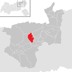
| map | |
The Kufstein district is a political district in the Austrian state of Tyrol .
General
In the north it borders on the Free State of Bavaria ( Miesbach , Rosenheim and Traunstein district ), on the southwest by the Schwaz district and in the southeast of the district Kitzbuehel .
The Kufstein district was in Bavarian hands for a long time before it came to Tyrol in 1506 with the Kitzbühel district (then the three courts of Kufstein, Rattenberg and Kitzbühel ) and thus later to Austria.
The district's predecessor was the Bavarian Regional Court of Kufstein between 1805 and 1814, which also included the present-day Bavarian communities of Kiefersfelden , Oberaudorf and parts of Flintsbach am Inn . When Kufstein was again added to Austria by the Ried Treaty , the Kufstein judicial district was established in 1849 . In the course of the separation of the political from the judicial administration, this was then merged from 1868 together with the judicial district of Rattenberg to form the political district of Kufstein.
Today it is the third most populous district in Tyrol and a rapidly growing district. Kufstein and Wörgl are among the largest cities in Tyrol, together with the neighboring communities of Ebbs, Kirchbichl, Langkampfen and Kundl, they form the center of the district in terms of economy and population.
The district with an area of 968.82 km² is part of the Euregio Inntal and the European region Tyrol – South Tyrol – Trentino .
traffic
The Inntal Autobahn A 12 and the Westbahn run through the district (from Wörgl main station with one branch via Zell am See and one branch via Kufstein to Salzburg). In Langkampfen there is a small airfield that is mainly used by glider pilots. The major airports of Innsbruck, Salzburg and Munich are each around 100 km away. From Kufstein to Niederndorf there was a tourist-oriented Inn shipping until 2011, due to a lack of passengers this was discontinued after 14 years of operation.
geography
The district mainly comprises the lowest part of the Tyrolean Lower Inn Valley up to the Bavarian border and the side valleys Alpbachtal , Brandenberger Tal , Wildschönau , Thierseetal , the Untere Schranne and parts of the Kufstein basin are already in the Alpine foothills .
In terms of mountains, he has a share in the Brandenberger Alps , the Kitzbühel Alps , the Kaiser Mountains and the Chiemgau Alps .
Important lakes are: Reintaler See , Thiersee , Hechtsee , Hintersteiner See and Walchsee .
From the town of Kufstein downwards, the valley floor is below 500 meters above sea level.
Economy and Infrastructure
The economy in the district is mainly characterized by the service sector, here trade and tourism are predominant. Important industrial locations are Kundl, Kufstein, Wörgl and Brixlegg. The largest production companies are in the pharmaceutical industry, manufacture of rubber and plastic goods and the construction industry.
The district has a relatively high proportion of out-commuters, especially to the neighboring districts and Innsbruck.
Administrative division
Communities
The Kufstein district is divided into 30 communities . These include three cities and two market towns . The population figures are as of January 1, 2020.
The largest municipality in the district in terms of area is the municipality of Brandenberg with 130.02 km² , while the municipality of Rattenberg has the smallest municipality area with 0.11 km² (it is also the smallest municipality in Austria). However, the population density is highest in Rattenberg and lowest in Brandenberg.
The city of Kufstein is the most populous municipality with 19,527 (January 1, 2020) inhabitants, Mariastein is the counterpart of Kufstein in terms of population with 448 (January 1, 2020) inhabitants.
Planning associations
The district is divided into six planning associations, three of which also include municipalities in the Kitzbühel district:
- Planning association 26 - Brixlegg and surroundings
- Planning Association 27 - Kufstein and the surrounding area
- Planning Association 28 - Untere Schranne - Kaiserwinkl
- Planning Association 29 - Wörgl and the surrounding area
- Planning Association 30 - Wilder Kaiser
- Planning association 37 - Brixental - Wildschönau
- Regions in the table are Tyrolean planning associations (as of March 2017)
| local community | location | Ew | km² | Ew / km² | Judicial district | region | Type
|
photo | Metadata |
|---|---|---|---|---|---|---|---|---|---|
Alpbach
|

|
2,533 | 58.35 | 43 | Rattenberg | 26 - Brixlegg and surroundings | local community
|

|
Acc. To code: 70501 |
Angath
|

|
1.006 | 3.49 | 288 | Kufstein | 29 - Wörgl and the surrounding area | local community
|

|
Acc. To code: 70502 |
Angerberg
|
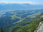
|
1,892 | 19.48 | 97 | Rattenberg | 29 - Wörgl and the surrounding area | local community
|
|
Acc. To code: 70528 |
Bad Haring
|

|
2,846 | 9.28 | 307 | Kufstein | 29 - Wörgl and the surrounding area | local community
|

|
Acc. To code: 70503 |
Brandenberg
|

|
1,526 | 130.02 | 12 | Rattenberg | 26 - Brixlegg and surroundings | local community
|

|
Acc. To code: 70504 |
Breitenbach am Inn
|

|
3,455 | 37.97 | 91 | Rattenberg | 29 - Wörgl and the surrounding area | local community
|

|
According to code: 70505 |
Brixlegg
|

|
3,012 | 9.12 | 330 | Rattenberg | 26 - Brixlegg and surroundings | market community
|
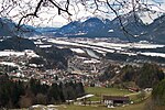
|
Acc. To code: 70506 |
Ebbs
|

|
5,645 | 39.98 | 141 | Kufstein | 28 - Lower Schranne – Kaiserwinkl | local community
|

|
According to code: 70508 |
Ellmau
|

|
2,848 | 36.32 | 78 | Kufstein | 30 - Wilder Kaiser | local community
|

|
Acc. To code: 70509 |
Erl
|

|
1,559 | 26.92 | 58 | Kufstein | 28 - Lower Schranne – Kaiserwinkl | local community
|

|
Acc. To code: 70510 |
Kirchbichl
|

|
5,858 | 14.93 | 392 | Kufstein | 29 - Wörgl and the surrounding area | local community
|
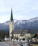
|
Acc. To code: 70511 |
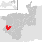
Kramsach
|
|
4,985 | 26.85 | 186 | Rattenberg | 26 - Brixlegg and surroundings | local community
|

|
Acc. To code: 70512 |
Kufstein
|

|
19,527 | 39.37 | 496 | Kufstein | 27 - Kufstein and surroundings | urban community
|

|
Acc. To code: 70513 |
Kundl
|

|
4,725 | 21.89 | 216 | Rattenberg | 29 - Wörgl and the surrounding area | market community
|

|
Acc. To code: 70514 |
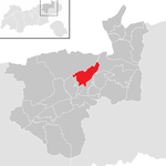
Langkampfen
|
|
4.179 | 26.47 | 158 | Kufstein | 27 - Kufstein and surroundings | local community
|

|
According to code: 70515 |
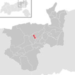
Mariastein
|
|
448 | 2.38 | 188 | Kufstein | 29 - Wörgl and the surrounding area | local community
|

|
Acc. To code: 70516 |
Muenster
|

|
3,398 | 27.73 | 123 | Rattenberg | 26 - Brixlegg and surroundings | local community
|

|
Acc. To code: 70517 |
Niederndorf
|

|
2,826 | 7.22 | 391 | Kufstein | 28 - Lower Schranne – Kaiserwinkl | local community
|

|
Acc. To code: 70518 |
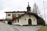
Niederndorferberg
|

|
721 | 12.13 | 59 | Kufstein | 28 - Lower Schranne – Kaiserwinkl | local community
|
|
Acc. To code: 70519 |
Radfeld
|

|
2,576 | 14.32 | 180 | Rattenberg | 26 - Brixlegg and surroundings | local community
|

|
Acc. To code: 70520 |
Rattenberg
|

|
442 | 0.11 | 4018 | Rattenberg | 26 - Brixlegg and surroundings | urban community
|

|
According to code: 70521 |
Reith im Alpbachtal
|

|
2,758 | 27.41 | 101 | Rattenberg | 26 - Brixlegg and surroundings | local community
|

|
Acc. To code: 70522 |
Rettenschöss
|

|
542 | 16.24 | 33 | Kufstein | 28 - Lower Schranne – Kaiserwinkl | local community
|

|
Acc. To code: 70523 |
Scheffau am Wilden Kaiser
|

|
1,475 | 31.45 | 47 | Kufstein | 30 - Wilder Kaiser | local community
|

|
Acc. To code: 70524 |
Schwoich
|

|
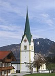
2,548 | 18.74 | 136 | Kufstein | 27 - Kufstein and surroundings | local community
|
|
According to code: 70525 |
Söll
|

|
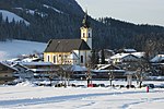
3,657 | 45.9 | 80 | Kufstein | 30 - Wilder Kaiser | local community
|
|
Acc. To code: 70526 |
Thiersee
|

|
3,033 | 108.56 | 28 | Kufstein | 27 - Kufstein and surroundings | local community
|

|
Acc. To code: 70527 |
Walchsee
|

|
1.936 | 39.22 | 49 | Kufstein | 28 - Lower Schranne – Kaiserwinkl | local community
|

|
According to code: 70529 |
Wildschönau
|

|
4,272 | 97.3 | 44 | 31 - Brixental – Wildschönau | Wildschönau high valley | local community
|

|
Acc. To code: 70530 |
Worgl
|

|
14,059 | 19.68 | 714 | Kufstein | 29 - Wörgl and the surrounding area | urban community
|

|
According to code: 70531 |
Population development

See also
Individual evidence
- ↑ Statistics of the Kingdom of Bavaria in relation to material civil laws with the exclusion of the Rhein-Kreis Born in 1828, Michael Jaeck
- ^ Reichs-Gesetz-Blatt for the Empire of Austria. Born in 1868, XVII. Piece, No. 44. "Act of May 19, 1868 on the establishment of political administrative authorities in the kingdoms ..."
- ^ Reichs-Gesetz-Blatt for the Empire of Austria. Born in 1868, XLI. Piece, No. 101: Ordinance of July 10, 1868
- ↑ The last trip of the St. Nikolaus auf dem Inn 2011 ( memento from February 16, 2012 in the Internet Archive ) on www.tirol-schiffahrt.at, accessed on September 22, 2017
- ↑ a b c Statistics Austria - Population at the beginning of 2002–2020 by municipalities (area status 01/01/2020)
- ↑ https://www.tirol.gv.at/fileadmin/themen/landesentwick/raumordnung/ueberoertl_ro/Planungsverbaende/Karte_Planungsverbaende080923.pdf
Coordinates: 47 ° 35 ' N , 12 ° 10' E


