
Kramsach
|
Kramsach
|
||
|---|---|---|
| coat of arms | Austria map | |
 |
|
|
| Basic data | ||
| Country: | Austria | |
| State : | Tyrol | |
| Political District : | Kufstein | |
| License plate : | KU | |
| Main town : | Voldopp | |
| Surface: | 26.85 km² | |
| Coordinates : | 47 ° 27 ' N , 11 ° 53' E | |
| Height : | 520 m above sea level A. | |
| Residents : | 4,985 (January 1, 2020) | |
| Postal code : | 6233 | |
| Area code : | 05337 | |
| Community code : | 7 05 12 | |
| NUTS region | AT335 | |
| UN / LOCODE | AT KRS | |
| Address of the municipal administration: |
Center 1 6233 Kramsach |
|
| Website: | ||
| politics | ||
| Mayor : | Bernhard Zisterer ( ÖVP ) | |
|
Municipal Council : (2016) (17 members) |
||
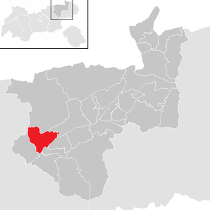
| Location of Kramsach in the Kufstein district | ||
  |
||
 View of Kramsach from the Vorderen Sonnwendjoch |
||
| Source: Municipal data from Statistics Austria | ||

Kramsach is a municipality with 4985 inhabitants (as of January 1, 2020) in the Kufstein district of the state of Tyrol in Austria .
Naming
In the writing, the name Kramsach was derived from the vernacular "Kranzach". "Kranzen" are the name given to the juniper bushes in Lower Inn Valley that grew in large quantities on the rubble heaps. The syllable "-ach" has nothing to do with the ache, but only indicates the large number of juniper bushes.
geography
Kramsach is located in the Tyrolean Lower Inn Valley on the north bank of the Inn and is spread across the alluvial cone of the Brandenberger Ache across from Rattenberg . The community is located in the judicial district of Rattenberg .
The Ganggalbichl district at the entrance to Kramsach is one of the oldest districts. Several different legends about its origins testify to the rich history of this district.
Community structure
|
structure
|
||||||
|
Legend for the breakdown table
|
The municipality includes the following two localities (population in brackets as of January 1, 2020):
- Mariatal (1541)
- Voldopp (3444)
Neighboring communities
- Brandenberg , Breitenbach am Inn , Brixlegg , Münster , Radfeld , Rattenberg and Reith im Alpbachtal in the Kufstein district
- Steinberg am Rofan in the Schwaz district.
history
The oldest part of Kramsach is the hamlet of Voldöpp, the name of which suggests a pre-Roman origin. In the Romanesque period the district of Mosen was built as a settlement. Voldöpp was first mentioned in a document in 1080, but a church had probably been in this district since the 8th century, which was probably a private church of a Bavarian nobleman. Kramsach himself is mentioned for the first time in a document from 1014-1024 in the tradition book of St. Peter Abbey in Salzburg as " Crasmaresaha ". Since the 13th century, the lords of Freundsberg were the most important landlords in this area, who also founded a Dominican convent in 1267.
In 1811 the two main teams that had previously existed, Voldöpp and Mariathal, were merged to form the municipality of Kramsach.
politics
In the 2004 municipal council elections, Manfred Stöger was elected a “black” (ÖVP) mayor after a long “red period” (SPÖ). A special feature was certainly that a youth list made it into the local council, Martin Rampel moved into the local council for the ZAK (Future Active Kramsach). The ZAK consists mainly of members of the JVP (Young People's Party) and is therefore to be assigned to the ÖVP. A black majority has been achieved for a long time.
- mayor
- 2004–2016 Manfred Stöger (ÖVP)
- since 2016 Bernhard Zisterer (ÖVP)
coat of arms
Blazon : a four-pole wooden rake in gold on a blue shield. Two silver waves in the base of the shield
Reason: Kramsach had the largest wood drift in Tyrol. The silver waves represent the Brandenberger Ache. The colors blue and gold are taken from the coat of arms of the Aschauer family, who founded the Achenrain brass works. Since the Tyrolean provincial government built the most modern sawmill in Tyrol in Kramsach in 1920 and thus the Holztrift was emphasized as economically important, the golden wooden rake symbolizes the Kramsacher loin.
Twin cities
-
 Azumino , since 1989 (originally Toyoshina, which was merged with three other municipalities to form the city of Azumino in 2005)
economy
The remnants of a prehistoric rockslide (white-pink marble ) from the Pletzachkogel have been mined in the hamlet of Hagau since the Middle Ages . The Kramsacher marble (or Tyrolean marble) was used in many churches and on the Anna column in Innsbruck.
The region's economic rise began in the 15th century: on the Pletzachkogel, red Kramsacher marble was quarried in many stonemasonry workshops. An important branch of the economy was fishing, which was mainly practiced on the Reintal lakes.
In 1412, Prince Duke Stephan of Bavaria granted “Fritz the blacksmith of Voldepp” the right to set up a rake in the Voldepp (Brandenberger Ache). At the beginning of the 16th century, a copper smelter was built by the Fuggers in the area of today's town center. At this point, Karl Aschauer founded the Achenrain brass works in 1648/49, which was the oldest and most important industrial company in Kramsach until the Second World War.
There was also a glassworks from 1627, which manufactured high-quality products until 1934 and has existed as a glass technical school since then.
Due to these industrial settlements in Kramsach and Brixlegg (on the other side of the Inn), a lot of firewood was needed for the operation of the stoves, which was carried through the Brandenberger Ache. For this reason, a wooden rake was built in Kramsach, which for centuries was the goal of drifting tree trunks for ore smelting.
In addition, in 1685 a powder mill for the production of gunpowder went into operation, which in 1949 became the "Austrian Hunting Cartridge Factory".
In addition to tourism, wood processing, glass processing companies, a clothing factory and transport companies are economically important.
On April 11, 2008 the crematorium in Kramsach was opened as the second Tyrolean crematorium .
tourism
Tourism is bi-seasonal with a focus on summer tourism. The Krummsee and the Reintaler See are popular bathing lakes, another bathing opportunity is offered by the remote Berglsteiner See , which is already located in the Breitenbach municipal area. In the Kramsacher municipality there are also Buchsee and Frauensee .
The Roßkogel- Sonnwendjoch ski area is located in Kramsach , but has only been in operation to a very limited extent in recent years due to the new construction of the lifts being discussed. In the meantime, the existing lifts have been taken over by the Alpbacher Bergbahnen , but only the practice lifts in the valley are currently in operation (winter season 2012/13).
A popular tourist destination is also the sculpture park on the Brandenberger Ache, which was created by the Kramsach artist Alois Schild.
traffic
The junction "Kramsach" connects the place and its neighboring communities with the Inntal Autobahn A 12, which leads in the west via Innsbruck into the Tyrolean Oberinntal, and in an easterly direction via Kufstein (from here A 93 ) to the Autobahn triangle Rosenheim .
The Unterinntalbahn offers a S-Bahn connection via the Rattenberg-Kramsach stop and the Brixlegg station .
Furthermore, there is local traffic with the Postbus line 4115 that runs daily between Kramsach and Brixlegg
Culture and sights


Kramsach has two parish churches:
- to the west the basilica and pilgrimage church Mariathal in the district of Mariatal at the end of the Tiefenbachklamm . The church in Mariathal is considered to be one of the most closed baroque ensembles and was elevated to a basilica in 2009.
- in the east the parish church of St. Nikolaus in Voldöpp at the confluence of the Brandenberger Ache in the Inn.
- There is also the “Hilaribergl” monastery and a small church next to the Ache in the Weidach district, which has been converted into a Kramsach war memorial.
- The Museum of Tyrolean Farms in the eastern district of Moosen was founded in 1974 by folklorists and, as an open-air museum, shows various farm forms as they are common in Tyrol, as well as old breeds of livestock and traditional food production. The courtyards are arranged in a way that corresponds to their approximate geographical location in Tyrol.
- The museum cemetery in Hagau shows forged grave crosses with bizarre grave inscriptions from various cemeteries in the Alpine region.
- The Tiefenbachklamm and the Kaiserklamm are popular for hiking and both are sights that go back to the Holztrift.
Personalities
- Sons and daughters of the church
- Karl Thurwieser (1789–1865), meteorologist, alpinist and theologian
- Rainer Salzburger (* 1944), boxer
- People related to the community
- Heinz AE Mantl (1921–1989), initiator of the Museum of Tyrolean Farms
- Thomas Rohrgger (* 1982), professional cyclist, lives here
- Taxis-Bordogna-Valnigra , representatives of this family live in the village
Web links
- Official website of the municipal administration
- Kramsach , in the history database ofthe association "fontes historiae - sources of history"
- Archive recordings from and about Kramsach in the online archive of the Austrian Media Library (radio reports , interviews, folklore film document)
Individual evidence
- ↑ Location and origin, coat of arms on the Kramsach municipal website; Retrieved November 22, 2013
- ↑ Statistics Austria: Population on January 1st, 2020 by locality (area status on January 1st, 2020) , ( CSV )
- ↑ Martin Bitschnau , Hannes Obermair : Tiroler Urkundenbuch, II. Department: The documents on the history of the Inn, Eisack and Pustertal valleys. Vol. 1: Up to the year 1140 . Universitätsverlag Wagner, Innsbruck 2009, ISBN 978-3-7030-0469-8 , p. 157, no. 187 .
- ^ Austrian-Japanese relations. Japanese Embassy Austria, accessed June 13, 2013 .
- ↑ Press text: TrauerHilfe.at opens Tyrol's first private crematorium ; Retrieved December 16, 2011.
- ↑ The pilgrimage church is elevated to a basilica http://tirol.orf.at/stories/371445/ ( Memento from July 15, 2012 in the web archive archive.today ) on ORF -Tirol from June 28, 2009; Retrieved June 28, 2009
Alpbach | Angath | Angerberg | Bad Haring | Brandenberg | Breitenbach am Inn | Brixlegg | Ebbs | Ellmau | Erl | Kirchbichl | Kramsach | Kufstein | Kundl | Langkampfen | Mariastein | Munster | Niederndorf | Niederndorferberg | Radfeld | Rattenberg | Reith im Alpbachtal | Rettenschöss | Scheffau am Wilden Kaiser | Schwoich | Söll | Thiersee | Walchsee | Wildschönau | Worgl