
Angerberg
|
Angerberg
|
||
|---|---|---|
| coat of arms | Austria map | |
 |
|
|
| Basic data | ||
| Country: | Austria | |
| State : | Tyrol | |
| Political District : | Kufstein | |
| License plate : | KU | |
| Surface: | 19.48 km² | |
| Coordinates : | 47 ° 30 ' N , 12 ° 2' E | |
| Height : | 650 m above sea level A. | |
| Residents : | 1,892 (January 1, 2020) | |
| Postal code : | 6320 | |
| Area code : | 05332 | |
| Community code : | 7 05 28 | |
| NUTS region | AT335 | |
| UN / LOCODE | AT ERG | |
| Address of the municipal administration: |
Linden 5 6320 Angerberg |
|
| Website: | ||
| politics | ||
| Mayor : | Walter Osl (ABL) | |
|
Municipal Council : (2016) (13 members) |
||
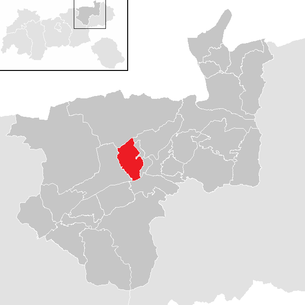
| Location of Angerberg in the Kufstein district | ||
  |
||
 View of the municipal area of Angerberg and Mariastein |
||
| Source: Municipal data from Statistics Austria | ||

Angerberg is a municipality with 1892 inhabitants (as of January 1, 2020) in the Kufstein district in Austria . The community is located in the judicial district of Rattenberg .
geography
The municipality of Angerberg is located above the traffic junction Wörgl on the 18 km long “low mountain range” that runs between the Brandenberger Ache and Niederbreitenbach . In the north of Angerberg is the mountain range of the Brandenberg Alps with the Hundsalmjoch ( 1637 m ) as the highest elevation.
Community structure
|
structure
|
||||||
|
Legend for the breakdown table
|
The municipality includes the following three localities (population in brackets as of January 1, 2020):
- Achleit (407)
- Angerberg (1228)
- Embach (257)
Neighboring communities
| Breitenbach am Inn | Thiersee | Langkampfen |
| Breitenbach am Inn |
.svg)
|
Mariastein Angath |
| Breitenbach am Inn | Worgl | Worgl |
geology
The municipality of Angerberg covers a large part of the plateau north of the Inn and the southern part of the Limestone Alps with the Buchacker to Hundalm area. The Angerberg plateau essentially consists of Quaternary gravel, sands and silts , which lie on a base of tertiary rocks. The latter include the "Unterangerberg layers", for which the municipality of Angerberg is the type locality . These are sandstones and marls that were deposited in the Upper Oligocene .
One attraction of the community is the Hundalm ice and stalactite cave .
The landscape of Angerberg is characterized by the frequent change from forest to open landscape. Numerous individual farmsteads, hamlets and settlements are scattered across these areas. Agricultural use takes place on the cleared areas within the forest areas.
Land use

Natural and cultural spatial structure

The community of Angerberg can be divided into the following landscape units:
- Embach
This northern edge of the municipal area is characterized by a gently reliefed ridge of the terrain. The ridge of the “Innerberge” and “Schrecken” (horror) ridge borders on these in the north. In the south there is the heavily wetted valley floor of the Mossbach valley and a wooded ridge up to "Angerberg-Mitte". The "Embach" area is completely shielded from the intensively used Inn Valley by the upstream low mountain range. The Bavarian settlement typical for Angerberg (central courtyard in the middle of cleared area) is missing here. Essential elements of the landscape are the streams (Moosbach, Wiesbach) running from north to south, most of which are still lined with typical accompanying vegetation.
- Angerberg-Mitte
The strong relief, wide ridge of the terrain, which extends from west to east over a length of about four kilometers, characterizes this area. The Bavarian settlement form is predominant here and therefore a constant change between wooded area and open meadow areas. Most of the farms are centrally located in the cleared agricultural areas. The central settlement area is on the eastern edge of the community center and includes the districts of Linden, Baumgarten and Unholzen. Linden can be regarded as the center of the village due to its numerous facilities (municipal office, elementary school, adult school, music school, kindergarten, library, bank branch, grocery store, recycling yard and chapel).
- Achleit
The Achleit ridge reaching into the Inn valley forms the third landscape area. Just like the Angerberg-Mitte area, the alternation between forest and meadow areas and the typical form of settlement characterize the area.
climate
The municipality is in the area of influence of the northern impoundment of the Alps. This requires rainfall of around 1150 mm per year, which is significantly higher than that of the inner alpine dry valleys. Most rainy days, but also the most hours of sunshine during the day, are recorded in Angerberg and the surrounding communities in the months from April to September. Maximum values: 19 rainy days in June and July, 7 hours of sunshine in July.
| Angerberg | ||||||||||||||||||||||||||||||||||||||||||||||||
|---|---|---|---|---|---|---|---|---|---|---|---|---|---|---|---|---|---|---|---|---|---|---|---|---|---|---|---|---|---|---|---|---|---|---|---|---|---|---|---|---|---|---|---|---|---|---|---|---|
| Climate diagram | ||||||||||||||||||||||||||||||||||||||||||||||||
| ||||||||||||||||||||||||||||||||||||||||||||||||
|
Average monthly temperatures for Angerberg
Source: Klima.org
|
|||||||||||||||||||||||||||||||||||||||||||||||||||||||||||||||||||||||||||||||||||||||||||||||||||||||||
history

Investigations on pollen grains, which were obtained from bog deposits of the linden moss, have shown that human presence in the area of the Angerberg has been proven through clearing activity at least since the early Bronze Age.
In ancient times, the Roman road led across the Angerberg . In the 8th century the lower Inn valley and thus probably also the Angerberg were settled. The forms of clearing, which are similar to those in the Munich forest, indicate a Bavarian settlement.
Mention of individual farms can only be found in the 12th century. Due to the weather-related situation, a comparatively good economic situation can be assumed. The Salbuch of the Rattenberg judge from the year 1416 lists 21 farms in today's municipality.
Today Angerberg is a rural, popular residential community. Of the 590 buildings in the parish, 96% are residential; 88% of the workforce from Angerberg are out-commuters.
Origin of name
Angerberg originally consisted of widely scattered hamlets and individual farms. Angerberg was first mentioned in a document in 1190 when it was donated to Baumburg Abbey as Anægahterberch . When this donation was confirmed by Pope Celestine III. 1195 the spelling is Anegaterperge . There is no doubt that the name Angerberg derives from the neighboring municipality of Angath. In the Middle Ages, the main Tyrolean road led over the Angerberg, from which the hamlet name "Straß" can be traced back.
The name Angerberg has existed for the current political municipality since December 18, 1981. Up to this point in time the municipality was called Unterangerberg .
Angerberg has had its own postcode with "6320" since 2008. Before that, the municipality was part of the postcode area "6300" (Wörgl).
Population development
The population of the municipality has been increasing continuously since the 1960s:

religion
At 94.2%, the majority of the population of Angerberg in the 2001 census committed to the Roman Catholic Church. Around 2% were Protestant and 2.5% were non-denominational. The community does not have its own parish church and, together with Mariastein, is part of the Angath-Angerberg-Mariastein parish. Holy masses are celebrated on Saturdays in the school house chapel in the village center.
Culture and sights

- The municipality of Angerberg has a large number of chapels.
| Surname | Built | Renovated | Location | Others |
|---|---|---|---|---|
| Stone chapel | 1751 | 1987 | Embach | Angerberg's oldest chapel, built on a boulder |
| Village chapel | 1773 | 1983 | Village | Built due to seven bad harvest years ; artistically most important chapel in Angerberg; listed property |
| Peace Chapel | 1926 | 2008 | Crossroads between Endstrasse and Pfaring | Burned down in 2007, rebuilt in 2008 |
| Schoolhouse chapel | 1929 | 1980 | Old school house in Linden | Consecrated to the "Holy Family" by Archbishop Karl Berg in 1980 ; Commemorative plaque of 36 fallen and 9 missing Angerbergers in World War II; listed property |
| Baumgarten Chapel | - | 2002 | Gasthof Baumgarten | Large, one-bay baroque chapel |
| Gatterer Chapel | 1931 | 1974 | Embach | The builder was shot in the lung during the war and vowed to build a chapel if he came home alive. |
| Brudersdorfer Chapel | 1933 | 1995 | Edge of the forest at Brudersdorfer Hof | high artistic importance; Relocated to the edge of the forest in 1995 |
| Wartlstein Chapel | 1935 | - | Embach | Built due to the dilapidation of the previous chapel |
| Schönsöller Chapel | 1950 | - | Achleit between Schönsöll and Ried | Erected as a thank you for an unexploded bomb |
politics

| Surname | Term of office | court |
|---|---|---|
| Josef Ellinger | until 1896 | Jaggl-Hof |
| Sebastian Steiner | 1896-1899 | Unterleming-Hof |
| Johann Felderer | 1899-1901 | Kleinlinden-Hof |
| Josef Haidacher | 1901-1905 | Brudersdorf ancestral farm |
| Sebastian Peer | 1905-1911 | Melcham farm |
| Josef Osl | 1911-1919 | Pfaring-Hof |
| Josef Haidacher | 1919-1928 | Brudersdorf ancestral farm |
| Josef Peer | 1929-1938 | Endstrass ancestral farm |
| Josef Bramböck | 1938-1945 | Ehrenstrasse Hof |
| Johann Osl | 1945–1962 | Linden yard |
| Josef Haidacher | 1962-1983 | Brudersdorf ancestral farm |
| Surname | Term of office | Political party |
|---|---|---|
| Walter Ertl | 1983-1998 | ? |
| Hubert Osl | 1998-2004 | Angerberger unit list |
| Walter Osl | since 2004 | Angerberg Citizens List (ÖVP) |
- Municipal council
The Angerberg municipal council consists of 13 councilors (including the mayor) and was last elected on February 28, 2016 as part of the Tyrolean municipal council election.
| Lists | 2016 |
|---|---|
| Angerberger Bürgerliste - OJ | 7th |
| Angerberger Future - AZ | 5 |
| Freedom Party Angerberg - FPA | 1 |
Up until the municipal council election in 1998, Angerberg was noticeable for its high political diversity of five lists and two parties . In a municipality with 1661 inhabitants (as of 1997) this represents a major political peculiarity, especially since political monocausality prevailed in many villages in the state of Tyrol .
In 2004 the number of political groups fell to four lists. The second strongest list up until 2004, the Angerberger Unity List, did not appear in the elections in the same year.
The loss of pluralism in the Angerberg municipal council intensified in the municipal council election in March 2010. Only two of the seven lists from 1998 ran for this election. Both the Angerberger Bürgerliste and the Angerberger Zukunft list are close to the ÖVP . Furthermore, as the number of parties and lists rose, so did the number of candidates for the mayor's office, which is extremely important at the local level. While there were still four candidates to choose from in 1998, there were only two in 2004. In 2010 there was only one candidate, the incumbent.
| Parties and lists | 2016 | 2010 | 2004 | 1998 |
|---|---|---|---|---|
| Angerberger citizen list | 52.56 | 68.7 | 35.8 | 21.7 |
| Angerberg future | 34.80 | 31.3 | 22.5 | 17.8 |
| Party-independent citizen list Liveable Angerberg | nk | nk | 22.3 | 15.7 |
| Alternative list Angerberg | nk | nk | 19.5 | 6.3 |
| Angerberger unit list | nk | nk | nk | 19.8 |
| Freedom and party-free list Angerberg / Freedom Party Angerberg - FPA | 12.65 | nk | nk | 9.8 |
| We Angerberger workers and settlers | nk | nk | nk | 8.9 |
coat of arms
The municipal coat of arms was awarded on July 6, 1972 and symbolizes the name of the municipality. It is reminiscent of the wealthy Frauenchiemsee monastery in Angerberg , whose coat of arms was the heraldic lily pad styled as a shamrock.
Blazon : Three silver shamrocks rising from bottom right to top left on a green background.
Web links
- 70528 - Angerberg. Community data, Statistics Austria .
- Homepage of the municipality of Angerberg
- Angerberg , in the history database ofthe association "fontes historiae - sources of history"
Individual evidence
- ↑ Statistics Austria: Population on January 1st, 2020 by locality (area status on January 1st, 2020) , ( CSV )
- ↑ Naturraum / Landschaft / Umwelt von Angerberg - WCC inventory ( page no longer available , search in web archives ) Info: The link was automatically marked as defective. Please check the link according to the instructions and then remove this notice.
- ↑ angerberg.at ( page no longer available , search in web archives ) Info: The link was automatically marked as defective. Please check the link according to the instructions and then remove this notice.
- ↑ klima.org Klima.org - Climate of Angerberg in Austria
- ^ Bortenschlager, S. (1984): Contributions to the vegetation history of Tyrol I: Inneres Ötztal and lower Inntal. Reports of the naturwiss.-med. Innsbruck Association, 71, pp. 19–56.
- ↑ Sample census 2006: Building and Apartment Census - Statistics Austria (PDF; 8 kB)
- ↑ Coordinated employment statistics 2009 - commuters by commuting target - Statistics Austria (PDF; 8 kB)
- ↑ Martin Bitschnau , Hannes Obermair : Tiroler Urkundenbuch, II. Department: The documents on the history of the Inn, Eisack and Pustertal valleys. Vol. 2: 1140-1200 . Universitätsverlag Wagner, Innsbruck 2012, ISBN 978-3-7030-0485-8 , p. 362-363, no. 890 .
- ↑ Martin Bitschnau, Hannes Obermair: Tiroler Urkundenbuch, II. Department: The documents on the history of the Inn, Eisack and Pustertal valleys. Vol. 2: 1140-1200 . Universitätsverlag Wagner, Innsbruck 2012, ISBN 978-3-7030-0485-8 , p. 387-388, No. 644 .
- ↑ Angerberger Dorfbüchl
- ^ Election result of the 2016 municipal council election in Angerberg. State of Tyrol, February 28, 2016, accessed on January 5, 2019 .
- ^ Election result of the municipal council election 2010 in Angerberg. State of Tyrol, March 14, 2010, accessed on January 5, 2019 .
- ^ Result of the 2004 municipal council election in Angerberg. State of Tyrol, March 7, 2004, accessed on January 5, 2019 .
- ^ Election result of the 1998 municipal council election in Angerberg. State of Tyrol, March 15, 1998, accessed on January 5, 2019 .
Alpbach | Angath | Angerberg | Bad Haring | Brandenberg | Breitenbach am Inn | Brixlegg | Ebbs | Ellmau | Erl | Kirchbichl | Kramsach | Kufstein | Kundl | Langkampfen | Mariastein | Munster | Niederndorf | Niederndorferberg | Radfeld | Rattenberg | Reith im Alpbachtal | Rettenschöss | Scheffau am Wilden Kaiser | Schwoich | Söll | Thiersee | Walchsee | Wildschönau | Worgl