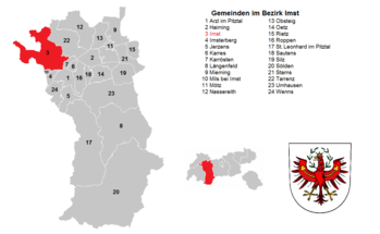
List of municipalities in the Imst district
This list of municipalities in the Imst district includes all political municipalities in the Tyrolean Imst district . The Imst district consists of a total of 24 municipalities in which 60,474 people (all population figures as of January 1, 2020) have their main residence. In relation to the area of the district with 1,723.82 square kilometers , this results in a population density of around 35 inhabitants per square kilometer.
Of the 24 municipalities in the district, only the district capital Imst has city rights. There are no market communities.
Municipalities in the Imst district
The commune names given are the official names of the communes used by the communes, as determined by state law.
Both the population figures (EWZ) and the population density calculated from them (inhabitants / km²) refer to data from Statistics Austria as of January 1st, 2020. In each case, these are exclusively registered main residences . The figures for the municipal areas were also taken from the statistics of Austria; the Federal Office for Metrology and Surveying (BEV) served as the source for the cadastral municipalities .
| Parish name | coat of arms | height | EWZ | surface | EW / km² | Cadastral communities | image |
|---|---|---|---|---|---|---|---|
| Arzl in the Pitztal |

|
880 m | 3.164 | 29.36 km² | 108 | Arzl im Pitztal, Blons, Hochasten, Leins, Ried, Timmls, Wald |

|
| Haiming |

|
670 m | 4,757 | 40.18 km² | 118 | Brunau, Haiming, Haimingerberg, Ochsengarten, Ötztal-Bahnhof, Schlierenzau | |
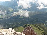
| Imst |

|
827 m | 10,765 | 113.34 km² | 95 | Imst |
|
| Imsterberg |

|
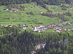
879 m | 801 | 10.81 km² | 74 | Imsterberg |
|
| Jerzens |

|
1,107 m | 947 | 30.39 km² | 31 | Jerzens | |
| Carts |

|
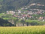
830 m | 620 | 7.5 km² | 83 | Carts |
|
| Roasting |

|
918 m | 676 | 7.9 km² | 86 | Roasting | |
| Längenfeld |

|
1,180 m | 4,742 | 195.61 km² | 24 | Längenfeld | |
| Mieming |

|
864 m | 3,790 | 50.34 km² | 75 | Barwies, Obermieming, See, Untermieming |

|
| Mils at Imst |

|
743 m | 608 | 3.48 km² | 175 | Mils at Imst |

|
| Mötz |

|
654 m | 1,250 | 5.84 km² | 214 | Mötz |
|
| Nassereith |

|
838 m | 2.149 | 72.39 km² | 30th | Nassereith |

|
| Obsteig |

|
991 m | 1,381 | 34.62 km² | 40 | Obsteig |

|
| Oetz |

|
812 m | 2,392 | 29.17 km² | 82 | Oetz |

|
| Rietz |

|
665 m | 2,367 | 19.55 km² | 121 | Rietz | |
| Ropes |

|
724 m | 1,818 | 30.83 km² | 59 | Ropes | |
| St. Leonhard in the Pitztal |

|
1,366 m | 1,384 | 223.44 km² | 6th | Plangeross, Sankt Leonhard im Pitztal, Zaunhof |

|
| Sautens |

|
812 m | 1,623 | 11.6 km² | 140 | Sautens |

|
| Silz |

|
654 m | 2,563 | 65.62 km² | 39 | Kühtai, Silz | |
| Soelden |

|
1368 m | 3,041 | 466.78 km² | 7th | Gurgl, Heiligkreuz, Sölden, Vent, Zwieselstein |

|
| Stams |

|
672 m | 1,547 | 33.55 km² | 46 | Stams |

|
| Tarrenz |

|
836 m | 2,736 | 74.59 km² | 37 | Dollinger, Obtarrenz, Strad, Tarrenz, Walchenbach |

|
| Umhausen |

|
1,031 m | 3,314 | 137.31 km² | 24 | Farst, Köfels, Niederthai, Östen, Tumpen, Umhausen |

|
| If it |

|
982 m | 2,039 | 29.63 km² | 69 | If it |
See also
Individual evidence
- ↑ a b Statistics Austria - Population at the beginning of 2002–2020 by municipalities (territorial status 01/01/2020) - Status 01 January 2020
- ↑ Tyrolean Municipal Code 2001 - TGO
- ↑ a b Statistics Austria , resident population and number of citizens of the individual communities
- ↑ Calculation based on the number of inhabitants
