Hoddesdon
| Hoddesdon | ||
|---|---|---|
|
|
||
| Basic data | ||
| status | City | |
| Longitude | −0.015 | |
| Latitude | 51,759 | |
| region | East of England | |
| Administration County | Broxbourne | |
| Administrative headquarters | Hertfordshire | |
| surface | km² | |
| population | 19,833 (2004, approx.) | |
| ONS code | ||
| prefix | 01992 TL | |
| Car sign | TL365085 | |
| Post Code | EN11 | |
| Website | http://www.hoddesdon-herts.co.uk | |
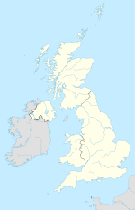
Hoddesdon is a commuter town in the English county of Hertfordshire , in the middle of the Lea Valley . The city grew rapidly as it was a post office on the route between Cambridge and London . The height of postal traffic was reached in the 18th century when more than 35 stagecoaches passed through the city every day.
The city experienced a boom in the middle of the 20th century due to the mining of gravel deposits that were exhausted in the 1970s. The resulting lakes and gravel pits were used for public recreational opportunities in Lee Valley County Park . Today Hoddesdon is a light industrial city, but mainly a residence for commuters to London. Since 1951 the city has also been the seat of the eighth Congress of International Modern Architecture.
history
Hoddesdon is a day's march from London, so to speak, and was a gathering place for armies and other travelers on their way north to Cambridge or any other north city. Where the autobahn runs today, inns and inns once lined the way.
Brewing was an important industry in this region, especially in the neighboring towns of Hertford and Ware . There was brisk trade every Tuesday at the hop market. Later, more and more hops were transported on the Lea River and the meat market on Wednesday took over. The Wednesday market lasted in Hoddesdon until the present and was merged with the Friday market at the end of the 20th century.
Since 1866 Hoddesdon has been divided into the two boroughs of Broxbourne and Great Amwell. The border between the two communities runs through a city gate on the city's main street. When the city gate was demolished in the 1960s, a special stone with inscriptions was built into the pavement to mark the historical border. Parts of Hoddesdon were assigned to the city by decree of the provincial government in 1894 and the remainder as parish to the urban area of Horresdon.
In 1937, a provincial government decree of 1929 enlarged the urban area by amalgamating all of the lands and parts of the parish of Broxbourne, Great Amwell, Stanstead Abbots and Wormley. The western border of the new urban area was marked by "Ermine Street" , which was a former Roman road. Hoddesdon was incorporated by Broxbourne in 1974 by order of the provincial government.
City center
The main street of Hoddesdon, most of which is pedestrianized, has many shops, fast food outlets, pubs, real estate agents, banks and a bookstore. The “Turmzentrum” business center , which is known for its frequent business changes, can be found on the northern main street behind the clock tower . It is generally expected that the center will be revitalized when the “Wilkonsons” group opens a new store there in 2008 as planned. Fawkon West is a lively business area in the west of the pedestrian zone, which has been affected by declining consumption since 2000, but which is to be compensated for by new shops. A passage now connects it with the new Aldi store. Sainsbury's , which was formerly in "Fawkon Walk" , is located in the east of the main street. Other shops in the city center of note are Argos, Woolworths , Boots, two Lloyds pharmacies, Tesco and Ladbrokes. A branch of the Cafè Nero chain opened in summer 2006.
Shops in Hoddesdon suffer from competition from the nearby Brookfield Center in Cheshunt and the shopping parks in Harlow . Since 1990, a number of independent traders have withdrawn from the city and been replaced by chains. The city is attractive for shoppers to relax after shopping in restaurants such as Marcanatos or La Piazza, cafes and fast food outlets such as “Starburger” or “Flames” .
schools
With the John Warner School and the Sheredes School there are two secondary schools in Hoddesdon, each of which is a communal school and a comprehensive school for students aged 11 to 18. The John Warner School focuses more on the natural sciences, the Sheredes School more on the creative arts.
Personalities born here
- William Christie Gosse (1842–1881), British-Australian naturalist and explorer
- Benjamin Samuel Williams (1824–1890), English commercial gardener
Web links
Coordinates: 51 ° 46 ′ N , 0 ° 1 ′ W

