Hoverla (village)
| Hoverla | ||
| Говерла | ||

|
|
|
| Basic data | ||
|---|---|---|
| Oblast : | Zakarpattia Oblast | |
| Rajon : | Rakhiv Raion | |
| Height : | 690 m | |
| Area : | 0.8 km² | |
| Residents : | 380 (2006) | |
| Population density : | 475 inhabitants per km² | |
| Postcodes : | 90647 | |
| Area code : | +380 3132 | |
| Geographic location : | 48 ° 5 ' N , 24 ° 27' E | |
| KOATUU : | 2123685002 | |
| Administrative structure : | 1 village | |
| Address: | 90647 с. Луги 436 | |
| Statistical information | ||
|
|
||
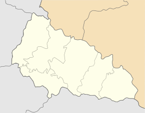
Howerla ( Ukrainian Говерла ; Russian Говерла Goverla , Slovak Hoverla ) is a village in the " Black Mountains " in the southeastern Ukrainian Zakarpattia Oblast with 380 inhabitants (2006).
The village, which only officially emerged in 1947, was until then a district of Luhy, but was given the name Hoverla (after the river in the valley) in the 19th century. It is located at an altitude of 690 m in the valley of the White Tisza at the foot of the Hoverla , the highest mountain in Ukraine. In the village of 12 km empties Howerla -Bach to the White Tisza.
Administratively, the village belongs to the district council of the neighboring village of Luhy ( Луги ⊙ ) in Rakhiv district . The Rajon center of Rakhiv is 25 km to the west and the Uzhhorod oblast center is 236 km to the northwest of Hoverla.
Individual evidence
- ↑ Hoverla on the official website of the Verkhovna Rada , accessed on January 12, 2015

