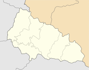
Rakhiv
| Rakhiv | ||
| Рахів | ||

|
|
|
| Basic data | ||
|---|---|---|
| Oblast : | Zakarpattia Oblast | |
| Rajon : | Rakhiv Raion | |
| Height : | 430 m | |
| Area : | 52.42 km² | |
| Residents : | 15,621 (2019) | |
| Population density : | 298 inhabitants per km² | |
| Postcodes : | 90600 | |
| Area code : | +380 3132 | |
| Geographic location : | 48 ° 3 ' N , 24 ° 12' E | |
| KOATUU : | 2123682501 | |
| Administrative structure : | 1 city | |
| Mayor : | Jaroslaw Dumyn | |
| Address: | вул. Миру 34 90 600 м. Рахів |
|
| Website : | http://www.rakhiv.com/ | |
| Statistical information | ||
|
|
||
Rachiw ( Ukrainian Рахів ; Russian Рахово Rachowo ; Russian Рахов Rachow ; German rarely Rauhau ; Hungarian Rahó ; Romanian Rahău ; Slovak Rachov ; Yiddish Rachew, Rachyw; Polish Rachów ) is a city in the east of the Ukrainian Oblast Zakarpattia near the border with Romania with around 15,500 inhabitants (as of 2019). In many publications and maps, in addition to the transliteration Rachiv , the English transcription Rakhiv is occasionally found .
Rakhiv is the administrative center of the raion of the same name . The city on the banks of the Tisza is embedded in the ridges of the Forest Carpathians . Nearby, the highest mountain in this mountain range and the Ukraine, the Hoverla , rises to 2061 m . Rakhiv itself lies at an altitude of 430 m and is the seat of the administration of the Carpathian Biosphere Reserve , which encloses the world's largest wild beech forest areas. The primeval beech forests in the Carpathian Mountains have been registered with UNESCO as a World Heritage Site since July 2007 .
history
There are several theses about the origin of the place name Rakhiv, in which either the verb “calculate” (Ukrainian rachuwaty ) is taken into account - this is how traders are said to have carried out their accounts here - or the name Rach is assumed to be the owner of an early farm.
Rakhiv, originally settled by Hutsuls from Galicia , was first mentioned in 1447 as a village within the Kingdom of Hungary . From around 1800 to 1820, state woodworkers from German-speaking settlement areas settled north of the actual city in what is now Slovakia at the invitation of the Hungarian government . Since most of the colonists came from the Spiš , they named their settlement Zipserei .
Since 1867 it belonged to Austria-Hungary . In the post-war turmoil of World War I , Rakhiv initially joined the Hungarian Soviet Republic , was then briefly occupied by Romania and finally, like the rest of Transcarpathia , annexed to the newly formed Czechoslovakia . During this time, the mountainous region around Rakhiv experienced a heyday of tourism, and the place was occasionally referred to as "Hutsul Paris". This phase ended when Hungary first annexed the southwestern parts of Transcarpathia as a result of the first Vienna arbitration in 1938 and the remaining part of the region in the Slovak-Hungarian War in 1939. As part of its advance westward, the Red Army took the region in 1944 , and in 1945 all of Transcarpathia became part of the Ukrainian Soviet Republic within the Soviet Union . On May 30, 1947, the village was given the status of an urban-type settlement , and in 1958 it was granted city rights. Since the collapse of the Soviet Union in 1991, Rakhiv has been part of independent Ukraine.
Economy and Transport
A border crossing for rail traffic to Sighetu Marmației in Romania is located near Rakhiv on the Sighetu Marmației – Ivano-Frankivsk railway line . In the city is u. a. a factory in the furniture industry. Mineral water is also produced in the city . Rakhiv is known as the "gateway to the Carpathian Mountains " and is increasingly drawing income from tourism. There are restaurants and several hotels of various categories. The Drahobrat winter sports area is nearby .
particularities
With the construction of the Sighetu Marmației – Ivano-Frankivsk railway from 1885 to 1887, the region was connected to the Austro-Hungarian railway network. During surveying work during construction, the engineers discovered that they had measured the geographical center of Europe . After a thorough examination, Viennese scientists confirmed this thesis and therefore a 2 m high geodetic monument made of concrete was erected in Dilowe in 1887 , the original of which has been preserved to this day. The stele is provided with a plaque with a Latin inscription:
- Locus Perennis Dilicentissime cum libella librationis quae est in Austria et Hungaria confectacum mensura gradum meridionalium et paralleloumierum Europeum. MD CCC LXXXVII.
The monument survived the two world wars and the Soviet system in its original form to the present day. Since the geodetic mark looked very modest, however, a modern, 7.20 meter high stele has been standing next to it since May 27, 1977, the parallel lines of which symbolize the four sides of the world. A sphere that symbolizes the planet earth is at a height of 6.60 meters. In addition to its symbolic value, the sphere also has a stabilizing effect on the divided stele.
literature
- Judith Schneiderman, Jennifer Schneiderman: I sang for my life. Memories of Rachov, Auschwitz and the new beginning in America. 2013, ISBN 978-3-942240-08-6 . (Autobiography)
Web links
Individual evidence
- ↑ Cities and Settlements of Ukraine on pop-stat.mashke.org ; accessed on February 28, 2020
- ↑ Geographical center of Europe in Zakarpattia ( Ukrainian Географічний центр Європи на Закарпатті )


