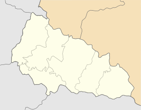
Batyovo
| Batyovo | ||
| Батьово | ||

|
|
|
| Basic data | ||
|---|---|---|
| Oblast : | Zakarpattia Oblast | |
| Rajon : | Berehove district | |
| Height : | 106 m | |
| Area : | Information is missing | |
| Residents : | 3,023 (December 2004) | |
| Postcodes : | 90212 | |
| Area code : | +380 3141 | |
| Geographic location : | 48 ° 22 ' N , 22 ° 24' E | |
| KOATUU : | 2120455400 | |
| Administrative structure : | 1 urban-type settlement | |
| Mayor : | Ferenz Berehsassi | |
| Address: | вул. Кошута 128 90212 смт. Батьово |
|
| Statistical information | ||
|
|
||
Batjowo (Ukrainian Батьово ; Russian Батёво , Slovak Baťu, Baťovo , Hungarian Bátyú ) is an urban-type settlement in western Ukraine about 24 kilometers southwest of the city of Mukachevo .
The place with about 3000 inhabitants is located in the Transcarpathian lowlands north of the river Serne (Серне). In Batjowo there is a border checkpoint on the railway line on the nearby border between Ukraine and Hungary .
history
The place was in 1270 for the first time in writing Bacy mentioned and since 1872 node to the railway lines Chop-Lviv and Batiovo-Korolewe .
In 1910, the place in the Kingdom of Hungary in Bereg County had 1,490 inhabitants, who were mainly Hungarians. After the end of the First World War it came to the newly formed Czechoslovakia (as part of the Carpathian Ukraine ) and was ceded to the USSR after the end of the Second World War . In 1971 the place received the status of an urban-type settlement. From 1946 to April 1, 1995 the place was called Wuslowe (Вузлове) or in Russian Uslowoje (Узловое).

