Volovets
| Volovets | ||
| Воловець | ||

|
|
|
| Basic data | ||
|---|---|---|
| Oblast : | Zakarpattia Oblast | |
| Rajon : | Wolovets Raion | |
| Height : | 492 m | |
| Area : | 6.67 km² | |
| Residents : | 5,166 (2018) | |
| Population density : | 775 inhabitants per km² | |
| Postcodes : | 89100 | |
| Area code : | +380 3136 | |
| Geographic location : | 48 ° 43 ' N , 23 ° 11' E | |
| KOATUU : | 2121555100 | |
| Administrative structure : | 1 urban-type settlement , 1 village | |
| Address: | вул. Пушкіна 7 89 100 смт. Воловеь |
|
| Website : | City council website | |
| Statistical information | ||
|
|
||
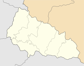
Wolowez ( Ukrainian Воловець ; Russian Воловец , Hungarian Volóc , Slovak Volovec ) is an urban-type settlement in the western Ukrainian Zakarpattia Oblast . Located in the Carpathian Forest , north of the 1681 m high Stij on the Witscha brook , it is the administrative center of the Rajons of the same name .
In addition to the main town with about 5200 inhabitants (2018), the village of Kanora ( Канора , ⊙ ) north of Wolowez with about 790 inhabitants belongs to the municipality. Wolowez is the twin town of Bad Endorf in Upper Bavaria .
history
The place is located in Carpathian Ukraine and shares the history of this historical region.
The first written mention of the place comes from the year 1433. Archaeological excavations have shown, however, that the area of the place Wolowets was already settled in the Bronze Age. In the following centuries it changed rulers several times until the Munkach rulership came at the beginning of the 17th century . In 1625 Janosch Balynda , the head of the Munkach garrison, appointed Oleksi Shimonu as administrator. Subsequently, the rule of Munkatsch belonged alternately to the Principality of Transylvania and the Kingdom of Hungary (in Bereg County ) until it came into the possession of the Rákóczis . At that time there were still less than 100 families living in Wolowez, most of whom lived from cattle breeding. In 1657 the place was completely destroyed in the course of armed conflict by Polish troops.
After the end of the Hungarian uprising against the Habsburgs led by Franz II Rákóczi (ended with the Peace of Sathmar in 1711 ), the Rákóczis lost the castle, whereby Wolowez became the property of Count Karl Schönborn in 1728 and became part of the Mukachevo-Tschynadijiwsk rule . In the following century there were repeated conflicts between the villagers and the new rulers. In 1761–62 alone, 33 residents of the town were imprisoned for rebellious activities.
In 1831 there was another uprising in the region, in which citizens of Volowez took part. During this time, the first processing companies were established in the village, including a brick factory. In the second half of the 19th century the place grew strongly, so that in 1870 there were already 600 people living in it, in 1887 the railway connection took place as part of the further construction of the line from Munkács to Stryj . The first elementary school was opened by the Austro-Hungarian state in 1882. In 1900 there were 1284 inhabitants in Wolowez, including 839 Ukrainians , 253 Germans , 177 Hungarians , 11 Jews , 3 Slovaks and 1 Romanian , of which only 346 were literate. There were a total of 198 buildings in the village, 24 of which were made of stone and 174 of wood.
During the First World War the place came to Czechoslovakia in the course of the dissolution of Austria-Hungary and was officially called Volovec from 1921 . In 1930 archaeological excavations were carried out in the place, during which 23 bronze and 5 gold objects were found, which were dated to the end of the 2nd millennium BC.
Until the annexation of Transcarpathia by Hungary (1939) the place remained Czechoslovak. In 1944 the primary school was converted into a general secondary school. After the end of the Second World War , the place finally came to the Soviet Union and in 1946 became the Rajon center of the newly founded Rajon of the same name. In 1957 Volovets was elevated to an urban-type settlement . In the course of an administrative reform, the Wolowez Raion was dissolved in 1962 and added to the Svalyava Raion. On January 4, 1965, the reform was reversed by a ukase from the Verkhovna Rada , which restored the Rajon.
traffic
Volovets has a railway station on the Budapest - Chop - Kiev route , one of the most important east-west connections in Ukraine. The railway distance to the Uzhhorod oblast center is 118 km. The Uzhhorod- Lviv road runs through the Wolovets district and continues via Kiev to Moscow and is also an important link. The road distance to the Uzhhorod oblast center is 114 km, the distance to Kiev is 780 km.
Web links
Individual evidence
- ↑ Cities and Settlements in Ukraine on pop-stat.mashke.org ; accessed on January 30, 2019


