Kolchyno
| Kolchyno | ||
| Кольчино | ||

|
|
|
| Basic data | ||
|---|---|---|
| Oblast : | Zakarpattia Oblast | |
| Rajon : | Mukachevo Raion | |
| Height : | 135 m | |
| Area : | Information is missing | |
| Residents : | 4,407 (December 2004) | |
| Postcodes : | 89636 | |
| Area code : | +380 3131 | |
| Geographic location : | 48 ° 28 ' N , 22 ° 45' E | |
| KOATUU : | 2122755300 | |
| Administrative structure : | 1 urban-type settlement , 3 villages | |
| Address: | вул. Корятовича 13 89636 смт. Кольчино |
|
| Statistical information | ||
|
|
||
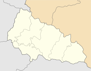
Kolchyno ( Ukrainian Кольчино ; Russian Кольчино Koltschino , Slovak Kolčino , Hungarian Kölcsény ) is an urban-type settlement in the Western Ukraine ( Zakarpattia Oblast , Raion Mukachevo ) northeast of the city of Mukachevo .
The place with about 4400 inhabitants is located in the valley of the Latoryzja at the confluence with the river Vysnyzja ( Визниця ) and has a train station on the railway line Lviv – Stryj – Chop . It has been an urban-type settlement since 1976.
In addition to the actual place also belong to the municipality, but independent places Shboriwzi ( Жборівці ), Klenowez ( Кленовець ) and Konopliwzi ( Коноплівці ). Friedrichsdorf ( Frigyesfalva in Slovak, Frigyesfalva in Slovak ), which was independent before the Second World War and located between Klenowez and Kolchyno , was renamed Kirowo after Transcarpathia became part of the Soviet Union in 1945/46 and was later incorporated into Kolchyno.
Sons and daughters of the village
- Eugen Gopko (* 1991), German soccer player


