
Berehove
| Berehove | |||
| Берегове | |||

|
|
||
| Basic data | |||
|---|---|---|---|
| Oblast : | Zakarpattia Oblast | ||
| Rajon : | District-free city | ||
| Height : | 115 m | ||
| Area : | 19.00 km² | ||
| Residents : | 26,554 (2004) | ||
| Population density : | 1,398 inhabitants per km² | ||
| Postcodes : | 90200 | ||
| Area code : | +380 3141 | ||
| Geographic location : | 48 ° 12 ' N , 22 ° 39' E | ||
| KOATUU : | 2110200000 | ||
| Administrative structure : | 1 city , 1 village | ||
| Mayor : | István Gajdos | ||
| Address: | вул. Б. Хмельницького 7 90200 м. Берегове |
||
| Website : | http://www.bereg.net.ua/ | ||
| Statistical information | |||
|
|||


Berehove (Ukrainian Берегове ; Rusyn Берегово / Berehovo , Russian Берегово / Beregovo , Hungarian Beregszász , German Bergsaß or older Lampert House , Czech and Slovak Berehovo ) is a city in the Zakarpattia Oblast in western Ukraine ( Carpathian Ukraine ) near the Hungarian border, and is the Administrative center of Berehove district .

geography
location
The place is located on the large Szernyes swamps not far from the mouth of the Borschawa in the Tisza .
population
In 2004 the city had 26,100 mostly Hungarian inhabitants, in 2001 there were 26,600, of whom 12,800 stated their nationality as Hungarian, 10,300 Ukrainian, 1,700 Gypsy and 1,400 Russian. However, the actual proportion of gypsies (mainly Roma) is likely to be significantly higher.
structure
In addition to the actual city, the village of Satyschne (Ukrainian Затишне , Hungarian Tasnád ) also belongs to the administrative area.
religion
Berehove is the official seat of the Bishop of the Reformed Church in Transcarpathia .
history

In the 11th century, a settlement with the name Lamperthaza or Luprechaza was built in the area of today's settlement . However, this was destroyed during the Mongol invasions in 1240/1241.
Then the place was re-established, in 1284 it was mentioned in writing for the first time as Beregzaza , since 1271 it has been the capital of Bereg County and since 1342 it has been a royal free town . In 1566 it was again devastated by the Mongols, in 1657 by the Poles and in 1686 by the Kuruc .
At the end of the 19th century, Beregszász was the chief town of the county, which is crossed by the Hungarian Northeast Railway , with (1881) 6930 inhabitants, viticulture and quarries, court of justice and tax inspectorate.
In 1910 the city had 12,933 inhabitants of whom 12,432 were Hungarians , 221 Ruthenians and 140 Germans.
Until 1919 the city was the capital of the Hungarian county of Bereg . Then it became part of Czechoslovakia with the Carpathian Ukraine and belonged again to Hungary from 1938 to 1945 due to the First Vienna Arbitration . From 1945 to 1991 Berehove belonged to the Ukrainian Soviet Republic of the USSR . Since June 15, 2001 the city has been under oblast administration.
After the German occupation of Hungary in March 1944, the Jewish population of Beregszász was first brought to the ghetto established by the occupiers in the city , from where most of them were deported to Auschwitz and murdered. The arrival of three deportation trains in the extermination camp and the selection made there are recorded photographically in the Auschwitz album .
traffic
The station is on the Batjowo – Korolewo railway line . There is also a narrow-gauge network in Berehove .
Berehove is located on the European route 81 from Uzhgorod to Constana. The M 23 road leads to Munkatsch.
Twin cities
-
 Kecskemét , Hungary
 -
 Miercurea Ciuc , Romania
Personalities
- Arthur Porr (1872–1915), Austrian building contractor
- Alfred von Hubicki (1887–1971), Austrian general of the armored forces
- Géza Kalocsay (1913–2008), Czechoslovak-Hungarian footballer
- Julius Rebek (* 1944), American chemist
- Věra Trnková (1934–2018), Czech mathematician and university professor, who was known for her work in topology and category theory
- Attila Vidnyánszky (* 1964), Ukrainian-Hungarian theater director and artistic director
- Andrea Bocskor (* 1978), Hungarian politician
See also
- History of Carpathian Ukraine
- History of Slovakia
- History of Hungary
- List of historical counties of Hungary
Web links
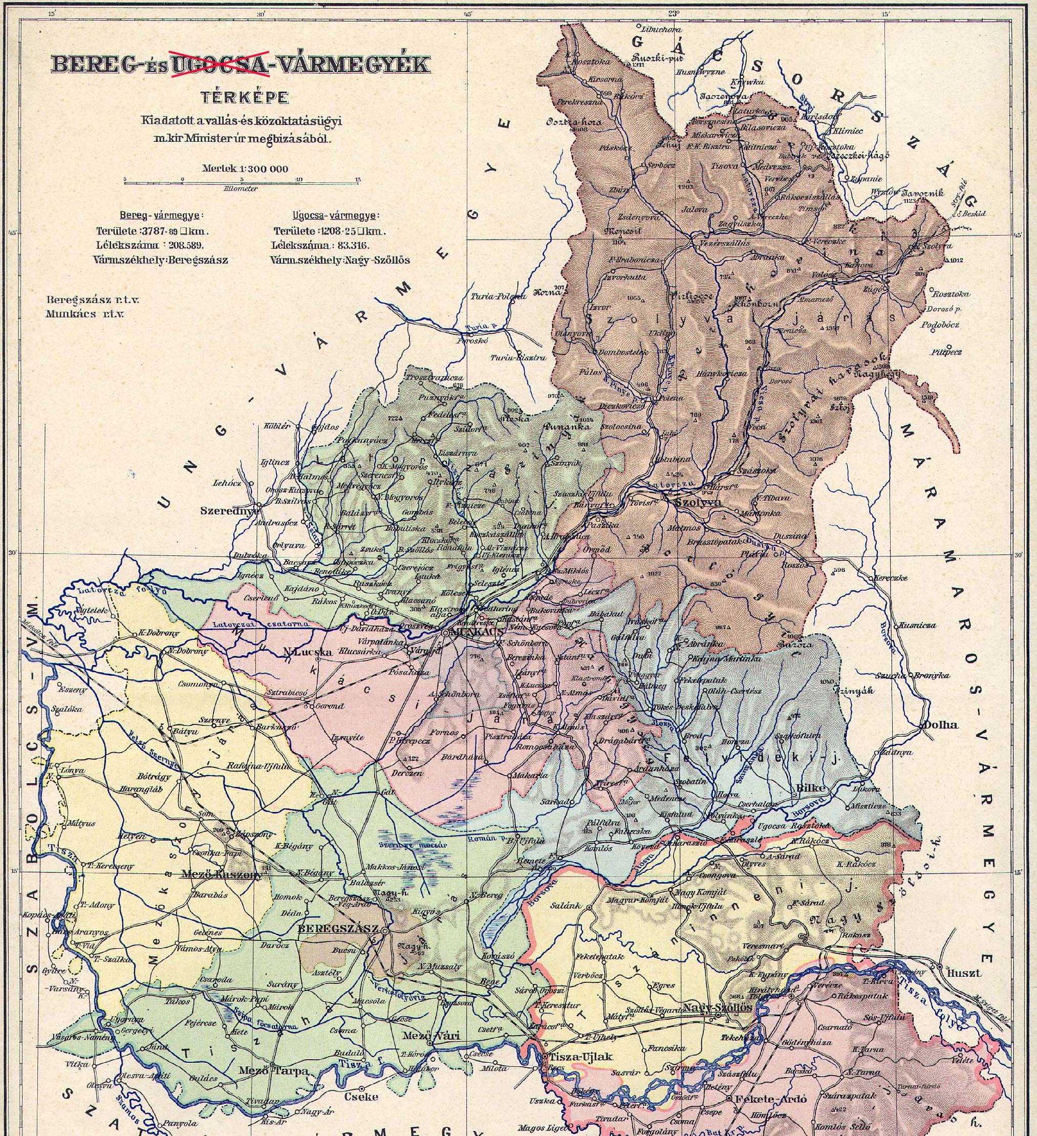
- Historical map of Bereg county
- Official site (Ukrainian)
- Non official site (English)
Individual evidence
- ↑ Верховна Рада України; Постанова від 17.05.2001 № 2427-III Про віднесення міста Берегове Берегівського району Закарпаткатону Закарпаткатокої чегарпаткатокоз чегост
- ↑ See the report by R. Vrba and A. Wetzler from 1944 in the Dodis database of Diplomatic Documents of Switzerland
Berehove | Chust | Irshava | Mukachevo | Perechyn | Rakhiv | Svyava | Tyachiv | Tschop | Uzhhorod | Vynohradiv
Batjowo urban-type settlements |
Bushhtyno |
Dubowe |
Yasinja |
Kobylezka Polyana |
Kolchyno |
Korolewo |
Mishhirja |
Serednje |
Shdeniyevo |
Zolotvyno |
Tereswa |
Chynadiyovo |
Ust-Chorna |
Velykyj Bereznyj |
Velykyi Bychkiv |
Volovets |
Wylok |
Vyshkovo
