Mishhirja
| Mishhirja | ||
| Міжгір'я | ||

|
|
|
| Basic data | ||
|---|---|---|
| Oblast : | Zakarpattia Oblast | |
| Rajon : | Mishhirja Rajon | |
| Height : | 430 m | |
| Area : | 6.63 km² | |
| Residents : | 9,421 (2004) | |
| Population density : | 1,421 inhabitants per km² | |
| Postcodes : | 90000 | |
| Area code : | +380 3146 | |
| Geographic location : | 48 ° 32 ' N , 23 ° 30' E | |
| KOATUU : | 2122455100 | |
| Administrative structure : | 1 urban-type settlement | |
| Mayor : | Vasyl Shchur | |
| Address: | вул. Шевченка 77 90,000 смт. Міжгір'я |
|
| Statistical information | ||
|
|
||
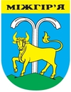
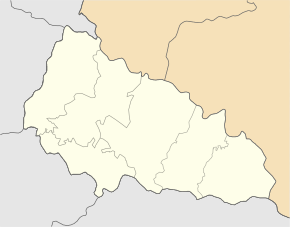
Mishhirja ( Ukrainian Міжгір'я ; Russian Межгорье Meschgorje , Hungarian Ökörmező , Slovak Volové ) is the name of an urban-type settlement in the Zakarpattia Oblast in western Ukraine . The Carpathian town is located east of the district capital Uzhhorod on the Rika , a tributary of the Tisza , and is the administrative center of the Mishhirja district .
history
In 1415 the place is mentioned for the first time in writing as Ukurmezew , until 1953 it was called Wolowe (Ukrainian Волове) or Russian Wolowo / Волово, the Hungarian name Ökörmező is the analogous translation and means "Ochsenwiese" in German. On May 30, 1947, Mishhirja, which had previously only existed as a village, was elevated to an urban-type settlement.
There is a 19th century Greek Catholic church in the parish.


