
Huck (Alps)
|
Huck
Municipality of the Alps
Coordinates: 51 ° 34 ′ 19 ″ N , 6 ° 31 ′ 53 ″ E
|
|
|---|---|
| Height : | 25 m |
| Area : | 3.23 km² |
| Residents : | 364 (December 31, 2011) |
| Population density : | 113 inhabitants / km² |
| Incorporation : | April 1, 1939 |
| Postal code : | 46519 |
| Area code : | 02802 |
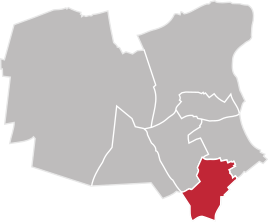  Location of Huck in Alps
|
|
Huck is a district of the municipality of Alpen in the Wesel district in North Rhine-Westphalia , statistically the place belongs to Alpen-Mitte.
location
Huck is 2 km southeast of the heart of the Alps. The federal motorway 57 runs south in a distance of 3 km.
history
Huck used to be characterized by agriculture and has always been closely associated with the Alps. As a peasantry, the Streudorf belonged to the mayor's office and later to the Alpine Office . On April 1, 1939, Huck was incorporated into the Alps. On July 1, 1969, as part of the first phase of the reorganization in North Rhine-Westphalia, the municipalities of Alpen, Menzelen and Veen came together to form the municipality of Alpen.
Population development
- 1830: 188
- 1910: 176
- 1931: 164
- 2011: 364
Individual evidence
- ^ History of the municipality of the Alps. Retrieved April 14, 2013 .
- ↑ Martin Bünermann: The communities of the first reorganization program in North Rhine-Westphalia . Deutscher Gemeindeverlag, Cologne 1970, p. 103 .
- ^ The Rhine Province of the Prussian Monarchy, Düsseldorf 1833, p. 156. Accessed April 15, 2013 .
- ↑ Municipal directory 1910, Moers district. Retrieved April 15, 2013 .
- ↑ GenWiki Office for the Alps. Retrieved April 14, 2013 .
- ↑ Municipality of Alpen, population statistics according to localities according to the residents' registration office. (PDF; 156 kB) (No longer available online.) Archived from the original on November 5, 2013 ; Retrieved April 15, 2013 . Info: The archive link was inserted automatically and has not yet been checked. Please check the original and archive link according to the instructions and then remove this notice.
