Hudson (Ohio)
| Hudson | |
|---|---|
|
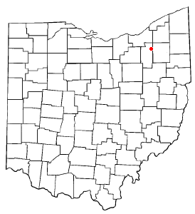
Location in Ohio
|
|
| Basic data | |
| Foundation : | 1799 |
| State : | United States |
| State : | Ohio |
| County : | Summit County |
| Coordinates : | 41 ° 14 ′ N , 81 ° 26 ′ W |
| Time zone : | Eastern ( UTC − 5 / −4 ) |
| Residents : | 23,154 (as of 2006) |
| Population density : | 349.2 inhabitants per km 2 |
| Area : | 67.0 km 2 (approx. 26 mi 2 ) of which 66.3 km 2 (approx. 26 mi 2 ) are land |
| Height : | 325 m |
| Postal code : | 44236 |
| Area code : | +1 330, 234 |
| FIPS : | 39-36651 |
| GNIS ID : | 1048857 |
| Website : | www.hudson.oh.us |
| Mayor : | William A. Currin |
Hudson is an American small town, about 50 kilometers south of Cleveland ( Ohio located). The "City of Hudson" has about 26,000 inhabitants (as of 2003).
In 1802 the settlement was given its current name, and in 1837 it was finally registered as a municipality . The city center is spacious, with a square tree-lined lawn in the center, the so-called Village Green . This is delimited by the main shopping streets, where the town hall , built in 1879, is also located. In Village Green you will find the two landmarks of Hudson, the Clock Tower and the Bandstand .
Since August 26, 1984 Hudson is a twin town of Landsberg am Lech ( Bavaria ).
sons and daughters of the town
- James William Ellsworth (1849-1925), industrialist
- Scott E. Forbush (1904-1984), geophysicist
- Dante Lavelli (1923-2009), American football player
- Christine Chubbuck (1944–1974), presenter
- Bill Watterson (born 1958), cartoonist, Calvin & Hobbes
- Ben Gedeon (born 1994), American football player
Web links
Commons : Hudson, Ohio - Collection of pictures, videos, and audio files
