
Hullern dam
| Hullern dam | |||||||||
|---|---|---|---|---|---|---|---|---|---|
 |
|||||||||
|
|||||||||
|
|||||||||
| Coordinates | 51 ° 44 '43 " N , 7 ° 17' 27" E | ||||||||
| Data on the structure | |||||||||
| Construction time: | 1973–1985 | ||||||||
| Height above valley floor: | 12.2 m | ||||||||
| Crown length: | 160 m | ||||||||
| Data on the reservoir | |||||||||
| Water surface | 150 ha | ||||||||
| Storage space | 11 million m³ | ||||||||

The Hullern dam (Hullerner See) in the Recklinghausen district in North Rhine-Westphalia , dams the Stever above the Haltern reservoir . The Gelsenwasser AG uses the dam for water collection, they also used the silent recovery. The dam was inaugurated on October 15, 1985 after a construction period of thirteen years.
The water depth is a maximum of eight meters.
Buildings
The dam has a flood overflow and a segment weir with an attached flap. The water surface is dammed at 40.40 m above sea level, around one meter higher than in the Haltern reservoir . The water flows over the Zwischenstever to the Haltern reservoir.
With four pumps with a capacity of 15,000 m³ / h, the dammed water can be used for the water supply in the Haltern waterworks even when the water level is lowered . In times of low rainfall, up to 200,000 m³ of water can be taken daily from the Dortmund-Ems Canal at Senden and fed into the Stever, so that a minimum water level can be maintained in Lake Hullern.
At the inflow of the Stever into the dam, an inlet structure with a rubber dam was built as a pre- dam . When the water level in the dam is lowered, it should ensure a constant water level in the upper reaches of the Stever.
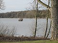
View of the reservoir in winter

Inflow of the Stever into the reservoir


See also
Web links
- Gelsenwasser (PDF file; 393 kB)
- Dams in North Rhine-Westphalia; State Environment Agency NRW (PDF; 124 kB)