
Nordheim before the Rhön
| coat of arms | Germany map | |
|---|---|---|

|
Coordinates: 50 ° 29 ' N , 10 ° 11' E |
|
| Basic data | ||
| State : | Bavaria | |
| Administrative region : | Lower Franconia | |
| County : | Rhön-Grabfeld | |
| Management Community : | Fladungen | |
| Height : | 340 m above sea level NHN | |
| Area : | 16.56 km 2 | |
| Residents: | 1110 (Dec. 31, 2019) | |
| Population density : | 67 inhabitants per km 2 | |
| Postal code : | 97647 | |
| Area code : | 09779 | |
| License plate : | NES, CAN, MET | |
| Community key : | 09 6 73 147 | |
| Community structure: | 2 districts | |
| Association administration address: | Marktplatz 1 97650 Fladungen |
|
| Website : | ||
| Mayor : | Thomas Fischer ( CSU / Citizens' Block) | |
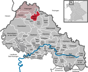
| Location of the municipality of Nordheim vdRhön in the district of Rhön-Grabfeld | ||
  |
||


Nordheim vor der Rhön (officially: Nordheim vdRhön ) is a municipality in the Lower Franconian district of Rhön-Grabfeld and a member of the Fladungen administrative community .
geography
Nordheim vor der Rhön is located in the Main-Rhön region on the Streu .
The community consists of the districts Nordheim vor der Rhön and Neustädtles .
history
Until the church is planted
The Franconian settlement of Nordheim vdRhön was founded around 525 and came to the Würzburg monastery in 1000 . From 1500 this bishopric was part of the Franconian Empire . After the secularization in 1803 in favor of Bavaria, the office of the bishopric was left to Archduke Ferdinand of Tuscany to form the Grand Duchy of Würzburg in 1805 and with this in 1814 it finally fell to Bavaria . In the course of the administrative reforms in Bavaria, today's municipality was created with the municipal edict of 1818 .
19th and 20th centuries
At least since the 19th century there were Jewish families living in the village , who formed a Jewish community , built a school at Untere Torgasse 7 and built a synagogue at Judengasse 4 . These buildings were taken over by SA men during the November pogrom in 1938 . Sometimes badly devastated, and to this day nothing reminds of this event. On April 7th, Nordheim is occupied by American troops and Leo Strauss is appointed mayor.
Incorporations
On January 1, 1972 Neustädtles was incorporated into Bavaria as part of the regional reform .
Population development
- 1961: 1292 inhabitants (224 of them in Neustädtles)
- 1970: 1308 inhabitants (205 of them in Neustädtles)
- 1987: 1176 inhabitants
- 1991: 1300 inhabitants
- 1995: 1277 inhabitants
- 2000: 1262 inhabitants
- 2005: 1185 inhabitants
- 2010: 1102 inhabitants
- 2015: 1121 inhabitants
politics
Mayor has been Thomas Fischer (CSU / Bürgerblock) since May 1, 2008.
- 1948–1977: Alex Hösl
- 1977–1994: Rudi Dietz
- 1994–2008: Hermann Hippeli
- 2008–?: Thomas Fischer
Economy and Infrastructure
Economy including agriculture and forestry
In 1998, according to official statistics, there were 105 employees at the place of work in the manufacturing sector and 44 in the trade and transport sector. In other economic sectors 37 people were employed at the place of work subject to social security contributions. There were a total of 379 employees at the place of residence subject to social security contributions. There were two companies in the manufacturing sector and two companies in the construction sector. In addition, in 1999 there were 13 farms with an agriculturally used area of 714 hectares, 588 hectares of which were arable land and 120 hectares of permanent green area.
education
There are the following institutions (as of 2018):
- A day-care center for children with 62 places and 44 children, 12 of them under three years of age
- A primary school with five teachers, four classes and 88 students
Attractions


- Parish Church of St. John the Baptist
- Church fortress
- Church entrance
- Kellergaden
- Johannis Bridge
- St. Sebastian Chapel
- Mary's Grotto
- town hall
- Gatehouse
- Tenth house
Architectural monuments
Personalities
- Franz Georg Benkert (1790–1850), theologian, cathedral dean, author
- Alex Hösl (1919–1977), mayor from 1948 to 1977, member of the Bundestag (CSU) from 1961 to 1977
- Max Mölter, retired rector D. and author of the community chronicle published in 1989
- Adolf Stein (1864–1932), honorary citizen, co-founder of Leimbach & Co. GmbH with the first basalt factory in Nordheim
- Max Stein (1901–1964), son of Adolf, lawyer and government official in Israel
literature
Franz Georg Benkert , historical-topographical-statistical description of the market town of Nordheim in front of the Rhone together with the subsidiary villages of the parish: Heufurt, Roth with the old Hildenburg, and Neustädtles, Würzburg 1821.
Rudolf Dietz, Festschrift for the 1200 year celebration (789–1989), from February 27, 1989 to February 26, 1990, Nordheim vd Rhön 1989.
Max Mölter, guide through Nordheim vd Rhön and the surrounding area, Mellrichstadt 1973.
Web links
- Entry on the coat of arms of Nordheim vor der Rhön in the database of the House of Bavarian History
Individual evidence
- ↑ "Data 2" sheet, Statistical Report A1200C 202041 Population of the municipalities, districts and administrative districts 1st quarter 2020 (population based on the 2011 census) ( help ).
- ↑ http://www.bayerische-landesbibliothek-online.de/orte/ortssuche_action.html ? Anzeige=voll&modus=automat&tempus=+20111120/232339&attr=OBJ&val= 1603
- ↑ Memorial sites for the victims of National Socialism. A documentation, volume 1. Federal Agency for Civic Education, Bonn 1995, ISBN 3-89331-208-0 , p. 179
- ↑ http://www.nordheimvdrhoen.rhoen-saale.net/Allgemeines/Geschichte?page=12133&&detailID=5963
- ^ Wilhelm Volkert (ed.): Handbook of Bavarian offices, communities and courts 1799–1980 . CH Beck, Munich 1983, ISBN 3-406-09669-7 , p. 520 .
- ^ Foreword to the church chronicle

Aubstadt | Bad Königshofen im Grabfeld | Bad Neustadt an der Saale | Bastheim | Bischofsheim in the Rhön | Burglauer | Fladungen | Großbardorf | Großeibstadt | Hausen | Hendungen | Herbstadt | Haystack | Höchheim | Hohenroth | Hollstadt | Mellrichstadt | Niederlauer | Nordheim before the Rhön | Oberelsbach | Top litter | Ostheim before the Rhön | Rödelmaier | Hall on the Saale | Salt | Sandberg | Schönau an der Brend | Sondheim before the Rhön | Stockheim | Radiations | Sulzdorf an der Lederhecke | Sulzfeld | Trappstadt | Unsleben | Willmars | Wollbach | Wülfershausen on the Saale
Unregulated areas in the district of Rhön-Grabfeld Bundorfer Forst |
Burgwallbach Forest |
Forest Schmalwasser-Nord |
Forest Schmalwasser-Süd |
Mellrichstadter Forest |
Steinacher Forest on the right of the Saale |
Sulzfelder Forest |
Weigler