
Trappstadt
| coat of arms | Germany map | |
|---|---|---|

|
Coordinates: 50 ° 19 ′ N , 10 ° 35 ′ E |
|
| Basic data | ||
| State : | Bavaria | |
| Administrative region : | Lower Franconia | |
| County : | Rhön-Grabfeld | |
| Management Community : | Bad Königshofen in Grabfeld | |
| Height : | 310 m above sea level NHN | |
| Area : | 25.8 km 2 | |
| Residents: | 953 (Dec. 31, 2019) | |
| Population density : | 37 inhabitants per km 2 | |
| Postal code : | 97633 | |
| Area code : | 09765 | |
| License plate : | NES, CAN, MET | |
| Community key : | 09 6 73 174 | |
| Market structure: | 2 districts | |
| Association administration address: | Josef-Sperl-Str. 3 97631 Bad Königshofen i.Grabfeld |
|
| Website : | ||
| Mayor : | Michael Custodis (Trappstadt voter block) | |
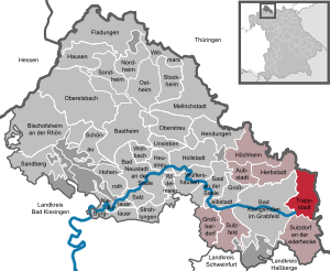
| Location of the Trappstadt market in the Rhön-Grabfeld district | ||
  |
||

Trappstadt is a market in the Lower Franconian district of Rhön-Grabfeld and a member of the Bad Königshofen administrative community in Grabfeld .
geography
Trappstadt is located in the Main-Rhön region . The place borders directly on the Free State of Thuringia ( Gompertshausen , Straufhain , Schlechtsart and Gleichamberg in the district of Hildburghausen ).
Community structure
Trappstadt is divided into two districts:
- Alsleben
- Trappstadt
There are the districts of Alsleben and Trappstadt. The Eschelhorn desert is located in the Alsleben district .
The nature reserves Altenburg in Trappstadt with an area of 307 hectares and dry grass on Kapellenberg in Alsleben with 25 hectares are located in the Haßberge Nature Park .
history
Until the church is planted
Trappstadt was a condominium place . The rights of the Hochstift Würzburg fell in 1803 to the Grand Duchy of Würzburg of Archduke Ferdinand of Tuscany . The rights of the county of Sachsen-Römhild (represented by the duchies of Sachsen-Meiningen and Sachsen-Gotha ) fell to the Grand Duchy by contract in 1808. The Grand Duchy of Würzburg became part of Bavaria in 1814 . In the course of the administrative reforms in Bavaria, today's municipality was created with the municipal edict of 1818 .
In 1778 all Ganerbe gave the place Trappstadt permission to hold four annual and cattle markets. The Ganerbe, a kind of community of heirs, were then the rule Römhild, the Hochstift Würzburg and the Count von und zu Eltz . With "Cunradus de Trapstat", a monk in Theres Monastery, Trappstadt was first mentioned in 1269. In 2005, the 225 year old market law was revived. Since then, the Anna market festival has taken place every year on the Sunday after July 26th. Over 70 traders and artisans as well as over 4000 visitors visit the market town on this day.
History of inheritance
The Ganerbendorf Trappstadt has an extremely interesting ownership history. In the 13th century, the Counts of Henneberg and the monasteries Theres and Veilsdorf shared the town's goods. 300 years later there were already twelve Ganerbe who issued a common village order in 1524. Around 1600 the village was divided into four districts, each of which was allowed to serve as mayor for a year. The castle was owned by the Barons of Bibra .
The ownership of the Ganerbeviertel was distributed as follows:
- Würzburg subjects (former Theres monastery) sat in 22 houses.
- Veilsdorf Monastery (from 1699 Würzburg Cathedral Chapter) had 28 houses.
- Henneberg (from 1584 Saxon) vassals owned 22 houses.
- Another 9 houses were owned by the following families since 1524: Schott (until 1585), Echter (until 1665), Faust von Stromberg (until 1738), Count von Eltz (until 1824).
In 1656, the bailiff von Römhild was elected director of the Ganerbenschaft as a representative of the Henneberg-Saxon part.
Religions
The Protestant community in the village belongs to the Evangelical Lutheran Dean's Office in Bad Neustadt an der Saale .
Incorporations
On January 1, 1978, the previously independent community of Alsleben was incorporated.
Population development
| year | 1961 | 1970 | 1987 | 1991 | 1995 | 2000 | 2005 | 2010 | 2015 |
| Residents | 1166 | 1112 | 1022 | 1010 | 1016 | 1065 | 1033 | 1012 | 991 |
politics
Market council
The local elections on March 16, 2014 resulted in the following composition of the local council:

| Party / list | Share of votes | Seats |
| Alsleben voter community | 50.3% | 6th |
| List Trappstadt | 49.7% | 6th |
mayor
Michael Custodis (electoral block Trappstadt) has been mayor since May 1, 2014. His predecessor was Kurt Mauer (Alsleben voter community).
Community finances
In 2016, the municipal tax revenue was 446,000 euros, of which 27,000 euros were trade tax revenues (net). The per capita debt is well below the Bavarian average.
coat of arms
Description : In silver with a blue shield base, a silver wavy bar , a black bustard with gold feet and a gold stalk in its beak.
Municipal alliance
Markt Trappstadt is a member of the municipal alliance Fränkischer Grabfeldgau .
economy
In 2015, according to official statistics, there were eight employees in the manufacturing sector and none in the trade and transport sector at the place of work. In other economic sectors, no persons were employed at the place of work subject to social security contributions. There were a total of 403 employees at the place of residence subject to social security contributions. There were no companies in the manufacturing sector and three companies in the main construction sector. In 2010 there were also 34 farms with an agricultural area totaling 1869 hectares, of which 1758 hectares were arable land and 110 hectares were permanent green space.
Culture and sights
Attractions


- Trappstadt moated castle (New Castle) around 1710 Joseph Greissing
- Old castle
- Chapel of St. Ursula near Alsleben
- Church of St. Kilian with Seuffert organ in Alsleben
- Parish church of St. Burkard with bust from the workshop of Tilman Riemenschneider (now replaced by a copy) in Trappstadt
- Gatehouse in Trappstadt
- Old castle monument in Alsleben
- Magerrasen nature reserve on Kapellenberg near Alsleben
- Altenburg nature reserve near Trappstadt
- Hiking trail border crossers to the history and ecology of the former inner-German border
- The community is crossed on the same route by the European long-distance hiking trails E3 and E6 .
- The Celtic Cycle Path runs through Trappstadt. The Saalbrunnen near Alsleben is one of the two source streams of the Franconian Saale and at the same time the starting point of the Franconian Saale cycle path.
Architectural monuments
Facilities
There is a kindergarten with 12 crèche places for one to three year old children and 33 places for three year olds up to school age.
Regular events
- Big carnival procession of the TCV on Mardi Gras Sunday
- Spring festival of TSV Trappstadt
Sons and daughters of the church
- Marcus Goldman (1821–1904), founder of the Goldman Sachs investment bank in America
- Bernhard Hellmuth (1725-1810), Franconian plasterer
Web links
- www.trappstadt.de
- Entry on the coat of arms of Trappstadt in the database of the House of Bavarian History
Individual evidence
- ↑ "Data 2" sheet, Statistical Report A1200C 202041 Population of the municipalities, districts and administrative districts 1st quarter 2020 (population based on the 2011 census) ( help ).
- ↑ http://www.bayerische-landesbibliothek-online.de/orte/ortssuche_action.html ? Anzeige=voll&modus=automat&tempus=+20111121/185608&attr=OBJ&val= 1617
- ↑ Trappstadt in Rhon lexicon
- ↑ Ganerbeviertel of Trappstadt in the Rhön Lexicon
- ↑ a b c Federal Statistical Office (ed.): Historical municipality directory for the Federal Republic of Germany. Name, border and key number changes in municipalities, counties and administrative districts from May 27, 1970 to December 31, 1982 . W. Kohlhammer GmbH, Stuttgart / Mainz 1983, ISBN 3-17-003263-1 , p. 741 .
- ↑ Gemeindeblatt Markt Trappstadt-Alsleben No. 84 • April 2018 , accessed on June 4, 2018

Aubstadt | Bad Königshofen im Grabfeld | Bad Neustadt an der Saale | Bastheim | Bischofsheim in the Rhön | Burglauer | Fladungen | Großbardorf | Großeibstadt | Hausen | Hendungen | Herbstadt | Haystack | Höchheim | Hohenroth | Hollstadt | Mellrichstadt | Niederlauer | Nordheim before the Rhön | Oberelsbach | Top litter | Ostheim before the Rhön | Rödelmaier | Hall on the Saale | Salt | Sandberg | Schönau an der Brend | Sondheim before the Rhön | Stockheim | Radiations | Sulzdorf an der Lederhecke | Sulzfeld | Trappstadt | Unsleben | Willmars | Wollbach | Wülfershausen on the Saale
Unregulated areas in the district of Rhön-Grabfeld Bundorfer Forst |
Burgwallbach Forest |
Forest Schmalwasser-Nord |
Forest Schmalwasser-Süd |
Mellrichstadter Forest |
Steinacher Forest on the right of the Saale |
Sulzfelder Forest |
Weigler