Hollstadt
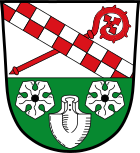
| coat of arms | Germany map | |
|---|---|---|

|
Coordinates: 50 ° 21 ' N , 10 ° 18' E |
|
| Basic data | ||
| State : | Bavaria | |
| Administrative region : | Lower Franconia | |
| County : | Rhön-Grabfeld | |
| Management Community : | Haystack | |
| Height : | 252 m above sea level NHN | |
| Area : | 24.3 km 2 | |
| Residents: | 1439 (Dec. 31, 2019) | |
| Population density : | 59 inhabitants per km 2 | |
| Postal code : | 97618 | |
| Area code : | 09773 | |
| License plate : | NES, CAN, MET | |
| Community key : | 09 6 73 136 | |
| Community structure: | 5 districts | |
| Association administration address: | Wetterstrasse 4 97618 Heustreu |
|
| Website : | ||
| Mayor : | Georg Menninger ( CSU ) | |
| Location of the municipality of Hollstadt in the Rhön-Grabfeld district | ||
Hollstadt is a municipality in the Lower Franconian district of Rhön-Grabfeld and a member of the Heustreu administrative community .
geography
Hollstadt is located in the Main-Rhön region .
Community structure
Hollstadt is divided into five districts:
- Herrnmühle
- Hollstadt
- Junkershausen
- Neumühle
- Wargolshausen
history
Until the church is planted
The first written mention of the place is controversial and took place either in the year 800 as "Uulunastat" or in the year 808 as "Holnstat". After a letter of privilege from Emperor Friedrich I Barbarossa, the Cistercian monastery in Bildhausen received rights in the place in 1157. The office of the Hochstift Würzburg belonged to the Franconian Empire from 1500 . After secularization in 1803 in favor of Bavaria, it was given to Archduke Ferdinand of Tuscany in 1805 to form the Grand Duchy of Würzburg and with this in 1814 it finally fell to Bavaria. In 1818 the political municipality was established.
Incorporations
On the occasion of the regional reform in Bavaria on January 1, 1978, the previously independent communities Wargolshausen and Junkershausen were incorporated.
Population development
- 1961: 1535 inhabitants
- 1970: 1555 inhabitants
- 1987: 1411 inhabitants
- 1991: 1534 inhabitants
- 1995: 1635 inhabitants
- 2000: 1655 inhabitants
- 2005: 1708 inhabitants
- 2010: 1603 inhabitants
- 2015: 1524 inhabitants
politics
mayor
Georg Menninger (CSU) has been mayor since 1996.
Town twinning
Hollstadt is a partner municipality of Frankenfels in Lower Austria .
Architectural monuments
Economy and Infrastructure
Economy including agriculture and forestry
In 1998, according to official statistics, there were four in the field of agriculture and forestry, 91 in the manufacturing sector and 25 in the trade and transport sector at the place of work. In other economic sectors, 15 people were employed at the place of work subject to social security contributions. There were a total of 348 employees at the place of residence subject to social security contributions. There was one company in the manufacturing sector and two companies in the construction sector. In addition, in 1999 there were 32 farms with an agriculturally used area of 686 hectares, of which 275 hectares were arable land and 411 hectares were permanent green space.
education
The following institutions exist (as of: 1999):
- 100 kindergarten places with 66 children
- an elementary school with eleven teachers and 232 students
Personalities
- Valentin Leucht (* around 1550, † 1619), Catholic priest, theologian, book author, imperial court palatinate count and imperial book commissioner
- Philipp Braun (1654–1735), clergyman, theologian and canon lawyer and vicar general of Würzburg
Web links
- Official website
- Entry on the coat of arms of Hollstadt in the database of the House of Bavarian History
Individual evidence
- ↑ "Data 2" sheet, Statistical Report A1200C 202041 Population of the municipalities, districts and administrative districts 1st quarter 2020 (population based on the 2011 census) ( help ).
- ↑ http://www.bayerische-landesbibliothek-online.de/orte/ortssuche_action.html ? Anzeige=voll&modus=automat&tempus=+20111120/223734&attr=OBJ&val= 1599
- ↑ a b c Federal Statistical Office (ed.): Historical municipality directory for the Federal Republic of Germany. Name, border and key number changes in municipalities, counties and administrative districts from May 27, 1970 to December 31, 1982 . W. Kohlhammer GmbH, Stuttgart / Mainz 1983, ISBN 3-17-003263-1 , p. 740 .


