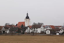
Gompertshausen
|
Gompertshausen
City of Heldburg
|
|
|---|---|
| Coordinates: 50 ° 18 ′ 0 ″ N , 10 ° 38 ′ 0 ″ E | |
| Height : | 310 m |
| Area : | 14.81 km² |
| Residents : | 434 (December 31, 2017) |
| Population density : | 29 inhabitants / km² |
| Incorporation : | 1st January 2019 |
| Postal code : | 98663 |
| Area code : | 036875 |
Gompertshausen is a district of Heldburg in the Heldburger Land in the Hildburghausen district in the Franconian south of the Free State of Thuringia .
geography
Gompertshausen is on the road from Hildburghausen to Bad Königshofen in a wide valley basin on the small river Gompertshäuser Kreck . The Weingartenberg (371 m) lies close to the site .
history
The place was first mentioned in 1119 as Gumpertshausen . During the time of the tribal duchies, the place belonged to the Duchy of Franconia .
On January 1, 2019, the municipality of Gompertshausen merged with the city of Bad Colberg-Heldburg and the municipality of Hellingen to form the new city of Heldburg . The community Gompertshausen belonged to the administrative community Heldburger Unterland .
Desolation
coat of arms
The older municipal coat of arms shows a lion on the Weingartenberg. The coat of arms, revised in 1992, was supplemented by a vine branch, which is intended to remind of the earlier viticulture in the place.
Municipal council
The community council in Gompertshausen last consisted of six council members.
- CDU / FW 4 seats
- BG 2 seats
(As of: local elections on June 7, 2009)
Culture and sights
- The oldest building in the village is the Marienkirche , built in 1461, and an old brewery . The Leitenhausen manor, two kilometers away, with other residential buildings, was demolished during the GDR era. Remains of the border barriers and watchtowers in the area still remind of the time of the division of Germany.
- Every Whitsun weekend, the youth club organizes the vineyard festival.
- In spring and autumn, the brewery is visited for traditional beer brewing.
- Hiking trail "Grenzgänger" on the history and ecology of the former inner-German border with the Gompertshausen border monument
- A village blacksmith's shop in the village shows the old craft of ironing horses and other blacksmithing techniques.
Personalities
- Georg Goetz (1849–1932), classical philologist
literature
- Max-Rainer Uhrig: The Heldburger Land. In: Frankenland, magazine for Franconian regional studies and culture. Issue 6, Würzburg, June 1990. Readable online at: [1]
- Norbert Klaus Fuchs: The Heldburger Land - a historical travel guide; Rockstuhl Publishing House, Bad Langensalza 2013, ISBN 978-3-86777-349-2
- P. Lehfeld: Architectural and Art Monuments of Thuringia, Booklet XXXI, Duchy of Saxony-Meiningen, District Court Districts Heldburg and Römhild, 1904, reprint, Verlag Rockstuhl, Bad Langensalza, ISBN 978-3-86777-378-2
- Susanna Sophia Herrmann (married Neri): The microtoponyms (field names) from Gompertshausen, Hildburghausen district ; Thesis, University of Jena, 1999
Individual evidence
- ^ "Rodach thermal baths, Gleichberge mit Heldburger Land" . In: Fritsch hiking map . tape 140 . Landkartenverlag Fritsch, Hof / Saale 2000, ISBN 3-86116-140-0 .

