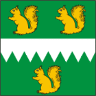
Iisaku
| Iisaku | |||
|
|||
| State : |
|
||
| Circle : |
|
||
| Coordinates : | 59 ° 6 ′ N , 27 ° 18 ′ E | ||
| Area : | 258 km² | ||
| Residents : | 1,380 (2010) | ||
| Population density : | 5 inhabitants per km² | ||
| Time zone : | EET (UTC + 2) | ||
| Community type: | former rural community | ||
| Mayor : | Avo Kiir
( IRL ) |
||
| Postal address : | Tartu mnt. 56 41101 Iisaku |
||
| Website : | |||

|
|||
The former rural community Iisaku ( Iisaku vald ) was in Ida-Viru County in northeast Estonia . As part of the 2017 community reform, it was merged with four other rural communities to form the rural community of Alutaguse .
description

View from Mount Tärivere to the main town of Iisaku
The rural community had an area of 258 km². It had 1526 inhabitants (January 1, 2004).
The rural community of Iisaku was located in the south of the Ida-Viru county, about 85 km from the town of Rakvere . It bordered on Lake Peipus .
Villages
In addition to the main town Iisaku the villages belonged to the rural community Alliku , Imatu , Jõuga , Kasevälja , Kauksi , Koldamäe , Kuru , Lipniku , Lope , Pootsiku , Sõrumäe , Sälliku , Taga-Roostoja , Tammetaguse , Tärivere , Vaikla and Varesmetsa .
Web links
Commons : Iisaku Rural Community - Collection of pictures, videos, and audio files
- Iisaku Municipality website (Estonian and English)
- Full description (Estonian)
- Iisaku Local History Museum (Estonian and English)
Individual evidence
- ↑ Archive link ( Memento of the original from October 21, 2011 in the Internet Archive ) Info: The archive link was inserted automatically and has not yet been checked. Please check the original and archive link according to the instructions and then remove this notice.

