Anarjohka
|
Anarjohka Anárjohka , Anarjokka , Inarijoki , Enare älv |
||
|
Anarjohka at the norweg.-finn. border |
||
| Data | ||
| Water code | FI : 68.03 | |
| location |
Lapland (Finland), Troms og Finnmark (Norway) |
|
| River system | Tanaelva | |
| Drain over | Tanaelva → Barents Sea | |
| origin | several small rivers in the municipality of Kautokeino | |
| Source height | ~ 500 m | |
| confluence | with Karasjohka to Tanaelva Coordinates: 69 ° 26 ′ 6 " N , 25 ° 48 ′ 24" E 69 ° 26 ′ 6 " N , 25 ° 48 ′ 24" E |
|
| Mouth height | 123 m | |
| Height difference | 377 m | |
| Bottom slope | 2.5 ‰ | |
| length | 152.9 km | |
| Catchment area | 3,151.8 km² | |
| Drain |
MQ |
33 m³ / s |
| Left tributaries | Iškorasjohka, Goššjohka , Ássuorgi, Cáskinjohka | |
| Right tributaries | Karigasjoki , Skiehččanjohka | |
| Communities | Karigasniemi | |
|
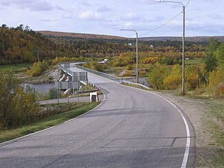
Bridge over the Anarjohka near Karigasniemi |
||
The river Anarjohka ( North Sami : Anárjohka , Norwegian : Anarjokka , Finnish : Inarijoki , Swedish : Enare älv ) is the upper reaches of the Norwegian - Finnish border river Tanaelva .
geography
It rises in the low mountain range in the south of Norway's part of Lapland and flows from south to north. The Anarjohka has covered 106 km to the confluence of the Karasjohka shortly after Karigasniemi . The length of the Anarjohka and Tanaelva river systems is given as 366.3 km.
Web links
Commons : Anarjohka - collection of images, videos and audio files

