Ivindo
| Ivindo | ||
|
Catchment area of the Ogooué with the Ivindo (top right) |
||
| Data | ||
| location |
|
|
| River system | Ogooué | |
| Drain over | Ogooué → Gulf of Guinea | |
| source | in northeast Gabon | |
| muzzle | in the province of Ogooué-Ivindo in the Ogooué coordinates: 0 ° 9 ′ 24 ″ S , 12 ° 10 ′ 22 ″ E 0 ° 9 ′ 24 ″ S , 12 ° 10 ′ 22 ″ E |
|
| Mouth height |
183 m
|
|
| Catchment area | 62,700 km² | |
| Discharge at the Makokou A Eo gauge : 35,800 km² Location: about 150 kilometers above the mouth |
MNQ 1980–1990 MQ 1980–1990 Mq 1980–1990 MHQ 1980–1990 |
293 m³ / s 632 m³ / s 17.7 l / (s km²) 1550 m³ / s |
|
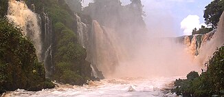
Kongou Falls |
||
The Ivindo is a river in Gabon and borders with Cameroon and the Republic of the Congo . It is the main tributary of the Ogooué .
Barrel and muzzle
The Ivindo rises in northeast Gabon in the province of Woleu-Ntem . Here he is referred to as Aïna (Ayina). It flows first in a northerly direction before turning to the east on the border with Cameroon. It continues to flow east before changing direction south again. Soon afterwards it forms the border between Gabon and the Republic of the Congo up to the confluence of the Djoua. While still on the border with the Republic of the Congo, it changes its name to Ivindo in a narrow river valley between the Misseke and Kokamegue Mountains . Below Makokou , the only large town on the Ivindo, it flows over a waterfall into a deep gorge. The river crosses the newly established Ivindo National Park , an area rich in exotic flora and fauna, birds and mammals. The Ivindo later flows into the 1200 km long Ogooué River .
The catchment area of the Ivindo stretches from the northeast of Gabon to the southwest. The course of the river leads through one of the wildest and most beautiful rainforest regions in Africa . There are also some of the largest waterfalls in Central Africa, such as B. the Mingouli waterfall.
Tributaries
- Djoua , the same time the natural border between Gabon and Republic of Congo is
- Djadie , by Mekambo flows
- Liboumba , the main tributary of the river lodie is
- Mvoung flowing through Ovan ; The main tributary is the Kuye
- Oua
- Zadia
- Bouinandjé
- Karangoua
Hydrometry
The flow rate of the Ivindo in Makokou (measured in m³ / s).

history
The Ivindo was first navigated below Makokou during a white water expedition in 1998. This was a group of people from Jackson Hole ( Wyoming ), which consisted of Chris Guier, Bruce Hayse, Louise Lasley, Marilyn Olsen, Rick Sievers and Howie cloud. The expedition discovered four impressive waterfalls: the Kongue, Mingouli, Tsengue and Leledei waterfalls as well as an unnamed or undescribed waterfall between Mingouli and Tsengue Leledei, which is probably the most beautiful of all. There are many whitewater stretches and the bank areas were occupied by intrepid elephants and other animals.
traffic
- The Trans-Gabon Railway runs over two bridges at the confluence of the Ivindo and Ogowe rivers.
- Large areas around the Ivindo now enjoy national park status.
swell
- National Geographic . 2003. African Adventure Atlas Pg 24.72. led by Sean Fraser
- Lerique Jacques. 1983. Hydrographic Hydrology. in Geographie et Cartographie du Gabon, Atlas Illustré led by The Ministère de l'Education Nationale de la Republique Gabonaise. Pg 14-15. Paris, France: Edicef.
Web links
Individual evidence
- ^ Ivindo National Park: Resource Use on the Ivindo River Corridor
- ↑ a b PDF on the hydrology of Gabon (French) Accessed February 28, 2020
- ^ A directory of African wetlands By RH Hughes, JS Hughes, p. 515 (on Google Books: [1] )

