Jahna
| Jahna | ||
| Data | ||
| Water code | DE : 53734 | |
| location | Saxony , Germany | |
| River system | Elbe | |
| Drain over | Elbe → North Sea | |
| source | At Großsteinbach 51 ° 6 ′ 46 ″ N , 13 ° 11 ′ 25 ″ E |
|
| muzzle | In Riesa in the Elbe coordinates: 51 ° 18 ′ 23 " N , 13 ° 18 ′ 37" E 51 ° 18 ′ 23 " N , 13 ° 18 ′ 37" E
|
|
| Discharge at the Seerhausen gauge 1 + 3 A Eo : 153 km² Location: 9.4 km above the mouth |
NNQ (09/06/1936) MNQ 1926–2014 MQ 1926–2014 Mq 1926–2014 MHQ 1926–2014 HHQ (08/13/2002) |
40 l / s 233 l / s 632 l / s 4.1 l / (s km²) 8 m³ / s 32.1 m³ / s |
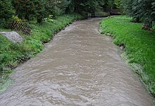
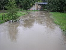
The Jahna is a left tributary of the Elbe in Saxony . It rises near the village of Präbschütz east of Döbeln (further sources in Kleinmockritz, Prüfern and Großsteinbach), flows through the municipality of Ostrau (Saxony) and finally flows into the Elbe after about 30 km at Riesa . The water is heavily eutrophicated in the lower reaches . The reason for this is that the entire Lommatzscher Pflege area uses the Jahna as a receiving water for the sewage (e).
The Jahnatal is located in the Jahnatal landscape protection area (d02) and in a designated FFH area ("Jahnaniederung", pSCI 4645-301).
The origin of the name should be traced back to the old Slavic rampart Gana , which was first mentioned in a document with the conquest campaigns of King Henry I in 929. The residents there withstood a period of over 20 days with inferior weapons. The old castle complexes were searched intensively in the entire region for many years and were finally discovered near the paper mill in Stauchitz . As early as 1929, Jahna was celebrating its 1,000-year history. On the oak in the immediate vicinity of the village church (with a remarkable painted box ceiling) a rock was placed with the carved date 929–1929.
Along the Jahna river, from the source in Präbschütz , via Mochau , the Baderitz reservoir, Ostrau (Saxony) to Riesa, the scenic Jahnatal cycle path runs for around 27 kilometers.
See also
literature
- Hydrological manual. (PDF; 115 kB) Part 2 - Area Codes. Free State of Saxony - State Office for Environment and Geology, p. 6 , accessed on December 25, 2017 .
- Martin Große: The Jahnatal. in: Mitteilungen des Landesverein Sächsischer Heimatschutz, Volume XXI, Issue 1–3 / 1932, pp. 82–92
Individual evidence
- ^ German Hydrological Yearbook Elbe Region, Part I 2014. (PDF) State Office for Flood Protection and Water Management Saxony-Anhalt, p. 114 , accessed on November 3, 2018 (from: lhw.sachsen-anhalt.de).


