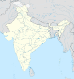
Jalpaiguri (Division)
| Jalpaiguri Division | ||
|---|---|---|
|
|
||
| State : | West Bengal | |
| Coordinates | 26 ° 31 ' N , 88 ° 44' E | |
| Administrative headquarters : | ? | |
| Area : | 21,873 km² | |
| Residents : | 14,721,616 | |
| Population density : | 673 inhabitants / km² | |
| Districts : | 6th | |
Jalpaiguri is a division in the Indian state of West Bengal .
Districts
The Jalpaiguri division consists of six districts :
| District | Capital | Area in km² | Population (as of 2001) | Population density in E / km² |
|---|---|---|---|---|
| Chef Bihar | Chef Bihar | 3,387 | 2,478,280 | 732 |
| Dakshin Dinajpur | Balurghat | 2,219 | 1,503,178 | 677 |
| Darjiling | Darjiling | 3.149 | 1,605,000 | 510 |
| Jalpaiguri | Jalpaiguri | 6,245 | 3,403,204 | 547 |
| Malda | Malda | 3,733 | 3,290,160 | 952 |
| Uttar Dinajpur | Raiganj | 3,140 | 2,441,794 | 778 |
| total | 21,873 | 14,721,616 | 673 |
Individual evidence
- ^ Official website of the Cooch Behar District. Retrieved March 11, 2010
