Jasonville
| Jasonville | |
|---|---|
 Main Street |
|
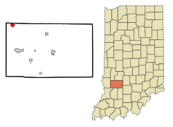
| Location in County and Indiana | |
| Basic data | |
| State : | United States |
| State : | Indiana |
| County : | Greene County |
| Coordinates : | 39 ° 10 ′ N , 87 ° 12 ′ W |
| Time zone : | Eastern ( UTC − 5 / −4 ) |
| Residents : | 2,222 (as of 2010) |
| Population density : | 655.5 inhabitants per km 2 |
| Area : | 3.39 km 2 (approx. 1 mi 2 ) of which 3.39 km 2 (approx. 1 mi 2 ) is land |
| Height : | 193 m |
| Postal code : | 47438 |
| Area code : | +1 812 |
| FIPS : | 18-37764 |
| GNIS ID : | 0436943 |
| Mayor : | Roy L. Terrell, Sr. ( D ) |
Jasonville is a city in Greene County in the US state of Indiana .
geography
The city of Jasonville, part of the metropolitan area of Bloomington, is located in the northeast of Greene County, on the border with Clay County in the north and Sullivan County in the west, about five kilometers southeast of Shakamak State Park with Lake Kickapoo and about 115 kilometers southwest of the capital Indianapolis .
The area of the city covers an area of 3.39 square kilometers. There are no bodies of water.
Neighboring communities
The following cities form - clockwise, starting in the northwest - the neighboring communities to Jasonville: Hymera , Farmersburg , Clay City , Switz City , Linton , Dugger , Sullivan and Shelburn .
history
The former mining town was almost completely destroyed by a major fire in 1914.
population
2010 census
Today, 2,222 people in 882 households live in 98.1 percent White, 0.2% African American, 0.1% Native American , 0.4% Asian, and 1.2% from other races. 26.7 percent of the population were younger than 18, 31.8% were between the ages of 18 and 44, 24.5% between 45 and 64, 17.1% were 64 years or older. 47.4 percent of the population were male and 52.6% were female. (As of 2010)
2000 census
The 2000 census counted 2,490 people in 970 households or 615 families in the city.
Economy and Infrastructure
traffic
East of the town center, Indiana State Road 48 ( Fairbanks - Worthington ) , which runs from west to east, and Indiana State Road 59 ( Waveland - Sandborn ) , which runs from north to south, cross .
To the northeast of the city center is the privately run Shakamak Airport , an airfield with two grass runways (530 x 12 meters and 700 x 23 meters).
education
There are three schools in Jasonville, Shakamak Elementary School , Shakamak Junior High School, and Blessed Hope Baptist School .
See also
Web links
Individual evidence
- ↑ US Gazetteer files 2010 . Archived from the original on February 20, 2011. Retrieved December 11, 2012.
- ↑ American FactFinder . Retrieved December 11, 2012.
