Jedovnický potok
| Jedovnický potok | ||
| Data | ||
| location | Czech Republic | |
| River system | Danube | |
| Drain over | Křtinský potok → Svitava → Svratka → Thaya → March → Danube → Black Sea | |
| muzzle |
Svitava coordinates: 49 ° 18 ′ 30 " N , 16 ° 41 ′ 30" E 49 ° 18 ′ 30 " N , 16 ° 41 ′ 30" E
|
|
| length | 18 km | |
| Býčí skála -Rudické propadání cave system | ||
|
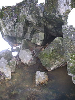
The Jedovnický potok emerges at the Býčí skála cave |
||
The Jedovnický potok ( Jedownitzer Bach ) is a brook in the Moravian Karst , Czech Republic .
On its upper reaches it is called Podomský potok up to the confluence with the Olšovec . It is 18 kilometers long, six kilometers of which it flows under the earth's surface.
course
The stream rises west of the Krásensko municipality at an altitude of 600 m nm on Kojál. It flows through the villages of Podomí and Jedovnice , where it feeds the Budkovan, Vrbový rybník and Olšovec ponds. After 12 kilometers it disappears behind Jedovnice into the abyss Rudické propadání ( Hugo Caves ). The water falls over several cascades about 90 meters deep into the gorge and collects in an underground lake, from which the stream continues to flow in a south-westerly direction. The Býčí skála- Rudické propadání cave system , which was created by the action of the watercourse in the karst area , forms the river bed. In places the brook flows 220 meters below the surface of the earth. After six kilometers it comes to the surface again near the main entrance of the cave ( ⊙ ) and flows a few meters further into the Křtinský potok, a tributary of the Svitava .

